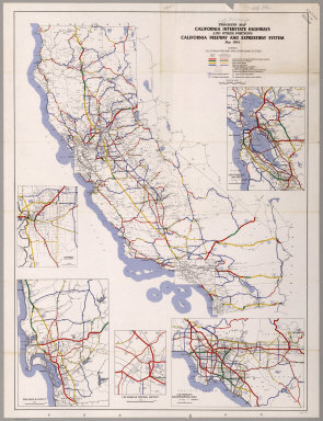
Detail View: David Rumsey Historical Map Collection: Progress Map, California Interstate Highways and Other Portions, May 1964.
|
Short Title:
|
Progress Map, California Interstate Highways and Other Portions, May 1964.
|
|
Obj Height cm:
|
130
|
|
Obj Width cm:
|
98
|
|
Scale 1:
|
1,192,107
|
|
Note:
|
Includes regional enlargements of San Francisco Bay Area, Sacramento, San Diego, and Los Angeles.
|
|
Reference:
|
Map obtained from the Institute of Transportation Studies Library (Harmer E. Davis Transportation Library) at the University of California, Berkeley.
|
|
Full Title:
|
Progress Map, California Interstate Highways and Other Portions, California Freeway and Expressway System, May 1964.
|
|
List No:
|
6357.000
|
|
Series No:
|
1
|
|
Pub Date:
|
1964
|
|
Pub Title:
|
Progress Map, California Interstate Highways and Other Portions, California Freeway and Expressway System, January 1964.
|
|
Pub Reference:
|
Map obtained from the Institute of Transportation Studies Library (Harmer E. Davis Transportation Library) at the University of California, Berkeley.
|
|
Pub Note:
|
See Note field above.
|
|
Pub List No:
|
6357.000
|
|
Pub Maps:
|
1
|
|
Pub Height cm:
|
152
|
|
Pub Width cm:
|
109
|
|
Image No:
|
6357000
|
|
Download 1:
|
|
|
Download 2:
|
|
|
Publisher Location:
|
Sacramento
|
|
Publisher:
|
California Department of Transportation, Division of Highways
|
|
Type:
|
Separate Map
|
|
State/Province:
|
California
|
|
Subject:
|
Roads and Streets
|
|
Publication Author:
|
California Department of Transportation, Division of Highways
|
|
Pub Type:
|
Separate Map
|
|
Author:
|
California Department of Transportation, Division of Highways
|
|
Date:
|
1964
|