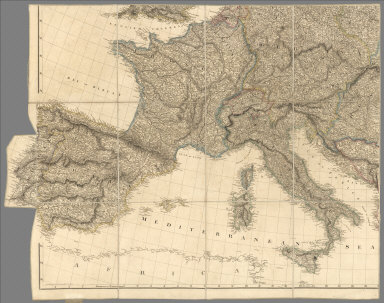
Detail View: David Rumsey Historical Map Collection: (Southwest Section) Map Exhibiting the Great Post Roads, Physical and Political Divisions of Europe.
|
Short Title:
|
(Southwest Section) Map Exhibiting the Great Post Roads, Physical and Political Divisions of Europe.
|
|
Obj Height cm:
|
81
|
|
Obj Width cm:
|
106
|
|
Scale 1:
|
2,500,000
|
|
Full Title:
|
(Southwest Section) Map Exhibiting the Great Post Roads, Physical and Political Divisions of Europe from Original Materials Collected from the Different Countries Delineated by A. Arrowsmith MDCCCX. London Published 2nd. Jany. 1810, by A. Arrowsmith No. 10 Soho Square, Hydrographer to H.R.H. The Prince of Wales.
|
|
List No:
|
7844.004
|
|
Page No:
|
SW Section
|
|
Series No:
|
4
|
|
Pub Date:
|
1810
|
|
Pub Title:
|
Map Exhibiting the Great Post Roads, Physical and Political Divisions of Europe from Original Materials Collected from the Different Countries Delineated by A. Arrowsmith MDCCCX. London Published 2nd. Jany. 1810, by A. Arrowsmith No. 10 Soho Square, Hydrographer to H.R.H. The Prince of Wales.
|
|
Pub Note:
|
Map cut into 4 separate map sections of 12 panels each. Colored tints along borders and coastlines.
|
|
Pub List No:
|
7844.000
|
|
Pub Maps:
|
4
|
|
Pub Height cm:
|
28
|
|
Pub Width cm:
|
25
|
|
Image No:
|
7844004
|
|
Download 1:
|
|
|
Download 2:
|
|
|
Publisher Location:
|
London
|
|
Publisher:
|
A. Arrowsmith
|
|
Type:
|
Atlas Map
|
|
World Area:
|
Europe
|
|
Engraver or Printer:
|
Edward Jones
|
|
Publication Author:
|
Arrowsmith, A.
|
|
Pub Type:
|
Case Map
|
|
Author:
|
Arrowsmith, A.
|
|
Date:
|
1810
|