COLLECTION NAME:
David Rumsey Historical Map Collection
Record
Short Title:
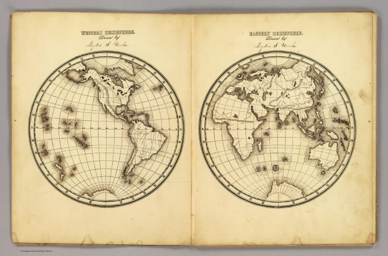
W. Hemisphere, E. Hemisphere.
Obj Height cm:
20
Obj Width cm:
38
Scale 1:
120,000,000
Note:
Printed map form with title, grid lines and numbers or "mapping plate." Two maps on 1 sheet. Map data added including relief by hachures in pen-and-ink by Lydia S. Weeks.
Full Title:
Western Hemisphere ... Eastern Hemisphere drawn by (to be filled in. By George W. Fitch. New York: Sheldon, Blakeman and Company, 115 Nassau Street. Entered ... 1850, by Huntington and Savage ... New York)
List No:
0289.001
Series No:
2
Pub Date:
1850
Pub Title:
Fitch's mapping plates, designed for learners in geography, being a collection of plates prepared for delineating maps of the World, and countries forming its principal subdivisions ... By George W. Fitch. New York: Sheldon, Blakeman and Company, 115 Nassau Street. Entered ... 1840, by Huntington and Savage ... New York.
Pub Note:
See note field above.
Pub List No:
0289.000
Pub Maps:
12
Pub Height cm:
27
Pub Width cm:
21
Image No:
0289001
Institution:
Rumsey Collection
Ownership Statement:
Copyright 2005
Publisher Location:
New York
Publisher:
Blakeman, Sheldon & Co.
Type:
Atlas Map
Type:
Manuscript Map
World Area:
World
Subject:
School
Publication Author:
Fitch, George W.
Pub Type:
School Atlas
Author:
Fitch, George W.
Author:
Weeks, Lydia S.
Date:
1850
W. Hemisphere, E. Hemisphere.