COLLECTION NAME:
David Rumsey Historical Map Collection
Record
Short Title:
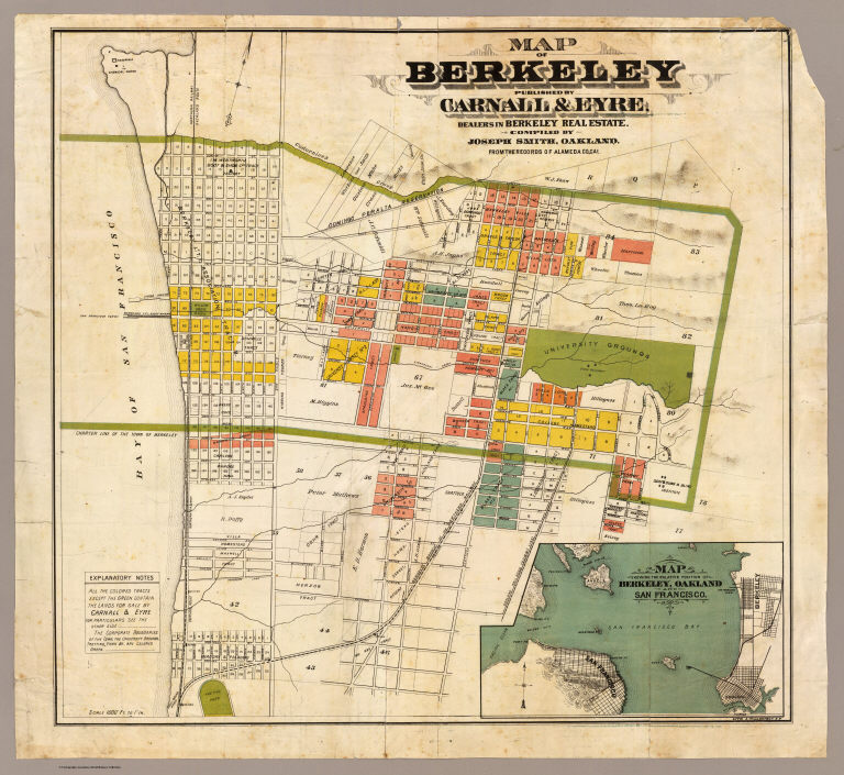
Map of Berkeley.
Obj Height cm:
54
Obj Width cm:
58
Scale 1:
12,000
Note:
Hand col. Relief shown by hachures. Shows drainage, tracts, land ownership, railroads, etc. Includes regional map. Oriented with north toward upper right.
Reference:
Rowell, J.C. List of printed maps of California, p. 13; Vodges, p. 213.
Full Title:
Map of Berkeley. Published by Carnall & Eyre, dealers in Berkeley Real Estate. Compiled by Joseph Smith, Oakland. From the records of Alameda Co., Cal. Lith. A. Waldstein, S.F. (1880)
List No:
5724.000
Series No:
1
Pub Date:
1880
Pub Title:
Map of Berkeley. Published by Carnall & Eyre, dealers in Berkeley Real Estate. Compiled by Joseph Smith, Oakland. From the records of Alameda Co., Cal. Lith. A. Waldstein, S.F. (1880)
Pub Note:
See note field above.
Pub List No:
5724.000
Pub Maps:
1
Pub Height cm:
54
Pub Width cm:
58
Image No:
5724000
Institution:
Rumsey Collection
Ownership Statement:
Copyright 2005
Publisher Location:
Berkeley?
Publisher:
Carnall & Eyre
Type:
Separate Map
State/Province:
California
City:
Berkeley (Calif.)
Subject:
Land Development
Engraver or Printer:
Waldstein, A. (Abraham), d. 1888
Publication Author:
Smith, Joseph, draftsman
Pub Type:
Separate Map
Author:
Smith, Joseph, draftsman
Date:
1880
Map of Berkeley.