COLLECTION NAME:
David Rumsey Historical Map Collection
Record
Short Title:
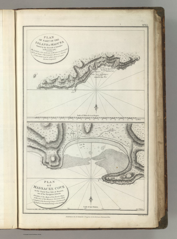
Charts of Parts of Maouna (Pago Pago, Samoa)
Obj Height cm:
39
Obj Width cm:
25
Scale 1:
200,000
Note:
Engraved. Relief shown with hachures. Rocks, vegetation, villages, and streams shown. Shows situation of the boats of the French ships (the Boussole and the Astrolabe) at the time of the massacre, December 11th, 1787.
Reference:
P693.
Full Title:
(Two charts on one sheet). Plan of a Part of the Island of Maouna (Pago Pago, Samoa), Visited by the Boussole & the Astrolabe in December 1787. Plan of Massacre Cove on the North West Side of Amouna, one of the Navigators Islands. Published as the Act directs Novr. 1st 1798, by G.G. & J. Robinson, Paternoster Row. S. Neele Sculpt., Strand. No. 65.
List No:
0414.065
Page No:
65
Series No:
69
Pub Date:
1799
Pub Title:
Charts And Plates To La Perouse's Voyage. Published as the Act directs Novr. 1st 1798, by G.G. & J. Robinson, Pater-noster Row. (title page only) J.M. Moreau Junr. delt. Heath Sculpt.
Pub Reference:
P693.
Pub Note:
1st English edition. The large foldout map of the world is hand painted with outline color; all other maps are without color.
Pub List No:
0414.000
Pub Height cm:
44
Pub Width cm:
29
Image No:
0414065
Institution:
Rumsey Collection
Ownership Statement:
Copyright 2009
Publisher Location:
London
Publisher:
G.G. & J. Robinson.
Type:
Chart Map
Country:
Samoa
Region:
Pago Pago
Engraver or Printer:
Neele, sculp.
Publication Author:
La Perouse, Jean-Francois de Galaup, comte de, 1741-1788
Pub Type:
Exploration Book
Author:
La Perouse, Jean-Francois de Galaup, comte de, 1741-1788
Date:
1799
Charts of Parts of Maouna (Pago Pago, Samoa)