Browse All

1940 Road map of Missouri National Atlas Rand McNally Road map, Missouri. Copyrig … |
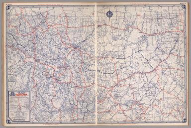
1940 Road map of Montana National Atlas Rand McNally Road map, Montana. Copyrigh … |

1940 Road map of Nebraska National Atlas Rand McNally Road map, Nebraska. Copyrig … |

1940 Road map of Nevada-Utah National Atlas Rand McNally Road map, Nevada - Utah. Co … |

1940 Road map of New Jersey National Atlas Rand McNally Road map, New Jersey. Copyr … |

1940 Road map of New York National Atlas Rand McNally Road map, New York. Copyrig … |

1940 Road map of North Carolina, South Caroli … National Atlas Rand McNally Road map, North Carolina, S … |

1940 Road map of North Dakota National Atlas Rand McNally Road map, North Dakota. Cop … |

1940 Road map of Ohio National Atlas Rand McNally Road map, Ohio. Copyright b … |

1940 Road map of Oklahoma National Atlas Rand McNally Road map, Oklahoma. Copyrig … |

1940 Road map of Oregon National Atlas Rand McNally Road map, Oregon. Copyright … |

1940 Road map of Pennsylvania National Atlas Rand McNally Road map, Pennsylvania. Cop … |

1940 Road map of South Dakota National Atlas Rand McNally Road map, South Dakota. Cop … |

1940 Road map of Texas National Atlas Rand McNally Road map, Texas. Copyright … |

1940 Road map of Washington National Atlas Rand McNally Road map, Wahington. Copyri … |

1940 Road map of Wisconsin National Atlas Rand McNally Road map, Wisconsin. Copyri … |

1940 Road map of Wyoming National Atlas Rand McNally Road map, Wyoming. Copyrigh … |

1940 Road map of Maritime Provinces National Atlas Rand McNally Road map, Maritime Province … |

1940 Road map of Ontario National Atlas Rand McNally Road map, Ontario. Copyrigh … |

1940 Road map of Quebec National Atlas Rand McNally Road map, Quebec. Copyright … |

1940 Road map of Western and Central Canada National Atlas Rand McNally Road map, Western and Centr … |

1940 Road map of Mexico National Atlas Rand McNally Road map, Mexico. Copyright … |

1940 Transcontinental Mileage Chart of the Un … National Atlas Rand McNally Transcontinental Mileage Ch … |

1940 City Maps, National Atlas City maps. Atlanta, GA., Albany, N.Y., A … |

1940 City Maps. Chicago and Vicinity National Atlas City maps. Chicago and Vicinity. Copyrig … |

1940 City Maps. Cleveland, Ohio and Vicinity National Atlas City maps. Cleveland, Ohio and Vicinity. … |

1940 City Maps. Kansas City, Kan.-Mo. and Vic … National Atlas City maps. Kansas City, Kan.-Mo. and Vic … |

1940 City Maps. Los Angeles, Calif. and Vicin … National Atlas City maps. Los Angeles, Calif. and Vicin … |

1940 City Maps. Minneapolis, St. Paul, Minn., … National Atlas City maps. Minneapolis, St. Paul, Minn., … |

1940 City Maps. New York and Vicinity National Atlas City maps. New York and Vicinity. Copyri … |

1940 City Maps. Pittsburg, Pa., and Vicinity. … National Atlas City maps. Pittsburg, Pa., and Vicinity. … |

1940 City Maps. San Francisco and East Bay Ci … National Atlas City maps. San Francisco and East Bay Ci … |

1940 City Maps. Washington, D.C. National Atlas City maps. Washington, D.C. Copyright by … |

1938 (County and Road) Map of California. [State Atlas, Statistical Atlas] (County and Road) Map of California. |

1938 Highways of the Western States. [State Atlas, Statistical Atlas] Highways of the Western States. |

1938 Highway Map of the State of Oregon. [State Atlas, Statistical Atlas] Highway Map of the State of Oregon. |

1938 Thomas Bros. Highway Map, State of Washi … [State Atlas, Statistical Atlas] Thomas Bros. Highway Map, State of Washi … |

1938 Highway Map State of Idaho. [State Atlas, Statistical Atlas] Highway Map State of Idaho. (inset) City … |

1938 Highway Map States of Utah and Nevada. [State Atlas, Statistical Atlas] Highway Map States of Utah and Nevada. |

1938 Highway Map State of Arizona. [State Atlas, Statistical Atlas] Highway Map State of Arizona. |
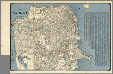
1938 City and County of San Francisco. [State Atlas, Statistical Atlas] Thomas Bros. Map of the City and County … |

1938 Map of Oakland, Berkeley, Alameda, San L … [State Atlas, Statistical Atlas] Map of Oakland, Berkeley, Alameda, San L … |

1938 Daly City, South San Francisco, San Brun … [State Atlas, Statistical Atlas] Thomas Bros: Map of Daly City, South San … |

1938 Thomas Bros. Map of the Major Part of th … [State Atlas, Statistical Atlas] Thomas Bros. Map of the Major Part of th … |

1938 Map of Palo Alto, Redwood City, Mountain … [State Atlas, Statistical Atlas] Map of Palo Alto, Redwood City, Mountain … |

1938 San Mateo, Burlingame, Hillsborough, San … [State Atlas, Statistical Atlas] San Mateo, Burlingame, Hillsborough, San … |

1938 Los Altos. Saratoga. Monte Vista. Los Ga … [State Atlas, Statistical Atlas] (verso of) Thomas Bros Map of San Jose, … |

1938 Thomas Bros Map of San Jose, Santa Clara … [State Atlas, Statistical Atlas] Thomas Bros Map of San Jose, Santa Clara … |

1938 Thomas Bros. Map of Hayward and Vicinity … [State Atlas, Statistical Atlas] Thomas Bros. Map of Hayward and Vicinity … |

1938 Map of Richmond, El Cerrito, San Pablo, … [State Atlas, Statistical Atlas] Map of Richmond, El Cerrito, San Pablo, … |