Browse All

1953 Germany. Poland. Czechoslovakia. Austria … World Atlas Germany. Poland. Czechoslovakia. Austria … |

1953 Central Alps and Switzerland. World Atlas Central Alps and Switzerland. (inset) (V … |

1953 Yugoslavia. Hungary. Romania. Bulgaria. … World Atlas Yugoslavia. Hungary. Romania. Bulgaria. … |

1953 Spain. Portugal. Italy. World Atlas Spain. Portugal. Italy. |

1953 Southern Balkans and Aegean Sea. Greece. World Atlas Southern Balkans and Aegean Sea. Greece. … |

1953 Mediterranean. Turkey. World Atlas Mediterranean. Turkey. (insets) (Vicinit … |

1953 U.S.S.R. Central and Eastern Asia. World Atlas U.S.S.R. Central and Eastern Asia. |

1953 U.S.S.R. Economic. World Atlas U.S.S.R. Economic. |

1953 Near East. Middle East. India. Pakistan. … World Atlas Near East. Middle East. India. Pakistan. … |

1953 Far East. Malaysia. World Atlas Far East. Malaysia. |

1953 Far East. Indonesia. Philippines. New Gu … World Atlas Far East. Indonesia. Philippines. New Gu … |

1953 Philippines. China. World Atlas Philippines. China. (insets) (Hankow and … |

1953 China. Japan. Korea. World Atlas China. Japan. Korea. |

1953 Central and West Africa. South and East … World Atlas Central and West Africa. South and East … |

1953 Australia. New Zealand. Tasmania. World Atlas Australia. New Zealand. Tasmania. |

1880 View: Union Bank, Charlottetown. Map: Pl … State Atlas (View) 1863 - 1879, Union Bank, Main Off … |

1966 Railway and Water Transport. National Atlas Railway and Water Transport. |

1966 Railway Goods Traffic and Communications … National Atlas Railway Goods Traffic and Communications … |

1966 Foreign Trade. National Atlas Foreign Trade. |

1966 Internal Trade and Consumption. National Atlas Internal Trade and Consumption. |

1943 Predominant Economies 11. World Atlas Predominant Economies 11. |

1943 Iron and Steel Trade, 1937, 20. World Atlas Iron and Steel Trade, 1937, 20. |

1943 Steel Production 1870, 1913 and 1939, 21 … World Atlas Steel Production 1870, 1913 and 1939, 21 … |

1967 Economic Regions. Pergamon World Atlas. World Atlas Economic Regions. Pergamon World Atlas. … |

1967 International Trade. Pergamon World Atla … World Atlas International Trade. Pergamon World Atla … |

1924 World On Mercator's Projection. National Atlas The World on Mercator's Projection. |

1924 Steamship Routes of The World. National Atlas Commercial Atlas of America. Rand McNall … |

1924 North America. National Atlas Commercial Atlas of America. Rand McNall … |

1924 United States. National Atlas Commercial Atlas of America. Rand McNall … |

1924 Industrial Map of the United States. National Atlas Commercial Atlas of America. Rand McNall … |

1903 Commercial Map, East of Chicago. National Atlas Rand, McNally & Co.'s New Commercial Map … |

1903 Commercial Map, Chicago to Denver. National Atlas Rand, McNally & Co.'s New Commercial Map … |

1903 Commercial Map, Denver to Pacific Coast. National Atlas Rand, McNally & Co.'s New Commercial Map … |
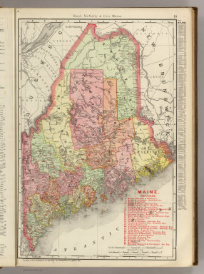
1903 Maine. National Atlas Rand, McNally & Co.'s Maine. |

1903 New Hampshire. National Atlas Rand, McNally & Co.'s New Hampshire. |

1903 Vermont. National Atlas Rand, McNally & Co.'s Vermont. |

1903 Connecticut. Rhode Island. National Atlas (Rand, McNally & Co.'s Connecticut. Rhod … |

1903 Massachusetts. National Atlas Rand, McNally & Co.'s Connecticut. (with … |

1882 France Industrielle et Commerciale. World Atlas France Industrielle et Commerciale. Atla … |