Who What Where WhenREMOVE |
Author
Vandermaelen, Philippe, 1795-1869
Full Title
Partie du Groenland. Amer. Sep. no. 4. (Dresse par Ph. Vandermaelen, lithographie par H. Ode. Quatrieme partie. - Amer. sept. Bruxelles. 1827)
Publisher
Ph. Vandermaelen
Author
[Long, George, 1800-1879, Society for the Diffusion of Useful Knowledge (Great Britain)]
Full Title
Ancient Egypt. By G. Long, Prof. Greek, Londn. Universy. Published by the Society for the Diffusion of Useful Knowledge. J. & C. Walker, sculpt. Published by Baldwin & Cradock, 47 Paternoster Row, Jany. 1st. 1831. (London: Chapman & Hall, 1844)
Publisher
Chapman and Hall
Author
Colton, G.W.
Full Title
Map of the United States Showing the Area, Acquisition & Transfer of Territory. (Published by) G. W & C. B. Colton & Co., No. 172 William St. New York.
Publisher
G. W & C. B. Colton & Co.
Author
Colton, G.W.
Full Title
Colton's Palestine. (insets) New Testament Map of Palestine; Map of Palestine Before the Conquest; The Peninsula of Mt. Sinai; A Map to Illustrate the Wondering of the Israelites from Egypt to Canaan. Published By G. W & C. B. Colton & Co., No. 182 William St. New York.
Publisher
G. W & C. B. Colton & Co.
Author
Raisz, Erwin
Full Title
17. Our Early Floridans. Sources: Various publications of the Florida State Museum in Gainesville and Writings of J.M. Goggin. (to accompany) Atlas of Florida by Erwin Raisz and associates with text by John R. Dunkle. Prepared in the Department of Geography, University of Florida. University of Florida Press, Gainesville, 1964. (on verso) 1964 Board of Commissioners of State Institutions of Florida.
Publisher
Un. Of Florida Press
Author
Raisz, Erwin
Full Title
18. With Cross and Sword. Sources: D. Dodd, K.A. Hanna, and Others. (to accompany) Atlas of Florida by Erwin Raisz and associates with text by John R. Dunkle. Prepared in the Department of Geography, University of Florida. University of Florida Press, Gainesville, 1964. (on verso) 1964 Board of Commissioners of State Institutions of Florida.
Publisher
Un. Of Florida Press
Author
Raisz, Erwin
Full Title
19. Changing Flags. Sources: General reference as before, and the various writings of P.C. Brooks, H.B. Fuller... (to accompany) Atlas of Florida by Erwin Raisz and associates with text by John R. Dunkle. Prepared in the Department of Geography, University of Florida. University of Florida Press, Gainesville, 1964. (on verso) 1964 Board of Commissioners of State Institutions of Florida.
Publisher
Un. Of Florida Press
Author
Raisz, Erwin
Full Title
20. The Land Settled. (to accompany) Atlas of Florida by Erwin Raisz and associates with text by John R. Dunkle. Prepared in the Department of Geography, University of Florida. University of Florida Press, Gainesville, 1964. (on verso) 1964 Board of Commissioners of State Institutions of Florida.
Publisher
Un. Of Florida Press
Author
Garnier, F. A., 1803-1863
Full Title
Tableau comparatif de l'etat des connaissances geographiques chez les anciens et chez les modernes, depuis les temps les plus recules jusqu'a l'epoque actuelle, suivi d'un resume chronologique des principales decouvertes avec le nom des divers explorateurs. Atlas spheroidal & universel de geographie dresse par F.A. Garnier, geographe. Paris, Vve. Jules Renouard, Editeur, no. 6, Rue de Tournon, Paris, 1860. Paris, Sarazin, Impr., r. Git-le-Coeur, 8. Paris.
Publisher
Veuve Jules Renouard, Libraire
Author
Garnier, F. A., 1803-1863
Full Title
Tableau du Monde actuel du planisphere terrestre, indiquant les itineraires des plus celebres navigateurs, l'epoque des principales decouvertes geographiques et la declinaison approximative de l'aiguille aimantee entre les deux poles magnetiques du Monde. Atlas spheroidal & universel de geographie dresse par F.A. Garnier, geographe. Paris, Ve. Jules Renouard, Editeur, R. de Tournon, no. 6, Paris, 1860. Impie. Sarazin, r. Git-le-Coeur, 8. Paris.
Publisher
Veuve Jules Renouard, Libraire
Author
Willard, Emma
Full Title
Introductory Map. To Accompany Willard's History Of The United States. Locations and Wanderings Of The Aboriginal Tribes. (Arrow) Shows The Direction Of their Wanderings. Engraved & Printed by Saml. Maverick.
Publisher
White, Gallaher, & White
Author
Willard, Emma
Full Title
First Map Or Map Of 1578. To Accompany Willard's History Of The United States. (Inset) Queen Elizabeth Signs for Sir Humphrey Gilbert. The First patent Granted by an English Sovereign to Lands Within the Territory of the United States 1578. Engraved & Printed by Saml. Maverick.
Publisher
White, Gallaher, & White
Author
Willard, Emma
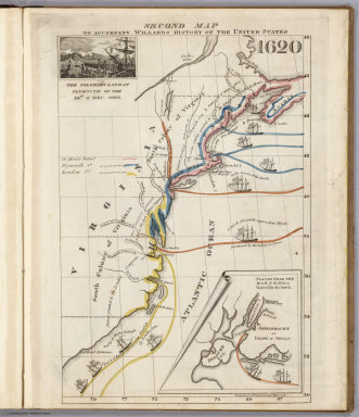
Full Title
Second Map. To Accompany Willard's History Of The United States 1620. (Inset) The Pilgrims Land at Plymouth on the 22nd. of Dec. 1620. (inset map) Places Near The Mouth of the Hudson Visited by the Dutch. Engraved & Printed by Saml. Maverick.
Publisher
White, Gallaher, & White
Author
Willard, Emma
Full Title
Third Map or Map Of 1643. To Accompany Willard's History Of The United States. (Inset) The Commencement of the Confederacy in the Union of Plymouth and Massachusetts and New Haven and Connecticut 1643. (inset map) Places Mentioned in the History of the Pequod War. Engraved & Printed by Saml. Maverick N.Y.
Publisher
White, Gallaher, & White
Author
Willard, Emma
Full Title
Fourth Map or Map Of 1692. To Accompany Willard's History Of The United States. (Inset) Massachusetts Receives a New Charter, Including Maine and Other Large Territories by the Arrival of Sir Wm. Phipps. (inset map) Places Mentioned in the History of King Philip's War. (Engraved & Printed by) Saml. Maverick & Co. N.Y.
Publisher
White, Gallaher, & White
Author
Willard, Emma
Full Title
Fifth Map or Map Of 1733. To Accompany Willard's History Of The United States. (Inset) Genl. Oglethorpe with a Colony Commence the Settlement of Georgia 1733. He meets the Indian Chief's in Council at Savannah. (Engraved & Printed by) Saml. Maverick & Co. N.Y.
Publisher
White, Gallaher, & White
Author
Willard, Emma
Full Title
Sixth Map or Map Of 1763. To Accompany Willard's History Of The United States. (Inset) The Death of Gen. Wolf Occurs at the Time of Quebec's Being Taken by the English ... that leads to the Peace of Paris 1763. (inset map) Quebec. Engraved & Printed by Saml. Maverick.
Publisher
White, Gallaher, & White
Author
Willard, Emma
Full Title
Seventh Map or Map Of 1776. To Accompany Willard's History Of The United States. (Inset) A Committee of Five draw up the Declaration of Independence. 1776. (inset map) Boston and Vicinity. (inset) (untitle map showing Lake George and surroundings). (inset) Charleston and Vicinity. Engraved & Printed by Saml. Maverick &Co. N.Y.
Publisher
White, Gallaher, & White
Author
Willard, Emma
Full Title
Eighth Map or Map Of 1789. To Accompany Willard's History Of The United States. (Inset) Federal Government Commen CD 1789. (2 untitled inset maps). (Engraved & Printed by) Saml. Maverick & Co. N.Y.
Publisher
White, Gallaher, & White
Author
Willard, Emma
Full Title
Principal Seat of the Revolutionary War in the Southern Section of the U.S. To Accompany Willard's History Of The United States. (inset map) Principal Seat of the Revolutionary War in the northern section of the U.S. Engraved & Printed by Saml. Maverick.
Publisher
White, Gallaher, & White
Author
Willard, Emma
Full Title
Ninth Map Or Map Of 1826. To Accompany Willard's History Of The United States. Referred to in the History, As the Map of the President Day. 1826. Saml. Maverick & Co. N.Y.
Publisher
White, Gallaher, & White
Author
Willard, Emma
Full Title
Principal Seat of the War of 1812-13-14. To Accompany Willard's History Of The United States. Engraved & Printed by Saml. Maverick. N.Y.
Publisher
White, Gallaher, & White
Author
McDonough, Leo & Co.
Full Title
Map of Daviess County, Ky. Showing precincts, location of towns, post offices, rail roads, wagon roads, churches, school houses, etc., etc. Drawn by E.J. Chamberlain, C.E.
Publisher
Leo McDonough & Co.
Author
Radefeld, Carl Christian Franz, 1788-1874
Full Title
Palaestina nach Berghaus, Raumer, Robinson, Kiepert, Berton, Sysmond, Russegger. (with) Ptolomais 1189-1191. (with) Jerusalem zur jetzigen Zeit. (with) Jerusalem in alten Zeiten. (with) Arabia Petrea. Entw. u. gez. von Major Carl Radefeld. 1849. Stich, Druck u. Verlag des Bibliographischen Instituts in Hildburghausen, (1860)
Publisher
Bibliographischen Instituts
Author
Grassl, J. (Joseph)
Full Title
Neueste Specialkarte von Persien entworfen u. gezeichnet von J. Grassl. (with) Ruinen von Babylon. (with) Ruinen von Nineveh. 1855. (Stich, Druck und Verlag des Bibliographischen Instituts zu Hildburghausen, 1860)
Publisher
Bibliographischen Instituts
Author
Brink, McCormick & Co.
Full Title
Map of Butler Grove Township, Town Nine North, Range Four West, 3rd P.M.
Publisher
Brink, McCormick & Co.
Author
Lisle, Guillaume de, 1675-1726
Full Title
Theatrum historicum ad annum Christi quadringentesimu. in quo tu. Imperii Romani tu. Barbarorum circumincolentium status ob oculos ponitur. Pars orientalis. Auctore Guillelmo Delisle e Regia Scientiarum Academia. Parisiis, apud Autorem in Ripa vulgo dicta le Quai de l'Horloge cum Privilegio Regis ad Vicennum, 1705. Des Rosiers sc.
Publisher
Guillaume DeLisle, Quai de l'Horloge
Author
Lisle, Guillaume de, 1675-1726
Full Title
Theatrum historicum ad annum Christi quadringentesimu. in quo tum Imperii Romani tu. Barbarorum circumincolentiu. status ob oculos ponitur. Pars occidentalis. Auctore Guillelmo Del'Isle e Regia Scientiaru. Academia. Parisiis, apud Autorem in Ripa vulgo dicta le Quai de l'Horloge cum Privilegio Regis ad Vicennum, 1705. Des Rosiers sc.
Publisher
Guillaume DeLisle, Quai de l'Horloge
Author
[Desbuissons, L.E., Migeon, J.]
Full Title
France Feodale. Grave par L. Smith. Dresse Sous La Direction De J. Migeon Par Ch. Lacoste. Migeon, editeur, imp, r. du Moulin Vert, Paris. Ecrit par A. Bizet. (1892). Fillatreau del. and Soudain sc. (for vignette).
Publisher
Direction & Administration.
Author
[Desbuissons, L.E., Migeon, J.]
Full Title
France en 1789. Formation des Provinces en Departments. Grave par L. Smith. Dresse Sous La Direction De J. Migeon Par Ch. Lacoste. Migeon, editeur, imp, r. du Moulin Vert, Paris. Ecrit par A. Bizet. (1892). Fillatreau del. and Barbier sc. (for vignette).
Publisher
Direction & Administration.
Author
[Desbuissons, L.E., Migeon, J.]
Full Title
Empire Francais en 1811. Grave par L. Smith. Dresse Sous La Direction De J. Migeon Par Ch. Lacoste. Migeon, editeur, imp, r. du Moulin Vert, Paris. Ecrit par A. Bizet. (1892). Fillatreau del. and Barbier sc. (for vignette).
Publisher
Direction & Administration.
Author
[Edward Stanford Ltd., Stanford, Edward]
Full Title
Sketch of the acquisitions of Russia in Europe and Central Asia since the accession of Peter 1st to the throne. London atlas series. Stanford's Geographical Establishment. London : Edward Stanford, 26 & 27, Cockspur St., Charing Cross, S.W. (1901)
Publisher
Edward Stanford
Full Title
Carte de l'adjonction progressive des divers etats au territoire et a l'union constitutionnelle des Etats-Unis de l'Amerique du Nord. 1825.
Publisher
J. Carez
Author
[Fremin, A.R., Monin, C.V., Montemont, A.]
Full Title
Amerique Boreale pour servir a l'Histoire des dernieres decouvertes. Dressee par C.V. Monin. Paris. Armand Aubree, Editeur. Rue Taranne, 14. Grave sur Acier par Laguillermie, Rue des Noyers, No. 56. Imprime par Mangeon. La Lettre gravee par Mardelet. (1837)
Publisher
Armand Aubree.
Author
Spruner von Merz, Karl
Full Title
Die iberische Halbinsel nach ihrer kirchlichen Eintheilung. Mit Angabe der romischen & gothischen Bischofsitze, so wie der aeltesten & wichtigern Kloster. Gestochen von Joh. Carl Ausfeld. K.v. Spruner's histor. Atlas: Spanien u. Portugal No. VII (Kirchl. Verhaltn. No. VI). Gotha: Justhus Perthes. Revidirt 1854.
Publisher
Justus Perthes
Author
Spruner von Merz, Karl
Full Title
Die Reiche der Nordmannen vom VIIIten. bis in's XIIte. Jahrdndt. (with) Die Kusten von Nord-America im Xten Jahrhundert. K.v. Spruner's histor. Atlas: Nordische Reiche No. I. Gotha: Justhus Perthes. (1854)
Publisher
Justus Perthes
Author
Spruner von Merz, Karl
Full Title
Scandinavien bis zur calmarischen Union, 1397. (with) Snialand, Gardarholm oder Island. (with) Swealand oder Suithiod ... (with) Dennemark. (with) Thrond. (with) Norwegens westliche Inseln. C. Stier sc. K.v. Spruner's histor. Atlas: Nordische Reiche No. II. (Gotha: Justhus Perthes). Revid. 1855.
Publisher
Justus Perthes
Author
Spruner von Merz, Karl
Full Title
Scandinavien bis zum Frieden von Friedrichshamm 1809. Mit Angabe der, bis zur neuesten Zeit merkwurdig gewordenen Orte. W. Alt sc. K.v. Spruner's histor. Atlas: Nordische Reiche No. III. (Gotha: Justhus Perthes). Rev. 1855.
Publisher
Justus Perthes
Author
Spruner von Merz, Karl
Full Title
Die Volker und Reiche der Slaven zwischen Elbe und Don bis 1125. K.v. Spruner's histor. Atlas: Nordische Reiche No. IV. (Gotha: Justhus Perthes). Rev. 1855.
Publisher
Justus Perthes
Author
Spruner von Merz, Karl
Full Title
Polen und Litthauen von 1125 bis zu ihrer Vereinigung, 1386. W. Alt sc. K.v. Spruner's histor. Atlas: Nordische Reiche No. V. Gotha: Justhus Perthes. Rev. 1855.
Publisher
Justus Perthes
Author
Levasseur, Victor.
Full Title
Europe. Atlas Universel Illustre. Ancien Continent. Geographie et Statistique par V. Levasseur, Ingenieur Geographe. Grave par Laguillermie, Rue St. Jacques, No. 82. Illustre par Raimond Bonheur, peintre. Impie. De Lemercier. Paris. A Paris, chez A. Combette, Editeur, rue de la Parcheminerie, 15. (1856)
Publisher
A. Combette
Author
Levasseur, Victor.
Full Title
Afrique. Atlas Universel Illustre. Ancien Continent. Geographie et Statistique de V. Levasseur, Ingenieur Geographe. Grave par Laguillermie, Rue St. Jacques, No. 82. Illustre par Raimond Bonheur, peintre. Impie. De Lemercier. Paris. A Paris, chez A. Combette, Editeur, rue de la Parcheminerie, 15. (1856)
Publisher
A. Combette
Author
Malte-Brun, Conrad, 1775-1826
Full Title
Geographie des Hebreux, 1831. No. 1. Longitude du Meridien Lutece. Grave par Thierry.
Publisher
Aime Andre.
Author
[Brue, Adrien Hubert, 1786-1832, Picquet, C.]
Full Title
L'Europe sous Charlemagne ou tableau historique de cette partie du Monde a la fin du Huitieme et au commencement du neuvieme siecle, par A. Brue, Geographe du Roi. (with) Tableau de demembrement de l'Empire de Charlemagne ou geographie politique de cette partie de l'Europe vers la fin de IX. siecle. Paris, 1826. Chez Chles. Picquet, Quai Conti No. 17, pres du Pont des Arts.
Publisher
C. Picquet
Author
[Brue, Adrien Hubert, 1786-1832, Picquet, C.]
Full Title
Carte generale de l'Europe en 1789, redigee pour l'etude de l'histoire du Moyen Age, par A. Brue, Geographe du Roi. Paris, 1826. Chez Chles. Picquet, Quai Conti No. 17, pres du Pont des Arts.
Publisher
C. Picquet
Author
[Brue, Adrien Hubert, 1786-1832, Picquet, C.]
Full Title
Carte generale d'Europe en 1813. (with) Confederation du Rhin en 1813. (with) Egypte. Redigee pour l'etude de l'histoire de 1788 a 1815. Par A. Brue, Geographe du Roi. Paris, 1826. Chez Chles. Picquet, Quai Conti No. 17, pres du Pont des Arts.
Publisher
C. Picquet
Author
[Brue, Adrien Hubert, 1786-1832, Picquet, C.]
Full Title
Carte de la France en 1789, indiquant les divisions comparatives des anciennes provinces et des departements actuels. Par A. Brue, Geographe du Roi. Paris, 1827. Chez Chles. Picquet, Quai Conti No. 17, pres du Pont des Arts.
Publisher
C. Picquet
Author
[Brue, Adrien Hubert, 1786-1832, Picquet, C.]
Full Title
Carte generale de l'Empire d'Allemagne, des royaumes de Hongrie, de Gallicie, de Prusse, et des Provinces-Unies des Pays-Bas; en 1789. Redigee pour la lecture de l'histoire du moyen age, par A. Brue, Geographe du Roi. Paris, 1826. Chez Chles. Picquet, Quai Conti No. 17, pres du Pont des Arts.
Publisher
C. Picquet
Full Title
La table des peuples de Moise et geographie de la Genese. Grave par C.E. Collin. La topographie dessinee par Bagge. Ecrit par Er. D. Vorzet. Imp. Fraillery. Histoire de la geographie. Atlas pl. I. Librairie Hachette et Cie. (1874)
Publisher
Hachette & Cie.
Author
[Hesiod, Homer, Vivien de Saint-Martin, M.]
Full Title
Geographie des temps heroiques de la Grece. Homere, Hesiode, les argonautes. Dessine par Vivien de Saint Martin. Imp. Fraillery. Histoire de la geographie. Atlas pl. I bis. Librairie Hachette et Cie. (1874)
Publisher
Hachette & Cie.
|