Browse All

1827 Partie du Groenland. Amer. Sep. 4. World Atlas Partie du Groenland. Amer. Sep. no. 4. ( … |

1831 Ancient Egypt. World Atlas Ancient Egypt. By G. Long, Prof. Greek, … |

1886 United States of America. World Atlas Map of the United States Showing the Are … |

1886 Palestine World Atlas Colton's Palestine. (insets) New Testame … |

1964 Our Early Floridans State Atlas 17. Our Early Floridans. Sources: Variou … |

1964 With Cross and Sword State Atlas 18. With Cross and Sword. Sources: D. Do … |

1964 Changing Flags State Atlas 19. Changing Flags. Sources: General ref … |

1964 The Land Settled State Atlas 20. The Land Settled. (to accompany) Atl … |

1862 Connaissances geographiques. World Atlas Tableau comparatif de l'etat des connais … |

1862 Le Monde, principales decouvertes. World Atlas Tableau du Monde actuel du planisphere t … |

1829 Introductory Map To Accompany Willard's … School Atlas Introductory Map. To Accompany Willard's … |

1829 First Map Or Map Of 1578 School Atlas First Map Or Map Of 1578. To Accompany W … |
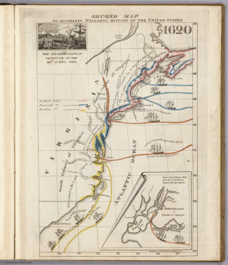
1829 Second Map 1620 School Atlas Second Map. To Accompany Willard's Histo … |

1829 Third Map or Map Of 1643 School Atlas Third Map or Map Of 1643. To Accompany W … |

1829 Fourth Map or Map Of 1692 School Atlas Fourth Map or Map Of 1692. To Accompany … |

1829 Fifth Map or Map Of 1733 School Atlas Fifth Map or Map Of 1733. To Accompany W … |

1829 Sixth Map or Map Of 1763 School Atlas Sixth Map or Map Of 1763. To Accompany W … |

1829 Seventh Map or Map Of 1776 School Atlas Seventh Map or Map Of 1776. To Accompany … |

1829 Eighth Map or Map Of 1789 School Atlas Eighth Map or Map Of 1789. To Accompany … |

1829 Principal Seat of the Revolutionary War … School Atlas Principal Seat of the Revolutionary War … |

1829 Ninth Map Or Map Of 1826 School Atlas Ninth Map Or Map Of 1826. To Accompany W … |

1829 Principal Seat of the War of 1812-13-14 School Atlas Principal Seat of the War of 1812-13-14. … |

1876 Daviess County, Kentucky. County Atlas Map of Daviess County, Ky. Showing preci … |

1849 Palaestina. World Atlas Palaestina nach Berghaus, Raumer, Robins … |

1855 Persien. World Atlas Neueste Specialkarte von Persien entworf … |

1874 Butler Grove Township, Montgomery County … County Atlas Map of Butler Grove Township, Town Nine … |

1705 Theatrum historicum ad annum Christi qua … World Atlas Theatrum historicum ad annum Christi qua … |

1705 Theatrum historicum ad annum Christi qua … World Atlas Theatrum historicum ad annum Christi qua … |

1892 France Feodale. World Atlas France Feodale. Grave par L. Smith. Dres … |

1892 France en 1789. World Atlas France en 1789. Formation des Provinces … |

1892 Empire Francais en 1811. World Atlas Empire Francais en 1811. Grave par L. Sm … |

1901 Acquisitions of Russia in Europe, Centra … World Atlas Sketch of the acquisitions of Russia in … |

1825 Etats-Unis de l'Amerique du Nord, l'adjo … National Atlas Carte de l'adjonction progressive des di … |

1837 Amerique Boreale. World Atlas Amerique Boreale pour servir a l'Histoir … |

1854 Die iberische Halbinsel nach ihrer kirch … Historical Atlas Die iberische Halbinsel nach ihrer kirch … |

1854 Reiche der Nordmannen vom VIIIten. bis i … Historical Atlas Die Reiche der Nordmannen vom VIIIten. b … |

1855 Scandinavien bis zur calmarischen Union, … Historical Atlas Scandinavien bis zur calmarischen Union, … |

1855 Scandinavien bis zum Frieden von Friedri … Historical Atlas Scandinavien bis zum Frieden von Friedri … |

1855 Volker und Reiche der Slaven zwischen El … Historical Atlas Die Volker und Reiche der Slaven zwische … |

1855 Polen und Litthauen 1125-1386. Historical Atlas Polen und Litthauen von 1125 bis zu ihre … |

1856 Europe. National Atlas Europe. Atlas Universel Illustre. Ancien … |

1856 Afrique. National Atlas Afrique. Atlas Universel Illustre. Ancie … |

1837 Geographie des Hebreux. World Atlas Geographie des Hebreux, 1831. No. 1. Lon … |

1826 L'Europe sous l'Empire de Charlemagne. World Atlas L'Europe sous Charlemagne ou tableau his … |

1826 Europe en 1789. World Atlas Carte generale de l'Europe en 1789, redi … |

1826 Europe en 1813. World Atlas Carte generale d'Europe en 1813. (with) … |

1827 France en 1789. World Atlas Carte de la France en 1789, indiquant le … |

1826 Empire d'Allemagne, Hongrie, Gallicie, P … World Atlas Carte generale de l'Empire d'Allemagne, … |

1874 La table des peuples de Moise et geograp … Historical Atlas La table des peuples de Moise et geograp … |

1874 Geographie des temps heroiques de la Gre … Historical Atlas Geographie des temps heroiques de la Gre … |