Who What Where WhenWHO
|
REFINE
Browse All : Atlas Map and National Atlas and U.S. Public Survey
1-33 of 33
Author
[Paullin, Charles O., Wright, John K.]
Full Title
Plate 57. Public Lands. Public Lands of United States, 1790. Public Lands of United States, 1810.
Publisher
[Carnegie Institution of Washington, American Geographical Society of New York]
Author
[Paullin, Charles O., Wright, John K.]
Full Title
Plate 58. Public Lands. Public Lands of United States, 1830. Public Lands of United States, 1850. Public Lands of United States, 1870. Public Lands of United States, 1890.
Publisher
[Carnegie Institution of Washington, American Geographical Society of New York]
Author
[Paullin, Charles O., Wright, John K.]
Full Title
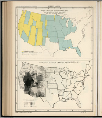
Plate 59. Public Lands. Public Lands of United States, 1910. Distribution of Public Lands of United States, 1929.
Publisher
[Carnegie Institution of Washington, American Geographical Society of New York]
Author
[Paullin, Charles O., Wright, John K.]
Full Title
Plate 61. Colonial Towns, States, Territories, and Cities. Colonial Towns, 1650. Colonial Towns, 1700. Colonial Towns, 1750. Colonial Towns, 1775. States, Territories and Cities, 1790. States, Territories and Cities, 1800. States, Territories and Cities, 1810.
Publisher
[Carnegie Institution of Washington, American Geographical Society of New York]
Author
[Paullin, Charles O., Wright, John K.]
Full Title
Plate 62. States, Territories and Cities. States, Territories and Cities, 1820. States, Territories and Cities, 1830.
Publisher
[Carnegie Institution of Washington, American Geographical Society of New York]
Author
[Paullin, Charles O., Wright, John K.]
Full Title
Plate 63. States, Territories and Cities. States, Territories and Cities, 1840. States, Territories and Cities, 1850.
Publisher
[Carnegie Institution of Washington, American Geographical Society of New York]
Author
[Paullin, Charles O., Wright, John K.]
Full Title
Plate 64. States, Territories and Cities. States, Territories and Cities, 1860. States, Territories and Cities, 1870. States and Territories (Additional Maps 1845-1868). States, Territories and Cities, 1880.
Publisher
[Carnegie Institution of Washington, American Geographical Society of New York]
Author
[Paullin, Charles O., Wright, John K.]
Full Title
Plate 65. States, Territories and Cities. States, Territories and Cities, 1890. States, Territories and Cities, 1900.
Publisher
[Carnegie Institution of Washington, American Geographical Society of New York]
Author
[Paullin, Charles O., Wright, John K.]
Full Title
Plate 66. States, Territories and Cities. States, Territories and Cities, 1910. States, Territories and Cities, 1920.
Publisher
[Carnegie Institution of Washington, American Geographical Society of New York]
Author
[Paullin, Charles O., Wright, John K.]
Full Title
Plate 67. States and Cities: Population. States and Cities, 1930. Slaves, 1790. Slaves, 1800. Slaves, 1810. Slaves, 1820. Slaves, 1830. Slaves, 1840.
Publisher
[Carnegie Institution of Washington, American Geographical Society of New York]
Author
U.S. General Land Office
Full Title
State of Ohio. Department of Interior, General Land Office, October 2d 1866. Jo. S. Wilson, Commissioner. The Major & Knapp Eng. Mfg. & Lith. Co. 71 Broadway N.Y.
Publisher
U.S.
Author
U.S. General Land Office
Full Title
A Diagram of the State of Indiana. Department of Interior, General Land Office, October 2d 1866. Jo. S. Wilson, Commissioner. The Major & Knapp Eng. Mfg. & Lith. Co. 71 Broadway N.Y.
Publisher
U.S.
Author
U.S. General Land Office
Full Title
Map of the State of Illinois. Department of Interior, General Land Office, October 2d 1866. Jo. S. Wilson, Commissioner. Bowen & Co. lith. Phila.
Publisher
U.S.
Author
U.S. General Land Office
Full Title
Sketch of the Public Surveys in Michigan. To accompany the annual Report of the Commissioner, Genl. Land Office. Department of the Interior, General Land Office, October 2nd 1866. Jo. S. Wilson, Commissioner. Bowen & Co. lith. Philada. (with) inset map of Isle Royale.
Publisher
U.S.
Author
U.S. General Land Office
Full Title
Sketch of the Public Surveys in the State of Wisconsin. Department of the Interior, General Land Office, October 2nd 1866. Jo. S. Wilson, Commissioner. The Major & Knapp Eng. Mfg. & Lith. Co. 71 Broadway, N.Y.
Publisher
U.S.
Author
U.S. General Land Office
Full Title
Sketch of the Public Surveys in the State of Minnesota. Department of the Interior, General Land Office, October 2nd 1866. Jo. S. Wilson, Commissioner. The Major & Knapp Eng. Mfg. & Lith. Co. 71 Broadway, N.Y. Joseph Gorlinski Draughtsman, G.L.O.
Publisher
U.S.
Author
U.S. General Land Office
Full Title
Diagram of the Public Surveys in Iowa. Department of the Interior, General Land Office, October 2nd 1866. Jo. S. Wilson, Commissioner. No. 7.
Publisher
U.S.
Author
U.S. General Land Office
Full Title
Dakota Territory. Department of the Interior, General Land Office, October 2nd 1866. Jo. S. Wilson, Commissioner. The Major & Knapp Eng. Mfg. & Lith. Co. 71 Broadway, N.Y.
Publisher
U.S.
Author
U.S. General Land Office
Full Title
State of Missouri. Department of the Interior, General Land Office, October 2nd 1866. Jo. S. Wilson, Commissioner. No. 9. Bowen & Co. Lith. Phila.
Publisher
U.S.
Author
U.S. General Land Office
Full Title
Map of Arkansas. Department of the Interior, General Land Office, October 2nd 1866. Jo. S. Wilson, Commissioner. No. 10.
Publisher
U.S.
Author
U.S. General Land Office
Full Title
Map of Louisiana. Department of the Interior, General Land Office, October 2nd 1866. Jo. S. Wilson, Commissioner. No. 11. Joseph Gorlinski, Draughtsman, G.L.O.
Publisher
U.S.
Author
U.S. General Land Office
Full Title
Sketch of the Public Surveys in the State of Mississippi. Department of the Interior, General Land Office, October 2nd 1866. Jo. S. Wilson, Commissioner. No. 12.
Publisher
U.S.
Author
U.S. General Land Office
Full Title
State of Alabama. Department of the Interior, General Land Office, October 2nd 1866. Jo. S. Wilson, Commissioner. No. 13. Bowen & Co. lith. Philada.
Publisher
U.S.
Author
U.S. General Land Office
Full Title
Map of the State of Florida, Showing the Progress of the Surveys Accompanying Annual Report of the Commissioner Genl. Land Office. Department of the Interior, General Land Office, October 2nd 1866. Jo. S. Wilson, Commissioner. Lith. of J. Bien, 24 Vesey Street, N.Y. Sen Ex. Doc. No. 1, 2d. Sess: 36 Cong.
Publisher
U.S.
Author
U.S. General Land Office
Full Title
(12) Map Showing the progress of the Public surveys in Kansas and Nebraska. 1866. Surveyor General's Office, Leavenworth, Kansas, August 25th, 1866. Department of the Interior, General Land Office, October 2nd 1866. Jo. S. Wilson, Commissioner. No. 15. Bowen & Co. lith. Philada.
Publisher
U.S.
Author
U.S. General Land Office
Full Title
Map of Public Surveys in Colorado Territory. to accompany report of the Surr. Genl. 1866. Department of the Interior, General Land Office, October 2nd 1866. Jo. S. Wilson, Commissioner. The Major & Knapp Engraving, Manuf. & Lithographic Company, 71 Broadway, New York.
Publisher
U.S.
Author
U.S. General Land Office
Full Title
Sketch of Public Surveys in New Mexico & Arizona to accompany the Annual Report of the Commissioner of the General Land Office for 1866. Department of the Interior, General Land Office, October 2nd 1866. Jo. S. Wilson, Commissioner. The Major & Knapp Eng. Mfg. & Lith. Co., 71 Broadway, New York. Ho. Reps. Ex. Doc. No. 1, 37th Cong. 3d. Sess.
Publisher
U.S.
Author
U.S. General Land Office
Full Title
Map of the Territory of Utah. To accompany the annual Report of the Commissioner of the General Land Office. Department of the Interior, General Land Office, October 2nd 1866. Jo. S. Wilson, Commissioner. No. 18. The Major & Knapp Engraving, Manuf. & Lithographic Company, 71 Broadway, New York.
Publisher
U.S.
Author
U.S. General Land Office
Full Title
Map of the State of Nevada. To accompany the Annual Report of the Commr. Genl. Land Office 1866. Department of the Interior, General Land Office, October 2nd 1866. Jo. S. Wilson, Commissioner. The Major & Knapp Eng., Mfg. & Lith. Co. 71 Broadway, New York.
Publisher
U.S.
Author
U.S. General Land Office
Full Title
Map of the Public Surveys in California and Nevada to accompany Report of the Commissioner of the General Land Office 1866. Department of the Interior, General Land Office, October 2nd 1866. Jo. S. Wilson, Commissioner. Lith. of J. Bien, 24 Vesey Street, N.Y. House R. Ex. Doc. No. 1. 38th Cong. 1st. Sess.
Publisher
U.S.
Author
U.S. General Land Office
Full Title
Oregon. Surveyor General's Office, Eugene City, July 20, 1866. E.L. Applegate. Surv. Gen. of Oregon. Department of the Interior, General Land Office, October 2nd 1866. Jo. S. Wilson, Commissioner. No. 21. The Major & Knapp Eng., Mfg. & Lith. Co. 71 Broadway, New York.
Publisher
U.S.
Author
U.S. General Land Office
Full Title
Map of Public Surveys in the Territory of Washington. To Accompany Report of Surveyor General. 1865. Department of the Interior, General Land Office, October 2nd 1866. Jo. S. Wilson, Commissioner. Surveyor General's Office, Olympia, W.T., July 15th, 1865. E. Giddings. Act. Survr. Genl. W.T. No. 22. Bowen & Co. lith. Philada.
Publisher
U.S.
Author
U.S. General Land Office
Full Title
Map of the United States and Territories. Shewing the extent of the Public Surveys and other details Constructed From the Plats and official sources of the General Land Office Under the direction of the Hon. Jos. S. Wilson, Commissioner, by Theodore Franks, Draughtsman. 1866. Department of the Interior, General Land Office, October 2nd 1866. Jo. S. Wilson, Commissioner. Engraved by D. McClelland, Washn. D.C.
Publisher
U.S.
1-33 of 33
|