Who What Where WhenREMOVE |
REFINE
Browse All : Atlas Map and National Atlas of North America
1-36 of 36
Author
[Reid, John, Winterbotham, W.]
Full Title
A General Map Of North America. Drawn From The Best Surveys 1795. Scoles, sc. Published by Smith, Reid & Wayland.
Publisher
John Reid
Author
Jefferys, Thomas
Full Title
An Accurate Map Of North America. Describing and distinguishing the British and Spanish Dominions on the great Continent; According to the Definitive Treaty Concluded at Paris 10th Feby. 1763. Also all the West India Islands Belonging to, and possessed by the Several European Princes and States. The whole laid down according to the latest and Most authentick Improvements, By Eman Bowen Gegr: to His Majesty and John Gibson Engraver. (with) A Particular Map of Baffin and Hudson's Bay. London. Printed for Robert Sayer No. 53 Fleet Street as the Act Directs 2d. July 1775.
Publisher
Sayer and Bennett
Author
Jefferys, Thomas
Full Title
North America from the French of Mr. D'Anville Improved with the English Surveys made Since the Peace. London Printed for Robt. Sayer & J. Bennett, Map & Printsellers, No. 53 Fleet Street, as the Act directs 10 June 1775.
Publisher
Sayer and Bennett
Author
Jefferys, Thomas
Full Title
A Map Of The British Empire, in North America. By Samuel Dunn, Mathematician, improved from the Surveys of Capt. Carver. London. Printed for R. Sayer & J. Bennett ... Augst. 17th, 1776.
Publisher
Sayer and Bennett
Author
Schonberg & Co.
Full Title
North America.
Publisher
Schonberg & Co.
Author
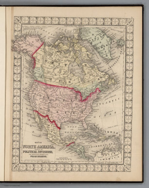
Mitchell, Samuel Augustus Jr.
Full Title
Map of North America Showing its Political Divisions and Recent Discoveries in the Polar Regions. Entered ... 1874 by S. Augustus Mitchell ... Washington.
Publisher
Ziegler & McCurdy
Author
[Breese, Samuel, 1802-1873, Morse, Sidney E. (Sidney Edwards), 1794-1871]
Full Title
North America. (By Sidney E. Morse and Samuel Breese. New York: Published by Harper & Brothers, 1845)
Publisher
Harper & Brothers
Full Title
Carte geographique, statistique et historique de l'Amerique. Amerique Sept. Grave par B. Beaupre, Rue de Vanguard No. 81. Amerique Merid. ... Fonderie et Imprimerie de J. Carez. (1825)
Publisher
J. Carez
Full Title
Carte geographique, statistique et historique de l'Amerique Septentrionale. Amerique Septentrionale. Grave par B. de Beaupre, Rue de Vaugirard No. 81, a Paris. Fonderie et Imprimerie de J. Carez. (1825)
Publisher
J. Carez
Author
Levasseur, Victor.
Full Title
Amerique Septentrionale. Atlas Universel Illustre. Nouveau Continent. Geographie et Statistique de V. Levasseur, Ingenieur Geographe. Grave par Laguillermie, rue St. Jacques, No. 82. Illustre par Raimond Bonheur, Peintre. Impie. de Lemercier. Paris. A Paris, chez A. Combette, Editeur, rue de la Parcheminerie, 15. (1856)
Publisher
A. Combette
Author
Colton, G.W.
Full Title
North America. No. 2. Published by J.H. Colton & Co., No 172 William St., New York. Entered according to the Act of Congress in the year 1855 by J.H. Colton & Co. in the Clerk's Office of the District Court of the United States for the Southern District of New York.
Publisher
J.H. Colton
Author
Colton, G.W.
Full Title
Northern America, British, Russian & Danish Possessions in North America. No. 3. Published by J.H. Colton & Co., No 172 William St., New York.
Publisher
J.H. Colton
Author
Bradford, Thomas G.
Full Title
North America. Entered ... 1838, by T.G. Bradford ... Massachusetts. Engraved by G.W. Boynton.
Publisher
[Weeks, Jordan & Co., Wiley and Putnam.]
Author
Finley, Anthony
Full Title
Map of North America Including All The Recent Geographical Discoveries. 1826. Drawn by D.H. Vance. Engraved by J.H. Young. Published by A. Finley Philada. 1826.
Publisher
Anthony Finley
Full Title
North America. (London: Published by Simpkin & Marshall -- and Thomas Wardle, Philadelphia. 1832)
Publisher
[Simpkin & Marshall, Thomas Wardle]
Author
[Paullin, Charles O., Wright, John K.]
Full Title
Plate 12. Cartography 1492-1867. De Soto Map ca. 1544. Gastaldi Map, 1546. (Facsimiles).
Publisher
[Carnegie Institution of Washington, American Geographical Society of New York]
Author
[Paullin, Charles O., Wright, John K.]
Full Title
Plate 14. Cartography 1492-1867. Harleian Map ca. 1536. (Facsimile).
Publisher
[Carnegie Institution of Washington, American Geographical Society of New York]
Author
[Paullin, Charles O., Wright, John K.]
Full Title
Plate 15. Cartography 1492-1867. Mercator Map, 1569. (Facsimile).
Publisher
[Carnegie Institution of Washington, American Geographical Society of New York]
Author
[Paullin, Charles O., Wright, John K.]
Full Title
Plate 38. Explorations. Spanish Explorations in the Southwest 1535-1706.
Publisher
[Carnegie Institution of Washington, American Geographical Society of New York]
Author
Finley, Anthony
Full Title
Map of North America including All the Recent Geographical Discoveries, 1827.
Publisher
Anthony Finley
Author
[Colton, J.H., Gray, O.W.]
Full Title
North America. Entered ... 1855 by J.H. Colton & Co. ....
Publisher
Stedman & Brown
Author
[Morse, Sidney E., Breese, Samuel]
Full Title
North America. (By Sidney E. Morse and Samuel Breese. New York: Published by Harper & Brothers, 1845). (to accompany) Morse's Cerographic Maps. No. VII.
Publisher
Harper and Brothers
Author
Robert Sayer and John Bennett (Firm)
Full Title
North America, As Divided amongst the European Powers By Samuel Dunn, Mathematician. London: Printed for Robt. Sayer ... 10 Jany. 1774.
Publisher
Sayer and Bennett
Author
Mitchell, Samuel Augustus
Full Title
Map Of North America Including All The Recent Geographical Discoveries. Published by S. Augustus Mitchell Philadelphia. 1831. J.H. Young Sc.
Publisher
S.A. Mitchell
Author
Finley, Anthony
Full Title
Map of North America including All the Recent Geographical Discoveries, 1827. Drawn by D.H. Vance. Published by A. Finley, Philada. Engraved by J.H. Young.
Publisher
Anthony Finley
Author
Rand McNally and Company
Full Title
Commercial Atlas of America. Rand McNally, 14 x 21 Inch Map of North America.
Publisher
Rand McNally and Company
Author
Lange, Henry, 1821-1893.
Full Title
Ethnographisches Karte von Nord Amerika. Ethnographical map of North America. (with inset map) Verbreitung der Deutschen in den Vereinigten Staaten. Nach A. Gallatin, H. Hale u. K. Andree, etc. Entworfen u. bearbeitet von H. Lange. H. Lange's Atlas v. Nord Amerika Blatt XV. Braunschweig: Verlag v. George Westermann. Lith. Anst. von L. Kraatz in Berlin.
Publisher
George Westermann.
Author
Lange, Henry, 1821-1893.
Full Title
Verbreitung u. vertheilung der Saugethiere (Mammalia) in Nord Amerika. (with 3 inset maps) Vergleichende Uebersicht der in Nord-Amerika einheimischen Familien der Land Saugethiere. H. Lange's Atlas v. Nord Amerika Blatt XVI. Braunschweig: Verlag v. George Westermann. Lith. Anst. von L. Kraatz in Berlin.
Publisher
George Westermann.
Author
Lange, Henry, 1821-1893.
Full Title
Verbreitung der nahrungs- und kleidungsstoffe liefernden Pflanzen etc. in Nord Amerika. H. Lange's Atlas v. Nord Amerika Blatt XVII. Braunschweig: Verlag v. George Westermann. Lith. Anst. von L. Kraatz in Berlin.
Publisher
George Westermann.
Author
[Bartholomew, John, Black, Adam & Charles]
Full Title
North America. Published by A. & C. Black. Edinburgh. Printed in Colours by Schenck & Macfariane. Edinburgh. Drawn & Engraved by J. Bartholomew, Edinburgh.
Publisher
A. & C. Black
Author
Lange, Henry, 1821-1893.
Full Title
Nord Amerika. (with inset map) Staaten Karte v. Amerika. (with) Seewege zwischen Europa u. Nord Amerika. H. Lange's Atlas v. Nord Amerika Blatt I. Braunschweig: Verlag v. George Westermann. Lith. Anst. von L. Kraatz in Berlin.
Publisher
George Westermann.
Author
Rand McNally and Company
Full Title
Rand, McNally & Co.'s North America.
Publisher
Rand McNally and Company
Author
Rand McNally and Company
Full Title
Rand, McNally & Co.'s North America.
Publisher
Rand McNally
Author
[Carey, H. C., Lea, I.]
Full Title
Geographical, Statistical, And Historical Map Of North America. North America. No. 3. Drawn by J. Finlayson. Engraved by J. Yeager.
Publisher
H.C. Carey & I. Lea
Author
Popple, Henry
Full Title
America Septentrionalis. A Map of the British Empire in America with the French and Spanish Settlements adjacent thereto. by Henry Popple. To the Queen's Most Excellent Majesty This Map is most humbly Inscribed by Your Majesty's most Dutiful, most Obedient, and most Humble Servant Henry Popple. W.H. Toms Sculp.
Publisher
Willm. Henry Toms & R.W. Seale.
Author
Popple, Henry
Full Title
America Septentrionalis. A Map of the British Empire in America with the French and Spanish Settlements adjacent thereto. by Henry Popple. To the Queen's Most Excellent Majesty This Map is most humbly Inscribed by Your Majesty's most Dutiful, most Obedient, and most Humble Servant Henry Popple. W.H. Toms Sculp.
Publisher
Willm. Henry Toms & R.W. Seale
1-36 of 36
|