Who What Where WhenREMOVEWHERE
|
REFINE
Browse All : Atlas Map and National Parks
1-23 of 23
Author
[California Geological Survey, King, Clarence, Gardner, J.T.]
Full Title
Map of the Yosemite Valley from Surveys made by order of the Commissioners to manage the Yosemite Valley and Mariposa Big Tree Grove by C. King and J.T. Gardner 1865. Drawn by J.T.G.
Publisher
University Press
Author
[California Geological Survey, Whitney, J.D., Gardner, J.T., Hoffmann, Chs. F.]
Full Title
Map of a Portion of the Sierra Nevada adjacent to Yosemite Valley, from surveys made by Chs. F. Hoffmann and J.T. Gardner, 1863 -1867. Geological Survey of California, J.D. Whitney, State Geologist. J. Bien, Lith. N.Y.
Publisher
Julius Bien
Author
[California Geological Survey, King, Clarence, Gardner, J.T.]
Full Title
Map of the Yosemite Valley from Surveys made by order of the Commissioners to manage the Yosemite Valley and Mariposa Big Tree Grove by C. King and J.T. Gardner 1865. Drawn by J.T.G.
Publisher
University Press
Author
[California Geological Survey, Whitney, J.D., Gardner, J.T., Hoffmann, Chs. F.]
Full Title
Map of a Portion of the Sierra Nevada adjacent to Yosemite Valley, from surveys made by Chs. F. Hoffmann and J.T. Gardner, 1863 -1867. Geological Survey of California, J.D. Whitney, State Geologist. J. Bien, Lith. N.Y.
Publisher
University Press
Author
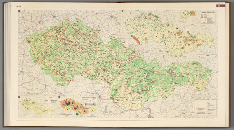
[Götz, Antonín, Československá akademie věd., Czechoslovakia. Ústřední správa geodézie a kartografie.]
Full Title
Culture.
Publisher
Czechoslovakia. Ústřední správa geodézie a kartografie.
Author
[USGS (U.S. Geological Survey), Walcott, Charles D., Plummer, Fred G.]
Full Title
Plate XXXVII. Mount Rainier Forest Reserve, Washington, Showing Distribution of Red or Yellow Fir (Pseudotsuga taxifolia) by Fred G. Plummer. 1899.
Publisher
Government Printing Office
Author
[USGS (U.S. Geological Survey), Walcott, Charles D., Plummer, Fred G.]
Full Title
Plate XXXIX. Mount Rainier Forest Reserve, Washington, Showing Distribution of Hemlock (Tsuga mertensiana) by Fred G. Plummer. 1899. Julius Bien & Co. Lith. N.Y.
Publisher
Government Printing Office
Author
[USGS (U.S. Geological Survey), Walcott, Charles D., Plummer, Fred G.]
Full Title
Plate XLII. Mount Rainier Forest Reserve, Washington, showing distribution of red cedar (Thuja plicata), by Fred G. Plummer. 1899. Julius Bien & Co. Lith. N.Y.
Publisher
Government Printing Office
Author
[USGS (U.S. Geological Survey), Walcott, Charles D., Plummer, Fred G.]
Full Title
Plate XLVI. Mount Rainier Forest Reserve, Washington, Showing distribution of yellow pine (Pinus ponderosa), by Fred G. Plummer. 1899. Julius Bien & Co. Lith. N.Y.
Publisher
Government Printing Office
Author
[USGS (U.S. Geological Survey), Walcott, Charles D., Dodwell, Arthur, Rixon, Theodore F.]
Full Title
Plate LI. Part of the Olympic Forest Reserve, Washington, Showing classification of lands. Land classification by Arthur Dodwell and Theodore F. Rixon.
Publisher
Government Printing Office
Author
[USGS (U.S. Geological Survey), Gannett, Henry, Dodwell, Arthur, Rixon, Theodore F., Walcott, Charles D.]
Full Title
Plate LIII. Part of the Olympic Forest Reserve, Washington, Show in the proportion which red fir bears to the total forest. Land classification by Arthur Dodwell and Theodore F. Rixon.
Publisher
Government Printing Office
Author
[USGS (U.S. Geological Survey), Gannett, Henry, Dodwell, Arthur, Rixon, Theodore F., Walcott, Charles D.]
Full Title
Plate LVI. Part of the Olympic Forest Reserve, Washington, Showing the proportion which hemlock bears to the total forest. 1899. Land classification by Arthur Dodwell and Theodore F. Rixon.
Publisher
Government Printing Office
Author
[USGS (U.S. Geological Survey), Walcott, Charles D., Gannett, Henry, Dodwell, Arthur, Rixon, Theodore F.]
Full Title
Plate LIX. Part of the Olympic Forest Reserve, Washington, Showing the proportion which cedar bears to the total forest. Land classification by Arthur Dodwell and Theodore F. Rixon.
Publisher
Government Printing Office
Author
[USGS (U.S. Geological Survey), Gannett, Henry, Dodwell, Arthur, Rixon, Theodore F., Walcott, Charles D.]
Full Title
Plate LXI. Part of the Olympic Forest Reserve, Washington, Showing the proportion which spruce bears to the total forest. Land classification by Arthur Dodwell and Theodore F. Rixon.
Publisher
Government Printing Office
Author
[USGS (U.S. Geological Survey), Walcott, Charles D., Gannett, Henry, Dodwell, Arthur, Rixon, Theodore F.]
Full Title
Plate LXIII. Part of the Olympic Forest Reserve, Washington, Showing the proportion which silver fir bears to the total forest. 1899.
Publisher
Government Printing Office
Author
[USGS (U.S. Geological Survey), Walcott, Charles D., Gannett, Henry, Leiberg, John B., Thompson, A.H.]
Full Title
Plate LXXI. Ashland Quadrangle. Oregon. Land Classification and Density of Standing Timber. Julius Bien & Co. Lith. N.Y.
Publisher
Government Printing Office
Author
[USGS (U.S. Geological Survey), Walcott, Charles D., Leiberg, John B.]
Full Title
Plate LXXXII. Part of Southern Oregon Showing Distribution of Yellow Pine and White Bark Pine.
Publisher
Government Printing Office
Author
[USGS (U.S. Geological Survey), Sudworth, George B., Walcott, Charles D.]
Full Title
Plate XC. Dardanelles Quadrangle, California. Land Classification and Density of Standing Timber. Julius Bien & Co. Lith. N.Y.
Publisher
Government Printing Office
Author
[USGS (U.S. Geological Survey), Walcott, Charles D., Sudworth, George B.]
Full Title
Plate CXV. Sonora Quadrangle, California. Land Classification and Density of Standing Timber.
Publisher
Government Printing Office
Author
[USGS (U.S. Geological Survey), Walcott, Charles D., Sudworth, George B.]
Full Title
Plate CXVI. Yosemite Quadrangle, California. Land Classification and Density of Standing Timber. Julius Bien & Co. Lith. N.Y.
Publisher
Government Printing Office
Author
[USGS (U.S. Geological Survey), Walcott, Charles D., Sudworth, George B.]
Full Title
Plate CXVII. Mt. Lyell Quadrangle, California. Land Classification and Density of Standing Timber. Julius Bien & Co. Lith. N.Y.
Publisher
Government Printing Office
Author
[USGS (U.S. Geological Survey), Walcott, Charles D., Gannett, Henry]
Full Title
Plate I. Map Showing Location and Extent of the Forest Reserves and National Parks in Western United States, 1899. Julius Bien & Co. Lith. N.Y.
Publisher
Government Printing Office
Author
[USGS (U.S. Geological Survey), Walcott, Charles D., Plummer, Fred G.]
Full Title
Plate XXXIII. Mount Rainier Forest Reserve, Washington, Showing Classification of Lands, by Fred G. Plummer. 1899.
Publisher
Government Printing Office
1-23 of 23
|