Browse All

1827 France physique. Physical Atlas Carte physique de la France. (Dessinee p … |

1908 Geomorphic map, California, Nevada, port … Physical Atlas Geomorphic map of California and Nevada … |

1908 Coast of California showing San Andreas … Physical Atlas Map of a portion of the coast of Califor … |

1908 San Andreas Rift near Fort Ross. Physical Atlas Detail map of a typical portion of the S … |

1908 San Francisco Bay showing San Andreas Ri … Physical Atlas Map of the region about San Francisco Ba … |

1908 Coast Ranges showing San Andreas Rift. Physical Atlas Map of a portion of the Coast Ranges of … |

1908 Mt. Pinos quadrangle showing San Andreas … Physical Atlas California, Mt. Pinos quadrangle of the … |

1908 Tejon quadrangle showing San Andreas Rif … Physical Atlas California, Tejon quadrangle of the U.S. … |

1908 Palmdale quadrangle showing San Andreas … Physical Atlas California, Palmdale quadrangle of the U … |

1908 Rock Creek quadrangle showing San Andrea … Physical Atlas California, Rock Creek quadrangle of the … |

1908 San Antonio quadrangle showing San Andre … Physical Atlas California, San Antonio quadrangle of th … |

1908 Hesperia quadrangle showing San Andreas … Physical Atlas California, Hesperia quadrangle of the U … |

1908 San Bernardino quadrangle showing San An … Physical Atlas California, San Bernardino quadrangle of … |

1908 Redlands quadrangle showing San Andreas … Physical Atlas California, Redlands quadrangle of the U … |

1908 San Gorgonio quadrangle showing San Andr … Physical Atlas California, San Gorgonio quadrangle of t … |

1908 San Jacinto quadrangle showing San Andre … Physical Atlas California, San Jacinto quadrangle of th … |

1908 Santa Rosa, portions destroyed by earthq … Physical Atlas Map of the city of Santa Rosa, Sonoma Co … |

1908 Geological map San Francisco. Physical Atlas Geological map of the city of San Franci … |

1908 Geological profiles, San Francisco. Physical Atlas Geological profiles with corresponding i … |

1908 San Francisco intensity of earthquake. Physical Atlas Map of San Francisco showing distributio … |

1908 San Francisco burnt area, 1906. Physical Atlas Map of the city of San Francisco showing … |

1908 San Mateo quadrangle showing intensity, … Physical Atlas California, San Mateo quadrangle of the … |

1908 Santa Cruz quadrangle showing intensity, … Physical Atlas California, Santa Cruz quadrangle of the … |

1908 California, Nevada showing intensity. Physical Atlas Map of California and Nevada showing the … |

1908 Coast Range Middle California distributi … Physical Atlas Map of the Coast Range Region of Middle … |

1908 Distribution of earth movement, April 18 … Physical Atlas Distribution of earth movement on April … |

1966 Index Map Physical Atlas Index Map. Locations are Approximate. (i … |

1966 Horizontal Strata. Soda Canyon, Colo. Physical Atlas Horizontal Strata. Soda Canyon, Colo. |

1966 Horizontal Strata. Bright angel Ariz. Physical Atlas Horizontal Strata. Bright Angel Ariz. |

1966 Horizontal Strata. Zion National Park, U … Physical Atlas Horizontal Strata. Zion National Park, U … |

1966 Horizontal Strata. Bryce Canyon national … Physical Atlas Horizontal Strata. Bryce Canyon National … |

1966 Horizontal Strata. Oljeto, Utah Physical Atlas Horizontal Strata. Oljeto, Utah. |

1966 Horizontal Strata. Big Clifty, KY. Physical Atlas Horizontal Strata. Big Clifty, KY. |

1966 Horizontal Strata. Jacksonville, Ill. Ge … Physical Atlas Horizontal Strata. Jacksonville, Ill. (o … |

1966 Horizontal Strata. New Haven, Ill. Dendr … Physical Atlas Horizontal Strata. New Haven, Ill. (on t … |

1966 Horizontal Strata. Elmira, N.Y. Sheep Mo … Physical Atlas Horizontal Strata. Elmira, N. Y. (on the … |

1966 Horizontal Strata. Paralle Drainage. Mes … Physical Atlas Horizontal Strata. Paralle Drainage. Mes … |

1966 Horizontal Strata. Cuestas. Rich Tazigza … Physical Atlas Horizontal Strata. Cuestas. Rich Tazigza … |

1966 Domes & Basin. Geology of the Michigan B … Physical Atlas Domes & Basin. Geology of the Michigan B … |

1966 Domes & Basin. Laccolithic Domes. Sundan … Physical Atlas Domes & Basin. Laccolithic Domes. Sundan … |

1966 Domes & Basin. Salt Domes. Derouen, LA. … Physical Atlas Domes & Basin. Salt Domes. Derouen, LA. … |

1966 Domes & Basin. Centripetal Drainage. Bur … Physical Atlas Domes & Basin. Centripetal Drainage. Bur … |

1966 Folded Structure. Harrisburg, PA. Geolog … Physical Atlas Folded Structure. Harrisburg, PA. (oppos … |

1966 Folds. Loysvill, PA. Folded Mountains-Hu … Physical Atlas Folds. Loysvill, PA. Folded Mountains-Hu … |

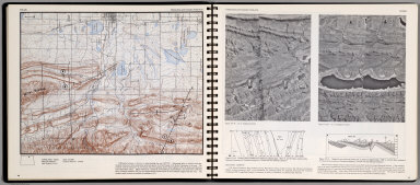
1966 Folds. Hollidysburg, PA. Belcher Islands … Physical Atlas Folds. Plunging Anticlines and Synclines … |

1966 Folds. Plunging Anticlinal and Synclinal … Physical Atlas Folds. Plunging Anticlinal and Synclinal … |
1966 Folds. Homoclines and Complex Folds-Arid … Physical Atlas Folds. Homoclines and Complex Folds-Arid … |

1966 Faulted Structure. Youth. Modoc Point, O … Physical Atlas Faulted Structure. Youth. Modoc Point, O … |

1966 Fault Block. Maturity. Halleck, Nev. Physical Atlas Fault Block. Maturity. Halleck, Nev. (on … |

1966 Fault Block. Old Age. Antelope Peak, Ari … Physical Atlas Fault Block. Old Age. Antelope Peak, Ari … |