Who What Where WhenREMOVE |
REFINE
Browse All : Atlas Map and State Atlas of United States
1-45 of 45
Author
[G.W. & C.B. Colton & Co., Walling, H. F.]
Full Title
Map of the United States of America. Entered according to act of Congress in the year 1873 by G.W. & C.B. Colton & Co ... Washington. (Drawn, compiled, and edited by H.F. Walling, C.E. ... Published by R.M. & S.T. Tackabury, Detroit, Mich. Entered ... 1873, by H.F. Walling ... Washington. The Claremont Manufacturing Company, Claremont, N.H., Book Manufacturers)
Publisher
R.M. & S.T. Tackabury
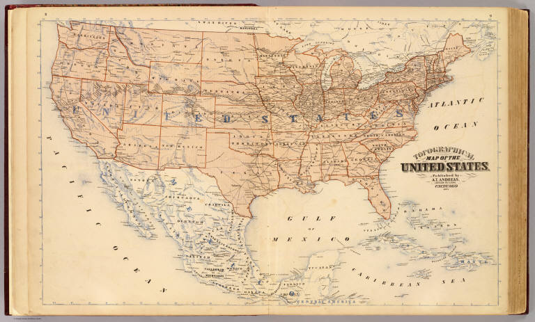
Author
Andreas, A. T. (Alfred Theodore), 1839-1900
Full Title
Topographical map of the United States. Published by A.T. Andreas, Lakeside Building, Chicago, 1873. (Chas. Shober & Co. Proprietors of Chicago Lith. Co.)
Publisher
A.T. Andreas
Author
Andreas, A. T. (Alfred Theodore), 1839-1900
Full Title
Population, United States Census, 1870: Density of population. Foreign population, Colored population, British American population, Swedish and Norwegian population. (Published by A.T. Andreas, Lakeside Building, Chicago, 1874. Chas. Shober & Co. Proprietors of Chicago Lith. Co.)
Publisher
A.T. Andreas
Author
Andreas, A. T. (Alfred Theodore), 1839-1900
Full Title
Agricultural productions colored by grades to show quantity raised in localities, from the ninth census: wheat, hay, corn, cotton, tobacco. (Published by A.T. Andreas, Lakeside Building, Chicago, 1874. Chas. Shober & Co. Proprietors of Chicago Lith. Co.)
Publisher
A.T. Andreas
Author
Andreas, A. T. (Alfred Theodore), 1839-1900
Full Title
Vital statistics, United Census, 1870: Deaths from consumption ... malarial diseases ... enteric cerebro-spinal and typhus fevers ... intestinal diseases. (Published by A.T. Andreas, Lakeside Building, Chicago, 1874. Chas. Shober & Co. Proprietors of Chicago Lith. Co.)
Publisher
A.T. Andreas
Author
Andreas, A. T. (Alfred Theodore), 1839-1900
Full Title
New railroad map of the United States, the Dominion of Canada, Mexico and the West Indies. (Published by the Andreas Atlas Co., Lakeside Building, Chicago, Ills. Engraved & printed by Chas. Shober & Co., Props. of Chicago Lithographing Co.)
Publisher
Andreas Atlas Co.
Author
Andreas, A. T. (Alfred Theodore), 1839-1900
Full Title
Population - United States census, 1870. Density of population. Foreign population. Colored population. British American population. Swedish and Nowegian population. (Published by the Andreas Atlas Co., Lakeside Building, Chicago, Ills. Engraved & printed by Chas. Shober & Co., Props. of Chicago Lithographing Co.)
Publisher
Andreas Atlas Co.
Author
Andreas, A. T. (Alfred Theodore), 1839-1900
Full Title
Agricultural productions colored by grades to show quantity raised in localities. From the ninth census. Wheat, hay, corn, cotton, tobacco. (Published by the Andreas Atlas Co., Lakeside Building, Chicago, Ills. Engraved & printed by Chas. Shober & Co., Props. of Chicago Lithographing Co.)
Publisher
Andreas Atlas Co.
Author
Andreas, A. T. (Alfred Theodore), 1839-1900
Full Title
Vital statistics, United Census, 1870: Deaths from consumption ... malarial diseases ... enteric cerebro-spinal and typhus fevers ... intestinal diseases. (Published by the Andreas Atlas Co., Lakeside Building, Chicago, Ills. Engraved & printed by Chas. Shober & Co., Props. of Chicago Lithographing Co.)
Publisher
Andreas Atlas Co.
Author
[Lloyd, H.H., Warner & Beers]
Full Title
Map of the United States. Warner & Beers, Publishers. From H.H. Lloyd & Co.'s Atlas of the United States.
Publisher
Warner & Beers
Author
[Lloyd, H.H., Warner & Beers]
Full Title
Atlas of the United States, New England, New York, and New Jersey. Warner & Beers, Publishers. From H.H. Lloyd & Co.'s Atlas of the United States.
Publisher
Warner & Beers
Author
[Lloyd, H.H., Warner & Beers]
Full Title
Atlas of the United States, Map of the Central States. Warner & Beers, Publishers. From H.H. Lloyd & Co.'s Atlas of the United States.
Publisher
Warner & Beers
Author
[Lloyd, H.H., Warner & Beers]
Full Title
Atlas of the United States, Map of the Western States. Warner & Beers, Publishers. From H.H. Lloyd & Co.'s Atlas of the United States.
Publisher
Warner & Beers
Author
[Lloyd, H.H., Warner & Beers]
Full Title
Atlas of the United States, Map of the Southern States. (inset) Map of Southern Florida. Warner & Beers, Publishers. From H.H. Lloyd & Co.'s Atlas of the United States.
Publisher
Warner & Beers
Author
[Beers, J.B. & Co., H.W. Burgett and Company]
Full Title
Map of the United States. 1876. (Published by H.W. Burgett & Co. 36 Vesey Street, New-York. 1876. Entered ... 1876 by H.W. Burgett & Co. ... Washington D.C. Engraved & printed by J.B. Beers & Co. 36 Vesey St. N.Y.)
Publisher
H.W. Burgett & Co.
Author
[Walling, H.F., Hitchcock, C.H.]
Full Title
Railroad Map of the United States.
Publisher
Comstock & Cline (Bien)
Author
Cram, George Franklin
Full Title
Map of the United States. Published by Geo. F. Cram, Chicago, Ill. (1909)
Publisher
E.A. Davis
Full Title
New topographical atlas and gazetteer of Indiana. United States and territories. (Indianapolis: Higgins & Ryan, 1870)
Publisher
Higgins & Ryan
Author
[Gray, Frank Arnold, O.W. Gray & Son]
Full Title
Gray's new map of the United States. (with) Territorial District of Alaska formerly Russian America ... (with) Sketch exhibiting the westward movement of the centre of population from 1790 to 1880 ... By Frank A. Gray. Copyright, 1894 by O.W. Gray & Son.
Publisher
J.H. Stuart & Co.
Author
[Gray, Frank Arnold, O.W. Gray & Son]
Full Title
Gray's new map of the United States. (with) Territorial District of Alaska formerly Russian America ... (with) Sketch exhibiting the westward movement of the centre of population from 1790 to 1880 ... By Frank A. Gray. Copyright, 1879 by O.W. Gray & Son. Philadelphia: O.W. Gray & Son. (1885)
Publisher
George N. Colby
Author
[Gray, Ormando Willis, Lloyd, H.H., Walling, H. F.]
Full Title
Atlas of the United States. Delaware, Illinois, Indiana, Iowa, Kentucky, Maryland, Missouri, New Jersey, North Carolina, Ohio, Pennsylvania, Tennessee, Virginia and West Virginia. (Published by Stedman, Brown & Lyon, Cincinnati. 1872. Entered ... 1872, by H.F. Walling, and O.W. Gray, and H.H. Lloyd & Co. ... Washington)
Publisher
Stedman, Brown & Lyon
Author
[Gray, Ormando Willis, Lloyd, H.H., Walling, H. F.]
Full Title
Map of the United States and territories. Philadelphia, 1872. (Published by Stedman, Brown & Lyon, Cincinnati. 1872. Entered ... 1872, by H.F. Walling, and O.W. Gray, and H.H. Lloyd & Co. ... Washington)
Publisher
Stedman, Brown & Lyon
Author
[Andreas, A. T. (Alfred Theodore), 1839-1900, Baskin, Forster and Company]
Full Title
New railroad map of the United States and Dominion of Canada. (Published by Baskin, Forster & Co. Lakeside Building Chicago, Ills. 1876. Engraved & Printed by Chas. Shober & Co. Props. of Chicago Lithographing Co.)
Publisher
Baskin, Forster & Co.
Author
[Andreas, A. T. (Alfred Theodore), 1839-1900, Baskin, Forster and Company]
Full Title
Population - United States census, 1870. German population. Irish population. (Published by Baskin, Forster & Co. Lakeside Building Chicago, Ills. 1876. Engraved & Printed by Chas. Shober & Co. Props. of Chicago Lithographing Co.)
Publisher
Baskin, Forster & Co.
Author
[Andreas, A. T. (Alfred Theodore), 1839-1900, Baskin, Forster and Company]
Full Title
Population - United States census, 1870. Density of population. Foreign population. Colored population. British American population. Swedish and Nowegian population. (Published by Baskin, Forster & Co. Lakeside Building Chicago, Ills. 1876. Engraved & Printed by Chas. Shober & Co. Props. of Chicago Lithographing Co.)
Publisher
Baskin, Forster & Co.
Author
[Andreas, A. T. (Alfred Theodore), 1839-1900, Baskin, Forster and Company]
Full Title
Agricultural productions colored by grades to show quantity raised in localities. From the ninth census. Wheat, hay, corn, cotton, tobacco. (Published by Baskin, Forster & Co. Lakeside Building Chicago, Ills. 1876. Engraved & Printed by Chas. Shober & Co. Props. of Chicago Lithographing Co.)
Publisher
Baskin, Forster & Co.
Author
[Andreas, A. T. (Alfred Theodore), 1839-1900, Baskin, Forster and Company]
Full Title
Vital statistics, United States census, 1870. Deaths from consumption, deaths from malarial diseases, deaths from enteric cerebro-spinal and typhus fevers, deaths from intestinal diseases. (Published by Baskin, Forster & Co. Lakeside Building Chicago, Ills. 1876. Engraved & Printed by Chas. Shober & Co. Props. of Chicago Lithographing Co.)
Publisher
Baskin, Forster & Co.
Author
[Mitchell, Samuel Augustus, Williams, W. (Wellington)]
Full Title
Map of the United States, and territories. Together with Canada &c. (with) Island of Newfoundland. Constructed & engraved by W. Williams, Philadelphia. Entered according to Act of Congress in the year 1872 by S. Augustus Mitchell in the Office of the Librarian of Congress at Washington. (1873)
Publisher
M.W. White
Author
Lloyd, H.H.
Full Title
Map of the United States and territories. Philadelphia, 1872. (by H.H. Lloyd. Published by Stedman, Brown & Lyon, Baltimore. 1873)
Publisher
Stedman, Brown & Lyon
Author
Lloyd, H.H.
Full Title
Atlas of the United States. Delaware, Illinois, Indiana, Iowa, Kentucky, Maryland, Missouri, New Jersey, North Carolina, Ohio, Pennsylvania, Tennessee, Virginia and West Virginia. (by H.H. Lloyd. Published by Stedman, Brown & Lyon, Baltimore. 1873)
Publisher
Stedman, Brown & Lyon
Author
[Mitchell, Samuel Augustus, Williams, W. (Wellington)]
Full Title
Map of the United States and territories. Together with Canada &c. (with) Island of Newfoundland. Constructed & engraved by W. Williams, Philadelphia. Entered ... 1870 by S. Augustus Mitchell, Jr. ... Pennsylvania.
Publisher
[R.A. Campbell, S.A. Mitchell, Jr.]
Author
[Gray, Ormando Willis, Walling, H. F.]
Full Title
Map of the United States and territories. H.F. Walling & O.W. Gray, Boston, 1871.
Publisher
Stedman, Brown & Lyon
Full Title
Map of the United States and territories. Philadelphia, 1872. (Published by Stedman, Brown & Lyon, Philadelphia)
Publisher
Stedman, Brown & Lyon
Author
Beers, F. W. (Frederick W.)
Full Title
Map of the United States of America. 1872.
Publisher
Beers, Comstock & Cline
Author
Geological Survey (U.S.)
Full Title
Map of the United States. Reduced from the nine sheet map of the United States Geological Survey. Julius Bien & Co., Lith., N.Y. (1895).
Publisher
Julius Bien & Co.
Author
[Union Atlas Co., Warner & Beers]
Full Title
New railroad map of the United States, and Dominion of Canada. (Union Atlas Co., Warner & Beers, Proprietors. Lakeside Building Cor: of Clark & Adams Sts. Chicago. 1876. Entered ... 1876 by Warner & Beers ... Washington D.C.)
Publisher
Warner & Beers
Author
[Union Atlas Co., Warner & Beers]
Full Title
These maps show amount of products raised in proportion to population and acres of improved land in 1870. Wheat. Hay. Corn. (Union Atlas Co., Warner & Beers, Proprietors. Lakeside Building Cor: of Clark & Adams Sts. Chicago. 1876. Entered ... 1876 by Warner & Beers ... Washington D.C.)
Publisher
Warner & Beers
Author
[Union Atlas Co., Warner & Beers]
Full Title
Agriculture and wealth by colors. Wealth. Cotton. Tobacco. Dairy products. (Union Atlas Co., Warner & Beers, Proprietors. Lakeside Building Cor: of Clark & Adams Sts. Chicago. 1876. Entered ... 1876 by Warner & Beers ... Washington D.C.)
Publisher
Warner & Beers
Author
[Union Atlas Co., Warner & Beers]
Full Title
United States vitality maps, compiled from the Census of 1870. Deaths from malarial diseases. Deaths from consumption. Deaths from enteric, cerebro-spinal and typhus fevers. Deaths from intestinal diseases. (Union Atlas Co., Warner & Beers, Proprietors. Lakeside Building Cor: of Clark & Adams Sts. Chicago. 1876. Entered ... 1876 by Warner & Beers ... Washington D.C.)
Publisher
Warner & Beers
Author
[Union Atlas Co., Warner & Beers]
Full Title
United States census maps, 1870. Foreign population. Density of population. Colored population. Irish population. German population. (Union Atlas Co., Warner & Beers, Proprietors. Lakeside Building Cor: of Clark & Adams Sts. Chicago. 1876. Entered ... 1876 by Warner & Beers ... Washington D.C.)
Publisher
Warner & Beers
Author
Snyder, Van Vechten & Co.
Full Title
United States Census maps, 1870. Density of population. Foreign population. Colored population. German population. Swedish & Norwegian population. Copyright 1877, by Syder Van Vechten & Co. (Compiled and published by Snyder, Van Vechten & Co., Milwaukee. 1878)
Publisher
Snyder, Van Vechten & Co.
Author
Snyder, Van Vechten & Co.
Full Title
United States vitality maps. Compiled from the Census of 1870. Deaths from consumption. Deaths from malarial diseases, deaths from enteric, cerebro-spinal and typhus fevers. Deaths from intestinal diseases. Copyright 1877, by Syder Van Vechten & Co. (Compiled and published by Snyder, Van Vechten & Co., Milwaukee. 1878)
Publisher
Snyder, Van Vechten & Co.
Author
Snyder, Van Vechten & Co.
Full Title
New rail road map of the United States. (Compiled and published by Snyder, Van Vechten & Co., Milwaukee. 1878)
Publisher
Snyder, Van Vechten & Co.
Author
Snyder, Van Vechten & Co.
Full Title
These maps show amount of products raised in proportion to population and acres of improved land in 1870. Wheat. Dairy Products. Corn. Copyright 1877, by Syder Van Vechten & Co. (Compiled and published by Snyder, Van Vechten & Co., Milwaukee. 1878)
Publisher
Snyder, Van Vechten & Co.
Author
Snyder, Van Vechten & Co.
Full Title
These maps show amount of products raised in proportion to population and acres of improved land in 1870. Hay. Tobacco. Cotton. Copyright 1877, by Syder Van Vechten & Co. (Compiled and published by Snyder, Van Vechten & Co., Milwaukee. 1878)
Publisher
Snyder, Van Vechten & Co.
1-45 of 45
|