Browse All

1872 Atlas of the United States, Map of the S … [National Atlas, State Atlas] Atlas of the United States, Map of the S … |

1872 Texas. [National Atlas, State Atlas] Atlas of the United States, Map of Texas … |

1872 Territory of Dakota, Minnesota, and Nebr … [National Atlas, State Atlas] Atlas of the United States, Map of the T … |

1872 Montana, Idaho, and Wyoming. [National Atlas, State Atlas] Atlas of the United States, Map of the M … |

1872 Utah, Arizona, New Mexico, Kansas, Color … [National Atlas, State Atlas] Atlas of the United States, Map of Utah, … |

1872 Nevada and California. [National Atlas, State Atlas] Atlas of the United States, Map of Nevad … |

1872 Washington and Oregon. Territory of Alas … [National Atlas, State Atlas] Atlas of the United States, Map of the W … |

1872 West Indies. [National Atlas, State Atlas] Map of the West Indies. Warner & Beers, … |

1875 Map of Franklin County, State of Iowa. State Atlas Map of Franklin County, State of Iowa. C … |

1872 Western Hemisphere. Eastern Hemisphere [National Atlas, State Atlas] Western Hemisphere. Eastern Hemisphere. |

1872 Morrison, Whiteside County, Illinois. [National Atlas, State Atlas] Morrison. |

1872 Mt. Pleasant Township, Whiteside County, … [National Atlas, State Atlas] Mt. Pleasant. |

1872 Lyndon Township, Whiteside County, Illin … [National Atlas, State Atlas] Lyndon. (insets) Lyndon. Round Ground. |

1872 Prophetstown Township, Whiteside County, … [National Atlas, State Atlas] Prophetstown. |

1872 Newton Township, Whiteside County, Illin … [National Atlas, State Atlas] Newton. (inset) Mineral Springs. |

1875 Map of Bremer County, Plan of Waverly, S … State Atlas Map of Bremer County, State of Iowa. (wi … |

1872 Garden Plain Township, Whiteside County, … [National Atlas, State Atlas] Garden Plain. (inset) Unionville. |

1872 Fulton Township, Whiteside County, Illin … [National Atlas, State Atlas] Fulton. |

1872 Hopkins Township, Whiteside County, Illi … [National Atlas, State Atlas] Hopkins. (insets) Galt. Empire. |
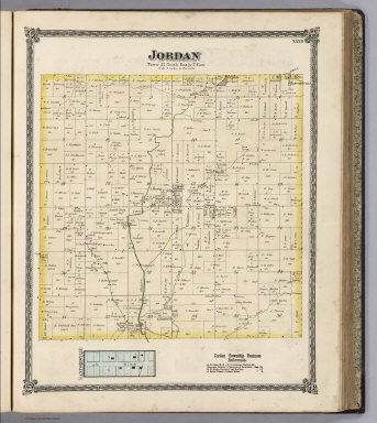
1872 Jordan Township, Whiteside County, Illin … [National Atlas, State Atlas] Jordan. (inset) Sanfordville. |

1875 Map of Butler County, State of Iowa. State Atlas Map of Butler County, State of Iowa. Cha … |

1875 Map of Black Hawk County, State of Iowa. State Atlas Map of Black Hawk County, State of Iowa. … |

1875 Map of Benton County, State of Iowa. State Atlas Map of Benton County, State of Iowa. Cha … |

1875 Plans of Vinton, Blairstown, Nevada and … State Atlas Plan of Vinton, Benton Co. (with) Plan o … |

1875 Map of Fayette County, State of Iowa. State Atlas Map of Fayette County, State of Iowa. (P … |

1875 Plans of Sioux Rapids, Onawa, Storm Lake … State Atlas Plan of Sioux Rapids, Buena Vista Co. (w … |

1870 Asher & Adams' New York, Railroads. State Atlas Asher & Adams' New Topographical Atlas A … |

1870 Asher & Adams' New York, Geological Map. State Atlas Asher & Adams' New Topographical Atlas A … |

1870 Asher & Adams' New York, Meteorological … State Atlas Asher & Adams' New Topographical Atlas A … |

1870 Asher & Adams' New York City. State Atlas Asher & Adams' New Topographical Atlas A … |

1870 United States and Territories. State Atlas Asher & Adams' New Topographical Atlas A … |

1870 Putnam, Rockland, Westchester, New York, … State Atlas Asher & Adams' New Topographical Atlas A … |

1870 Delaware, Sullivan, Greene, Ulster, Oran … State Atlas Asher & Adams' New Topographical Atlas A … |

1870 Oneida, Madison, Otsego, Fulton, Montgom … State Atlas Asher & Adams' New Topographical Atlas A … |

1870 Jefferson, Oswego, Lewis, Herkimer, Hami … State Atlas Asher & Adams' New Topographical Atlas A … |

1870 St. Lawrence, Franklin, Clinton, and Ess … State Atlas Asher & Adams' New Topographical Atlas A … |

1870 New York Counties. State Atlas Asher & Adams' New Topographical Atlas A … |

1870 Niagara, Orleans, Genese, Monroe, and Wa … State Atlas Asher & Adams' New Topographical Atlas A … |

1870 Niagara, Erie, Chautaugua, Cattaraugus, … State Atlas Asher & Adams' New Topographical Atlas A … |

1870 Onondaga, Cortland, Broome, Madison, and … State Atlas Asher & Adams' New Topographical Atlas A … |

1876 Map Of The World on Mercator's Projectio … State Atlas Map of the world on Mercator's projectio … |

1876 Map of the United States. State Atlas Map of the United States. 1876. (Publish … |

1876 Map Of Vermont. State Atlas Map of Vermont. (Published by H.W. Burge … |

1876 Plan of Bennington County, Vermont. State Atlas Plan of Bennington County, Vermont. (Pub … |

1876 Bennington and Plan of Battleboro, Vt. State Atlas Bennington: Town of Bennington, Benningt … |

1876 Plan of Windham County, Vermont. State Atlas Plan of Windham County, Vermont. Ed. W. … |

1876 Plan of Rutland Co., Vermont. State Atlas Plan of Rutland Co., Vermont. (Published … |

1876 Plan of Rutland, Rutland County, Vermont … State Atlas Plan of Rutland, Rutland County, Vermont … |

1876 Plan of Windsor Co., Vermont. State Atlas Plan of Windsor Co., Vermont. (Published … |

1876 Woodstock, Brandon, Fayetteville and Win … State Atlas Woodstock: Town of Woodstock, Windsor Co … |