1856
Holland And Belgium.
World Atlas
Holland and Belgium (with) two inset map
…
|

1804
Netherlands, part of Germany.
World Atlas
A new map of Netherlands, also of that p
…
|

1865
Belgium and Holland.
World Atlas
Belgium and Holland.
|

1952
Benelux.
World Atlas
Benelux. (insets) Amsterdam, Antwerpen,
…
|

1889
Belgium and Netherlands. Denmark.
World Atlas
Belgium and the Netherlands, Engraved Ex
…
|

1861
Belgium, Netherlands.
World Atlas
Belgium and the Netherlands. By Keith Jo
…
|

1886
Holland and Belgium.
World Atlas
Colton's Holland and Belgium. (insets) A
…
|

1832
Antwerp. Antwerpen. Anvers.
World Atlas
Antwerp. Antwerpen. Anvers. (with) Plan
…
|

1837
Brussels. Bruxelles.
World Atlas
Brussels. Bruxelles. Published under the
…
|

1874
Holand and Belgium.
World Atlas
Colton's Holland and Belgium. (insets) A
…
|

1866
Holland and Belgium.
World Atlas
Colton's Holland and Belgium. (insets) A
…
|

1901
Belgium. Netherlands.
World Atlas
Belgium and the Netherlands.
|

1853
Holland and Belgium
World Atlas
Holland and Belgium. Entered ... 1850, b
…
|

1862
Belgique & Hollande.
World Atlas
Belgique & Hollande. Atlas spheroidal &
…
|

1864
France, Holland and Belgium
World Atlas
Johnson's France By Johnson and Ward. Jo
…
|

1855
Holland and Belgium
World Atlas
Holland and Belgium. Entered ... 1850 by
…
|

1955
Index: Belgium, Plate 61, V. III
World Atlas
(Index to) Belgium. Secant Conic Project
…
|

1955
Belgium, Plate 61, V. III
World Atlas
Belgium. The Geographical Institute Edin
…
|

1873
Belgium.
World Atlas
Belgium.
|

1828
Netherlands.
World Atlas
Netherlands. By Sidney Hall. London, pub
…
|

1953
Belgium. Netherlands. Luxembourg.
World Atlas
Belgium. Netherlands. Luxembourg. (inset
…
|

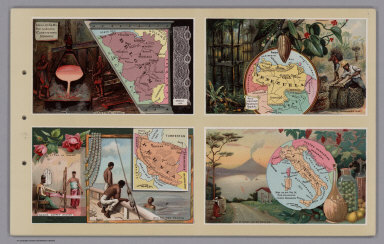
1890
Belgium. Venezuela. Persia. Italy.
World Atlas
Belgium. Venezuela. Persia. Italy.
|

1880
Netherlands & Belgium.
World Atlas
Netherlands & Belgium. W. Swan Sonnensch
…
|

1880
Netherlands & Belgium.
World Atlas
Netherlands & Belgium. W. Swan Sonnensch
…
|

1844
Holland, Belgien, Luxemburg.
World Atlas
Neueste Karte von Holland, Belgien und L
…
|

1860
Brussel, Bruxelles.
World Atlas
Brussel, Bruxelles. Aus der Geographisch
…
|

1845
Antwerpen, Anvers.
World Atlas
Antwerpen. Plan topographique d'Anvers,
…
|

1870
Holland and Belgium.
World Atlas
Johnson's Holland and Belgium. Entered .
…
|

1846
Regni di Olanda e del Belgio, e Gran Duc
…
World Atlas
Regni di Olanda e del Belgio, e Gran Duc
…
|

1824
Frankreich und die Niederlande.
[School Atlas, World Atlas]
Frankreich und die Niederlande. Berlin 1
…
|

1825
Konigreich der Niederlande.
[School Atlas, World Atlas]
Konigreich der Niederlande. Berlin 1825
…
|

1840
Belgium And Holland.
World Atlas
Belgium And Holland.
|

1874
Holland, Belgium, and Switzerland.
World Atlas
Johnson's Holland and Belgium. Published
…
|

1848
Holland And Belgium.
World Atlas
Holland and Belgium. 49. (1848)
|

1848
Belgium And Holland.
World Atlas
Belgium And Holland.
|

1811
Netherlands, Germany W. of Rhine.
World Atlas
Netherlands and that part of Germany wes
…
|

1901
Netherlands, Belgium.
World Atlas
The Netherlands and Belgium. London atla
…
|

1835
Belgium And Holland.
World Atlas
Belgium And Holland. Entered ... Nov. 11
…
|

1855
Niederlande, Belgien.
World Atlas
Niederlande und Belgien. Entw. u. gez. v
…
|

1845
Belgium.
World Atlas
Belgium. (Written and engraved by Jos. P
…
|

1842
Belgique, Hollande, Limbourg, Luxembourg
…
World Atlas
Carte de la Belgique et de Hollande, et
…
|

1865
Niederlande u. Belgien.
World Atlas
Niederlande und Belgien. Entworfen von J
…
|

1814
Gallia.
World Atlas
Gallia C Published Novr. 4th 1808 by the
…
|

1814
Netherlands.
World Atlas
The Netherlands. Drawn and Engraved for
…
|

1832
Holland, Belgium.
World Atlas
Holland & Belgium, by J. Arrowsmith. Lon
…
|

1821
Pays-Bas.
World Atlas
Carte du Royaume des Pays-Bas, par A.H.
…
|

1872
Holland & Belgium.
World Atlas
Holland & Belgium by G.H. Swanston, Edin
…
|

1822
Holland.
World Atlas
Holland. S. Harrison, Scl. (1822)
|

1892
Pays-Bas et Belgique.
World Atlas
Pays-Bas et Belgique. Grave par L. Smith
…
|

1824
Bataille de Mont Saint Jean.
World Atlas
Bataille de Mont Saint Jean. Ordre de ba
…
|