Who What Where WhenWHERE
|
Author
Clouet, J. B. L. (Jean-Baptiste Louis), b. 1730
Full Title
De la Turquie d'Europe. (1787)
Publisher
Mondhare et Jean
Author
Clouet, J. B. L. (Jean-Baptiste Louis), b. 1730
Full Title
De l'Europe. (1787)
Publisher
Mondhare et Jean
Author
Clouet, J. B. L. (Jean-Baptiste Louis), b. 1730
Full Title
Turquie d'Asie. De la Perse. (1787)
Publisher
Mondhare et Jean
Author
Clouet, J. B. L. (Jean-Baptiste Louis), b. 1730
Full Title
De l'Arabie. (1787)
Publisher
Mondhare et Jean
Author
Clouet, J. B. L. (Jean-Baptiste Louis), b. 1730
Full Title
De la Tartarie. (1787)
Publisher
Mondhare et Jean
Author
Clouet, J. B. L. (Jean-Baptiste Louis), b. 1730
Full Title
Empire du Mogol. (1787)
Publisher
Mondhare et Jean
Author
Clouet, J. B. L. (Jean-Baptiste Louis), b. 1730
Full Title
De l'Empire de la Chine, Re. de Coree, du Japon. (1787)
Publisher
Mondhare et Jean
Author
Clouet, J. B. L. (Jean-Baptiste Louis), b. 1730
Full Title
De l'Asie. (1787)
Publisher
Mondhare et Jean
Author
Clouet, J. B. L. (Jean-Baptiste Louis), b. 1730
Full Title
Barbarie. (with) Acores. (1787)
Publisher
Mondhare et Jean
Author
Clouet, J. B. L. (Jean-Baptiste Louis), b. 1730
Full Title
De l'Egypte. De la Nubie. De l'Abissinie. (1787)
Publisher
Mondhare et Jean
Author
Clouet, J. B. L. (Jean-Baptiste Louis), b. 1730
Full Title
De la Guinee. Du Congo. (with Caferie and Madagascar). (with) I. du Cap Verd. (with) I. de France, I Bourbon. (1787)
Publisher
Mondhare et Jean
Author
Clouet, J. B. L. (Jean-Baptiste Louis), b. 1730
Full Title
De l'Afrique. (1787)
Publisher
Mondhare et Jean
Author
Clouet, J. B. L. (Jean-Baptiste Louis), b. 1730
Full Title
Des possessions Francoises, aujourd'hui sous la domination Angloises. (1787)
Publisher
Mondhare et Jean
Author
Clouet, J. B. L. (Jean-Baptiste Louis), b. 1730
Full Title
Du Mexique. (with) La Terre Ferme. (1787)
Publisher
Mondhare et Jean
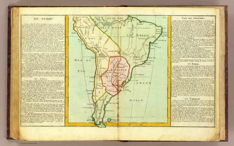
Author
Clouet, J. B. L. (Jean-Baptiste Louis), b. 1730
Full Title
Du Perou, du Chili, Pays des Amazones, du Bresil, du Paraguay. (1787)
Publisher
Mondhare et Jean
Author
Clouet, J. B. L. (Jean-Baptiste Louis), b. 1730
Full Title
De l'Amerique en general. (1787)
Publisher
Mondhare et Jean
Author
Dunn, Samuel
Full Title
A general map of the world or terraqueous globe; with all the new discoveries and marginal delineations, containing the most interesting particulars in the solar, starry and mundane systems. By Saml. Dunn, Mathematician. London: printed for Robert Sayer, no. 53 Fleet Street, as the Act directs, January 6, 1787.
Publisher
Robert Sayer
Author
Dunn, Samuel
Full Title
(A general map of the world or terraqueous globe; with all the new discoveries and marginal delineations, containing the most interesting particulars in the solar, starry and mundane systems. By Saml. Dunn, Mathematician). London: printed for Rt. Sayer, Map, Chart and Printseller, 53 Fleet Street, 1787.
Publisher
Robert Sayer
Author
Dunn, Samuel
Full Title
(Composite of) A general map of the world or terraqueous globe; with all the new discoveries and marginal delineations, containing the most interesting particulars in the solar, starry and mundane systems. By Saml. Dunn, Mathematician. London: printed for Rt. Sayer, Map, Chart and Printseller, 53 Fleet Street, 1787.
Publisher
Robert Sayer
Author
Kitchin, Thomas
Full Title
Europe divided into its empires, kingdoms, states, republics, &c. (Northern States). By Thos. Kitchin, Hydrographer to the King, with many additions and improvements from the latest surveys and observations. London, published by Robt. Sayer, Fleet Street, as the Act directs, Jany. 1st, 1787.
Publisher
Robert Sayer
Author
Kitchin, Thomas
Full Title
(Europe divided into its empires, kingdoms, states, republics, &c. Southern States. By Thos. Kitchin, Hydrographer to the King, with many additions and improvements from the latest surveys and observations. London, published by Robt. Sayer, Fleet Street, as the Act directs, Jany. 1st, 1787).
Publisher
Robert Sayer
Author
Kitchin, Thomas
Full Title
(Composite of) Europe divided into its empires, kingdoms, states, republics, &c. By Thos. Kitchin, Hydrographer to the King, with many additions and improvements from the latest surveys and observations. London, published by Robt. Sayer, Fleet Street, as the Act directs, Jany. 1st, 1787.
Publisher
Robert Sayer
Author
Jefferys, Thomas
Full Title
A chart of the British Channel; comprehending the southern coasts of England and Wales: from the mouth of the Thames to St. David's Head, with the coast of France from Dunkirk to the River of Nantes. By Thomas Jeffery's, Geographer to the King. London, published by Robert Sayer, no. 53 in Fleet Street, as the Act directs 20 Feby. 1787.
Publisher
Sayer and Bennett
Author
Pownall, Thomas
Full Title
The Atlantic Ocean by Governor Pownall, F.R.S. Published 20th Septr. 1787, by Robt. Sayer, 53 Fleet Street, London.
Publisher
Sayer and Bennett
Author
Jefferys, Thomas
Full Title
Chart of the Acores (Hawks) Islands, called also Flemish and Western Islands. London, Printed for Robert Sayer, as the Act directs May 1st, 1787.
Publisher
Sayer and Bennett
Author
Jefferys, Thomas
Full Title
A chart of the Maderas and Canary Islands, according to surveys published at Madrid in 1780, by Don Thomas Lopes, Geographer to His Catholick Majesty and ascertained by the astronomic observations of the Chevalier de Fleurieu, made by order of the French government in 1769. London, printed for Robt. Sayer, as the Act directs 1 Jany. 1787.
Publisher
Sayer and Bennett
Author
Jefferys, Thomas
Full Title
A new chart of the coast of Guyana from Rio Orinoco to River Berbice, containing the Dutch colonies of Poumaron, Issequibo and Demerary, and Berbice. (By Thomas Jefferys). London, printed for R. Sayer, Map & Chartseller, no. 53 Fleet Street, as the Act directs, 1 June 1787.
Publisher
Sayer and Bennett
Author
Clouet, J. B. L. (Jean-Baptiste Louis), b. 1730
Full Title
Mappe-monde suivant les nouvelles observations. Par Mr. l'Abbe Clouet. 1786.
Publisher
Mondhare et Jean
Author
[Paullin, Charles O., Wright, John K.]
Full Title
Plate 50. Lands. Lands Granted to States for Educational and Other Purposes, 1785 - 1919. Land of the Ohio Company about 1787. George Rogers Clark Grant about 1785. Lands Granted in 1828 for Construction of Columbus and Sandusky Turnpike (Facsimiles).
Publisher
[Carnegie Institution of Washington, American Geographical Society of New York]
Author
Barbie du Bocage, Jean Denis
Full Title
Phocis and Doris : For the travels of Anacharsis. By M. Barbie du Bocage June 1787. T.Cook, Sc. (to accompany) Maps, Plans, Views and Coins, Illustrative of the Travels of Anacharsis the Younger in Greece ... Second Edition ... M.DCC.XCIII. (1793). (on upper margin) No. 15. Vol. II. p. 374.
Publisher
G.G. & J. Robinson
Author
Barbie du Bocage, Jean Denis
Full Title
Essay on the Environs of Delphi, For the travels of Anacharsis. By M. Barbie du Bocage, March 1787. T.Cook, Sc. (inset) View of Delphi and the two rocks of Parnassus. (to accompany) Maps, Plans, Views and Coins, Illustrative of the Travels of Anacharsis the Younger in Greece ... Second Edition ... M.DCC.XCIII. (1793). (on upper margin) No. 16. Vol. II. p. 376.
Publisher
G.G. & J. Robinson
Author
Barbie du Bocage, Jean Denis
Full Title
Boeotia : For the travels of Anacharsis. By M. Barbie du Bocage, May 1787. T. Cook, Sc. (to accompany) Maps, Plans, Views and Coins, Illustrative of the Travels of Anacharsis the Younger in Greece ... Second Edition ... M.DCC.XCIII. (1793). (on upper margin) No. 18. Vol. III. p. 249.
Publisher
G.G. & J. Robinson
Full Title
(Carte de France levee par ordre du Roy). No. 129 (Rennes. 1787)
Publisher
Carte de la France Directeures
Full Title
(Carte de France levee par ordre du Roy). No. 130 (Paimboeuf - Redon. 1787)
Publisher
Carte de la France Directeures
Full Title
(Carte de France levee par ordre du Roy). No. 157 (Uzel. 1787)
Publisher
Carte de la France Directeures
Full Title
(Carte de France levee par ordre du Roy). No. 159 (Belle-Isle. 1787)
Publisher
Carte de la France Directeures
Author
Bonne, Rigobert, 1727-1794
Full Title
Carte des Gouvernements de Languedoc, de Foix et de Roussillon avec la partie orientale du Gouvernement de Guienne. Assujettie au ciel et projettee par Mr. Bonne, Hydrographe du Roi. A Paris, Chez Lattre, rue St. Jacques a la Ville de Bordeaux. 1787. Arrivet inv. & sculp.
Publisher
Lattre & Delalain
Author
Bonne, Rigobert, 1727-1794
Full Title
Carte du Royaume d'Ecosse. Projettee et assujettie aux observations astronomiques; par M. Bonne, Hydrographe du Roi. A Paris, Chez Lattre, rue S. Jacques a la Ville de Bord(eau)x. Avec privilege du Roy. 1787. Arrivet inv. & sculp.
Publisher
Lattre & Delalain
Author
Bonne, Rigobert, 1727-1794
Full Title
Carte de l'Empire de Perse. Projettee et assujettie aux observations astron. par Mr. Bonne, Hydrographe du Roi. A Paris, Chez Lattre Graveur, ordinaire de Monseigr. le Dauphin, rue S. Jacques a la Ville de Bordeaux. Avec privilege du Roy. 1787. Arrivet inv. & sculp.
Publisher
Lattre & Delalain
Author
Kitchin, Thomas
Full Title
A new map of the Kingdom of Poland with its dismembered provinces. (By Thomas Kitchin). London: printed for Robert Sayer, Fleet Street, as the Act directs, January 1st, 1787.
Publisher
Robert Sayer
Author
Kitchin, Thomas
Full Title
Asia and its islands according to d'Anville; divided into empires, kingdoms, states, regions, &ca. with the European possessions and settlements in the East Indies and an exact delineation of all the discoveries made in the eastern parts by the English under Captn. Cook. (Northern section. By Thomas Kitchin). London, printed for Robert Sayer, Fleet Street as the Act directs, 6 Jany. 1787.
Publisher
Robert Sayer
Author
Kitchin, Thomas
Full Title
(Asia and its islands according to d'Anville; divided into empires, kingdoms, states, regions, &ca. with the European possessions and settlements in the East Indies and an exact delineation of all the discoveries made in the eastern parts by the English under Captn. Cook. Southern section. By Thomas Kitchin. London, printed for Robert Sayer, Fleet Street as the Act directs, 6 Jany. 1787)
Publisher
Robert Sayer
Author
Boulton, S.
Full Title
Africa, with all its states, kingdoms, republics, regions, islands, &ca. (Northern section). Improved and inlarged from D'Anville's map; to which have been added a particular chart of the Gold coast, wherein are distinguished all the European forts and factories. By S. Boulton, and also a summary description relative to the trade and natural produce, manners and customs of the African continent and islands. London, printed for Robert Sayer, Fleet Street, as the Act directs, 6 Jany. 1787.
Publisher
Robert Sayer
Author
Boulton, S.
Full Title
(Africa, with all its states, kingdoms, republics, regions, islands, &ca. Southern section. Improved and inlarged from D'Anville's map; to which have been added a particular chart of the Gold coast, wherein are distinguished all the European forts and factories. By S. Boulton, and also a summary description relative to the trade and natural produce, manners and customs of the African continent and islands. London, printed for Robert Sayer, Fleet Street, as the Act directs, 6 Jany. 1787)
Publisher
Robert Sayer
Author
Kitchin, Thomas
Full Title
(A map of South America, containing Tierra-Firma, Guyana, New Granada, Amazonia, Brasil, Peru, Paraguay, Chaco, Tucuman, Chili and Patagonia. Northern section. From Mr. d'Anville with several improvements and additions, and the newest discoveries. London, printed for Robert Sayer, no. 53 Fleet Street, as the Act directs, July the 1st 1787)
Publisher
Robert Sayer
Author
Kitchin, Thomas
Full Title
A map of South America, containing Tierra-Firma, Guyana, New Granada, Amazonia, Brasil, Peru, Paraguay, Chaco, Tucuman, Chili and Patagonia. (Southern section). From Mr. d'Anville with several improvements and additions, and the newest discoveries. London, printed for Robert Sayer, no. 53 Fleet Street, as the Act directs, July the 1st 1787.
Publisher
Robert Sayer
|