Who What Where When |
Author
[Delamarche, Charles Francois, Lattre, Jean]
Full Title
(Positions de la Sphere. A Paris, chez Delamarche, Geogr., ca. 1800)
Publisher
C.F. Delamarche
Author
[Delamarche, Charles Francois, Lattre, Jean]
Full Title
(Systemes. A Paris, chez Delamarche, Geogr., ca. 1800)
Publisher
C.F. Delamarche
Full Title
Mappe-monde ou description du Globe Terrestre avec les nouvelles decouvertes. P.J. Picquet, sculpt. (A Paris, chez Delamarche, Geogr., ca. 1800)
Publisher
C.F. Delamarche
Full Title
L'Europe suivant ses nouvelles divisions. (A Paris, chez Delamarche, Geogr., ca. 1800)
Publisher
C.F. Delamarche
Author
Lattre, Jean
Full Title
Carte de la France divisee par gouvernements. A Paris, chez Lattre, Rue St. Jacques, avec priv. (ca. 1800)
Publisher
C.F. Delamarche
Full Title
L'Empire Francais, divise en 110 departemens avec les principaux chefs lieux. Picquet sculpt. (A Paris, chez Delamarche, Geogr., ca. 1800)
Publisher
C.F. Delamarche
Author
Lattre, Jean
Full Title
Les Pays Bas Septentrionaux et Meridionaux. A Paris, chez Lattre, avec priv. (ca. 1800)
Publisher
C.F. Delamarche
Full Title
Roymes. d'Espagne et de Portugal divises par gdes. provinces. (A Paris, chez Delamarche, Geogr., ca. 1800)
Publisher
C.F. Delamarche
Full Title
L'Italie divisee en ses differents etats. Avec priv. (A Paris, chez Delamarche, Geogr., ca. 1800)
Publisher
C.F. Delamarche
Author
Lattre, Jean
Full Title
L'Allemagne, divisee par cercles avec les etats de Boheme. A Paris, ches Lattre, rue St. Jacq. (ca. 1800)
Publisher
C.F. Delamarche
Full Title
Royaume de Hongrie divise en ses principales provinces. (A Paris, chez Delamarche, Geogr., ca. 1800)
Publisher
C.F. Delamarche
Full Title
La Pologne avec ses demenbremens. (A Paris, chez Delamarche, Geogr., ca. 1800)
Publisher
C.F. Delamarche
Full Title
Les royaumes d'Angleterre, d'Ecosse et d'Irelande. Avec privil. (A Paris, chez Delamarche, Geogr., ca. 1800)
Publisher
C.F. Delamarche
Full Title
Couronnes du Nord comprenant les royaumes de Danemarc, Suede et Norwege. Avec priv. (A Paris, chez Delamarche, Geogr., ca. 1800)
Publisher
C.F. Delamarche
Author
Delamarche, Charles Francois
Full Title
Russie d'Europe divisee par gouvernemens. A Paris, chez Delamarche, Geogr., rue du Foin St. Jacques. (ca. 1800)
Publisher
C.F. Delamarche
Full Title
Turquie d'Europe et partie de celle d'Asie, divisee par gds. gouvernemts. (A Paris, chez Delamarche, Geogr., ca. 1800)
Publisher
C.F. Delamarche
Full Title
L'Asie divisee en ses principaux etats. Avec pivilege du Roi 1783. (A Paris, chez Delamarche, Geogr., ca. 1800)
Publisher
C.F. Delamarche
Author
Lattre, Jean
Full Title
Les Indes Orientales et leur archipel. A Paris, ches Lattre. Avec priv. (ca. 1800)
Publisher
C.F. Delamarche
Author
Lattre, Jean
Full Title
L'Empire de la Chine avec les isles du Japon. A Paris, ches Lattre, rue St. Jacq. (ca. 1800)
Publisher
C.F. Delamarche
Author
Delamarche, Charles Francois
Full Title
L'Afrique divisee en ses principaux etats. A Paris, chez Delamarche, Geo. (ca. 1800)
Publisher
C.F. Delamarche
Author
Delamarche, Charles Francois
Full Title
L'Egypte ancienne et moderne. A Paris, chez Delamarche, Geog. (ca. 1800)
Publisher
C.F. Delamarche
Full Title
Cotes de Barbarie ou les royaumes de Maroc, de Fez, d'Alger, de Tunis et de Tripoli. Avec privilege. (A Paris, chez Delamarche, Geogr., ca. 1800)
Publisher
C.F. Delamarche
Author
Delamarche, Charles Francois
Full Title
Amerique Septentrionle. divisee en ses principaux etats. A Paris, chez Delamarche, Geo., 1783. (ca. 1800)
Publisher
C.F. Delamarche
Full Title
Etats-Unis de l'Amerique Seple. avec le Canada et la Floride. (A Paris, chez Delamarche, Geogr., ca. 1800)
Publisher
C.F. Delamarche
Author
Delamarche, Charles Francois
Full Title
Golfe du Mexique avec les Isles Antilles. A Paris, chez Delamarche, Geog., avec privil., 1783. (ca. 1800)
Publisher
C.F. Delamarche
Author
Delamarche, Charles Francois
Full Title
Amerique Meridionale divisee en ses principaux etats, avec privilege. A Paris, ches Delamarche, Geo., Rue du Foin St. Jacques. (ca. 1800)
Publisher
C.F. Delamarche
Author
Delamarche, Charles Francois
Full Title
Carte des 12 tribus d'Israel. A Paris, chez Delamarche, Geog., avec priv. (ca. 1800)
Publisher
C.F. Delamarche
Author
Delamarche, Charles Francois
Full Title
Carte des regions et des lieux dont il est parle dans le Nouveau Testament. (with) Plan de Jerusalem du tems le N.S.J.Ch. (with) Judee sous Herode le Grand et sous ses 3 fils Archelaus, Herode Antipas et Philippe. A Paris, chez Delamarche, Geogr., ca. 1800)
Publisher
C.F. Delamarche
Author
Robert Laurie & James Whittle
Full Title
A new chart of the World on Wright's or Mercator's projection in which are exhibited all the parts hitherto explored or discovered; with the tracks of the British circumnavigators Byron, Wallis, Carteret and Cook, &c. and the track of La Perouse in the Pacific Ocean. Published 25th Novemr. 1800 by Laurie & Whittle, No. 53 Fleet Street, London.
Publisher
Laurie & Whittle
Author
[Boulton, S., Robert Laurie & James Whittle]
Full Title
Africa, with all its states, kingdoms, republics, regions, islands, &ca. (North half). Improved and inlarged from d'Anville's map; to which have been added the discoveries of Parke, Vaillant, Brown &c. Also a particular chart of the Gold Coast, wherein are distinguished all the European forts and factories, by S. Boulton: and also a summary description relative to the trade and natural produce, manners and customs of the African continent and islands. London, Published by Laurie & Whittle, No. 53, Fleet-Street, as the act directs 12th May, 1800.
Publisher
Laurie & Whittle
Full Title
(Africa, with all its states, kingdoms, republics, regions, islands, &ca. South half. (with) A particular chart of the Gold Coast ... Improved and inlarged from d'Anville's map; to which have been added the discoveries of Parke, Vaillant, Brown &c. Also a particular chart of the Gold Coast, wherein are distinguished all the European forts and factories, by S. Boulton: and also a summary description relative to the trade and natural produce, manners and customs of the African continent and islands. London, Published by Laurie & Whittle, No. 53, Fleet-Street, as the act directs 12th May, 1800)
Publisher
Laurie & Whittle
Author
Robert Laurie & James Whittle
Full Title
Plan of the isle of Trinidad, from actual surveys made in the year 1797. Published 12th Decr. 1800 by Robert Laurie & James Whittle, No. 53 Fleet Street, London. Engraved by George Allen, 19 Shoe Lane, Fleet Str.
Publisher
Laurie & Whittle
Author
[Delarochette, Louis Stanislas d'Arcy, Faden, William, 1750?-1836]
Full Title
Italy with the addition of the southern parts of Germany as far as Pettau in Stiria; Murlakia, Dalmatia, the adjacent countries, and all the Illyric Islands, by L.S. De la Rochette. (North sheet). 2d. edition describing the new divisions. London, published by Willm. Faden, Geographer to the King and to H.R.H. the Prince of Wales, Charing Cross, Septr. 12th, 1800.
Publisher
William Faden
Full Title
(Italy with the addition of the southern parts of Germany as far as Pettau in Stiria; Murlakia, Dalmatia, the adjacent countries, and all the Illyric Islands, by L.S. De la Rochette. South sheet. 2d. edition describing the new divisions. London, published by Willm. Faden, Geographer to the King and to H.R.H. the Prince of Wales, Charing Cross, Septr. 12th, 1800)
Publisher
William Faden
Author
[Delarochette, Louis Stanislas d'Arcy, Faden, William, 1750?-1836]
Full Title
Hind, Hindoostan, or India. By L.S. de la Rochette. MDCCLXXXVIII. London, published by William Faden, Geographer to the King and to H.R.H. the Prince of Wales. 3d. edition with considerable improvements, June 1st, 1800. Wm. Palmer, sculp.
Publisher
William Faden
Full Title
(A map of the peninsula of India from the 19th degree north latitude to Cape Comorin. North sheet. MDCCXCII. London, printed by W. Faden, Geographer to the King and to the Prince of Wales, Charing Cross, May 10, 1800. Third edition. B. Baker, sculp., Islington.)
Publisher
William Faden
Author
Faden, William, 1750?-1836
Full Title
A map of the peninsula of India from the 19th degree north latitude to Cape Comorin. (South sheet). MDCCXCII. London, printed by W. Faden, Geographer to the King and to the Prince of Wales, Charing Cross, May 10, 1800. Third edition. B. Baker, sculp., Islington.
Publisher
William Faden
Author
Wilkinson, Robert
Full Title
Bohemia including Moravia Austrian Silesia Eger & Glatz.
Publisher
Robert Wilkinson
Author
Wilkinson, Robert
Full Title
Estates of the Church, Grand Duchy of Tuscany, Republic of Lucca &c.
Publisher
Robert Wilkinson
Author
Wilkinson, Robert
Full Title
Naples and Sicily. (inset) Malta and Goza.
Publisher
Robert Wilkinson
Author
Wilkinson, Robert
Full Title
Turkey in Europe.
Publisher
Robert Wilkinson
Author
Wilkinson, Robert
Full Title
A New and Accurate Map of the Southern Province of Hindoostan.
Publisher
Robert Wilkinson
Author
Wilkinson, Robert
Full Title
Africa including the Mediterranean, Reduced from the Four Sheet Map.
Publisher
Robert Wilkinson
Author
Wilkinson, Robert
Full Title
The World from the Discoveries & Observations made in the Latest Voyages & Travels.
Publisher
R. Wilkerson
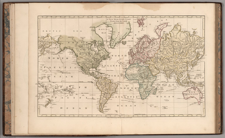
Author
Wilkinson, Robert
Full Title
A New Mercator's Chart Drawn from the Latest Discoveries.
Publisher
R. Wilkerson
Author
Wilkinson, Robert
Full Title
A New Map of Denmark and Holstein.
Publisher
R. Wilkerson
Author
Wilkinson, Robert
Full Title
Bohemia including Moravia, Austrian Silesia, Eger, & Glatz.
Publisher
R. Wilkerson
Author
Wilkinson, Robert
Full Title
Estates of the Church, Grand Duchy of Tuscany, Republic of Lucca &c.
Publisher
R. Wilkerson
|