Browse All

1829 Introductory Map To Accompany Willard's … School Atlas Introductory Map. To Accompany Willard's … |

1829 First Map Or Map Of 1578 School Atlas First Map Or Map Of 1578. To Accompany W … |
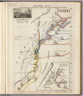
1829 Second Map 1620 School Atlas Second Map. To Accompany Willard's Histo … |

1829 Third Map or Map Of 1643 School Atlas Third Map or Map Of 1643. To Accompany W … |

1829 Fourth Map or Map Of 1692 School Atlas Fourth Map or Map Of 1692. To Accompany … |

1829 Fifth Map or Map Of 1733 School Atlas Fifth Map or Map Of 1733. To Accompany W … |

1829 Sixth Map or Map Of 1763 School Atlas Sixth Map or Map Of 1763. To Accompany W … |

1829 Seventh Map or Map Of 1776 School Atlas Seventh Map or Map Of 1776. To Accompany … |

1829 Eighth Map or Map Of 1789 School Atlas Eighth Map or Map Of 1789. To Accompany … |

1829 Principal Seat of the Revolutionary War … School Atlas Principal Seat of the Revolutionary War … |

1829 Ninth Map Or Map Of 1826 School Atlas Ninth Map Or Map Of 1826. To Accompany W … |

1829 Principal Seat of the War of 1812-13-14 School Atlas Principal Seat of the War of 1812-13-14. … |

1829 Rivers, mountains. School Atlas Comparative lengths of the principal riv … |

1829 The World School Atlas The World. Published by Hilliard, Gray, … |

1829 North America. School Atlas North America. Published by Hilliard, Gr … |

1829 United States. School Atlas United States. Published by Hilliard, Gr … |

1829 West Indies. School Atlas West Indies. Published by Hilliard, Gray … |

1829 South America. School Atlas South America. Published by Hilliard, Gr … |

1829 Europe. School Atlas Europe. Boston, Published by Hilliard, G … |

1829 Asia. School Atlas Asia. Boston, Published by Hilliard, Gra … |

1829 Africa. School Atlas Africa. Published by Hilliard, Gray, Lit … |

1829 Maine. State Atlas Map of the principal rivers, mountains a … |

1829 Upper & Lower Canada, Gaspe. State Atlas Sketch from Bouchette's maps of Upper & … |

1829 Maine highlands. State Atlas Sketch of the imaginary ranges of highla … |

1829 Maine vertical sections. State Atlas Vertical sections, exhibiting the compar … |

1829 Maine grants & land sales. State Atlas Map exhibiting the principal original gr … |

1829 Maine, inhabited part. State Atlas Map of the inhabited part of the State o … |

1829 New York, Queens, Kings, Richmond counti … State Atlas Map of the counties of New York, Queens, … |

1829 Suffolk County. State Atlas Map of the County of Suffolk. By David H … |

1829 Westchester County. State Atlas Map of the County of Westchester. By Dav … |

1829 Dutchess, Putnam counties. State Atlas Map of the counties of Dutchess and Putn … |

1829 Orange, Rockland counties. State Atlas Map of the counties of Orange and Rockla … |

1829 Ulster County. State Atlas Map of the County of Ulster. By David H. … |

1829 Sullivan County. State Atlas Map of the County of Sullivan. By David … |

1829 Delaware County. State Atlas Map of the County of Delaware. By David … |

1829 Greene County. State Atlas Map of the County of Greene. By David H. … |

1829 Columbia County. State Atlas Map of the County of Columbia. By David … |

1829 Rensselaer County. State Atlas Map of the County of Rensselaer. By Davi … |

1829 Albany, Schenectady counties. State Atlas Map of the counties of Albany and Schene … |

1829 Schoharie County. State Atlas Map of the County of Schoharie. By David … |

1829 Montgomery County. State Atlas Map of the County of Montgomery. By Davi … |

1829 Hamilton County. State Atlas Map of the County of Hamilton. By David … |

1829 Saratoga County. State Atlas Map of the County of Saratoga. By David … |

1829 Washington County. State Atlas Map of the County of Washington. By Davi … |

1829 Warren County. State Atlas Map of the County of Warren. By David H. … |

1829 Essex County. State Atlas Map of the County of Essex. By David H. … |

1829 Clinton County. State Atlas Map of the County of Clinton. By David H … |

1829 Franklin County. State Atlas Map of the County of Franklin. By David … |

1829 St. Lawrence County. State Atlas Map of the County of St. Lawrence. By Da … |

1829 Jefferson County. State Atlas Map of the County of Jefferson. By David … |