Browse All

1852 NW Deutschland, Niederlande, Belgien. School Atlas Nordwestliches Deutschland, Niederlande … |

1852 NO Deutschland. School Atlas Nordostliches Deutschland. Enthalt die P … |

1852 SW Deutschland. School Atlas Sudwestliches Deutschland. (Efter Stiele … |

1852 Oestliche Halbkugel. School Atlas Oestliche Halbkugel. (Efter Stielers Han … |

1852 Westliche Halbkugel. School Atlas Westliche Halbkugel. (Efter Stielers Han … |

1852 Europa. School Atlas Europa. (Efter Stielers Hand-Atlas. Stoc … |

1852 Asia. School Atlas Asia. (Efter Stielers Hand-Atlas. Stockh … |

1852 Africa. School Atlas Africa. (Efter Stielers Hand-Atlas. Stoc … |

1852 Nord-America; West-Indien. School Atlas Nord-America und West-Indien. (Efter Sti … |

1852 Sud-America. School Atlas Sud-America. (Efter Stielers Hand-Atlas. … |

1852 Australien. School Atlas Australien. (Efter Stielers Hand-Atlas. … |

1852 Spanien, Portugal. School Atlas Spanien und Portugal. (Efter Stielers Ha … |

1852 SO Deutschland, Oesterreich. Lande. School Atlas Sud-ostliches Deutschland, enthalt die O … |

1852 Schweiz, Liechtenstein. School Atlas Die Schweiz und das Furstenthum Liechten … |

1852 Preussen, Posen, Polen, Krakau. School Atlas Preuss. Provinzen, Preussen u. Posen, Kg … |

1852 Galizien, Ungarn, Slavonien, Kroatien, S … School Atlas Galizien, Ungarn, Slavonien und Kroatien … |

1852 Daenemark, Schleswig, Holstein, Lauenbur … School Atlas Daenemark mit Schleswig, Holstein und La … |

1852 Schweden, Norwegen, Finnland. School Atlas Schweden, Norwegen und Finnland. (Efter … |

1852 Europaeisches Russland. School Atlas Europaeisches Russland. (Efter Stielers … |

1852 Osmanischen Reichs europ. Theil, Grieche … School Atlas Des Osmanischen Reichs, europaeischer Th … |
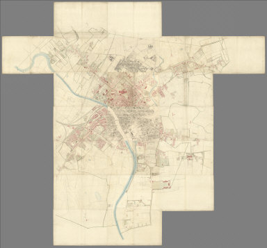
1852 Composite: Sheets 1 - 21, Plan of York, … [City Atlas, Survey Map] (Composite to) (Sheets 1 - 21) York. Sur … |

1852 Chart of the World Showing the Forms and … Physical Atlas Chart of the World Showing the Forms and … |

1852 Comparative Form and Extent of the Inlan … Physical Atlas Comparative Form and Extent of the Inlan … |

1852 River Systems of the World. Physical Atlas The River Systems of the World.... |

1852 Mountains, Table Lakes, Plains & Valleys … Physical Atlas The Mountains, Table Lakes, Plains & Val … |

1852 Mountains, Table Lands, Plains & Valleys … Physical Atlas The Mountains, Table Lands, Plains & Val … |

1852 Mountains, Table Lands, Plains & Valleys … Physical Atlas The Mountains, Table Lands, Plains & Val … |

1852 Mountains, Table Lands, Plains & Valleys … Physical Atlas The Mountains, Table Lands, Plains & Val … |

1852 Mountains, Table Lands, Plains & Valleys … Physical Atlas The Mountains, Table Lands, Plains & Val … |

1852 The Mountains, Table Lands, Plains & Val … Physical Atlas The Mountains, Table Lands, Plains & Val … |

1852 Distribution of Earthquakes & Volcanoes … Physical Atlas The Distribution of Earthquakes & Volcan … |

1852 Climatological Chart, Showing by Lines & … Physical Atlas Climatological Chart, Showing by Lines & … |

1852 Winds and the Regions visited by Storms … Physical Atlas The Distribution of Constant Periodical … |

1852 Distribution of Rain and Snow over the G … Physical Atlas The Distribution of Rain and Snow over t … |

1852 Distribution of the Most Important Trees … Physical Atlas The Distribution of the Most Important T … |

1852 Distribution of Animals Including the Ma … Physical Atlas The Distribution of Animals Including th … |

1852 Ethnographic Map of the World Showing th … Physical Atlas Ethnographic Map of the World Showing th … |

1852 Distribution of Man According to the Pre … Physical Atlas Moral & Statistical Chart, Showing the D … |

1852 Minnesota, Wisconsin, North Dakota, Sout … National Atlas (Minnesota, Wisconsin, North Dakota, Sou … |

1852 Wisconsin, Michigan. National Atlas (Wisconsin, Michigan). |

1852 Ontario, Canada. National Atlas (Ontario, Canada). |

1852 Quebec, New Brunswick, Maine, Vermont, N … National Atlas (Quebec, New Brunswick, Maine, Vermont, … |

1852 Nebraska, Kansas, Iowa, Missouri. National Atlas (Nebraska, Kansas, Iowa, Missouri). |

1852 Illinois, Indiana, Ohio. National Atlas (Illinois, Indiana, Ohio). |

1852 Ohio, Pennsylvania, New York, Maryland. National Atlas (Ohio, Pennsylvania, New York, Maryland) … |

1852 New York, New Jersey, Massachusetts, Con … National Atlas (New York, New Jersey, Massachusetts, Co … |

1852 Arkansas, Oklahoma, Texas. National Atlas (Arkansas, Oklahoma, Texas). |

1852 Kentucky, Tennessee, Mississippi, Alabam … National Atlas (Kentucky, Tennessee, Mississippi, Alaba … |

1852 Virginia, North Carolina, South Carolina … National Atlas (Virginia, North Carolina, South Carolin … |

1852 Canada, Alaska. National Atlas (Canada, Alaska). |