Browse All

1875 Planche XXIII. Vicksburg (Mississippi). Military Atlas Planche XXIII. Vicksburg (Mississippi). … |

1875 Planche XXIV. Vallee du Monocacy et Cont … Military Atlas Planche XXIV. Vallee du Monocacy et Cont … |

1875 Planche XXV. Gettysburg (Pennsylvania). Military Atlas Planche XXV. Gettysburg (Pennsylvania). … |

1875 Planche XXVI. Valley du Shenandoah (Virg … Military Atlas Planche XXVI. Valley du Shenandoah (Virg … |

1875 Planche XXVII. Bristow Station (Virginie … Military Atlas Planche XXVII. Bristow Station (Virginie … |

1875 Planche XXVIII. Carnifex Ferry (Virginie … Military Atlas Planche XXVIII. Carnifex Ferry (Virginie … |

1875 Planche XXIX. Perryville (Kentucky). Iuk … Military Atlas Planche XXIX. Perryville (Kentucky). (in … |

1875 Planche XXX. Cours Inferieur du Mississi … Military Atlas Planche XXX. Cours Inferieur du Mississi … |

1881 Section along 36th parallel Rio Grande-C … Exploration Book Section along 36th parallel from the Rio … |

1881 Section along 37th parallel, Rio Grande- … Exploration Book Section along 37th parallel from the Rio … |

1879 Sketch map, ancient mounds, burial place … Exploration Book Sketch map showing localities of ancient … |

1875 61C. SW Colorado. National Atlas Southwestern Colorado, Atlas Sheet 61 C. … |

1875 Pittsburg, Cincinnati and St. Louis R.R. … County Atlas Map of the Pittsburg, Cincinnati and St. … |

1875 101. Keswick, Cockermouth, SE Quad. Geologic Atlas 101. Keswick, Cockermouth, SE Quad. |

1889 Cave Valley, Nevada. Exploration Book Plan and section of cave in Cave Valley, … |

1889 Map, river and land parties, exploring G … Exploration Book Map showing routes of the river and land … |

1889 Horizontal sketch from Tallac Peak, Cal. Exploration Book Horizontal sketch from Tallac Peak, Cal. … |

1889 Horizon sketch from Tallac Peak, Cal. Exploration Book Horizon sketch from Tallac Peak, Cal. Oc … |

1889 Main-route, side meanders, topographical … Exploration Book Main-route and side meanders, and topogr … |

1889 Topography (Truckee-Donner Pass Region, … Exploration Book Topography (Truckee-Donner Pass Region, … |

1889 Sketch, surveys of the public lands, mil … Exploration Book Sketch indicating the advancement of the … |

1889 United States districts, general governm … Exploration Book Sketch indicating a distribution of the … |

1889 Antilia, 1463. Exploration Book The island of Antilia by Benincasa, 1463 … |

1889 America, 1508. Exploration Book America from Ptolomaens, Edit: Romae, 15 … |

1889 Maris Pacifici, America. Exploration Book Maris Pacifici, quod vulgo Mar del Zur, … |

1889 North America, 1566. Exploration Book North America by Zaltieri 1566. Reduced. … |

1889 America sive India Novam, 1609. Exploration Book America sive India Nova, ad magnae Gerar … |

1889 North part of America, 1625. Exploration Book The north part of America ... R. Elstrac … |
1889 America, about 1670. Exploration Book From a map of America by F. De Wit. Foli … |

1889 North America, 1710. Exploration Book From map of North America by John Senex, … |

1889 North America, 1722. Exploration Book From map of North America by Edward well … |

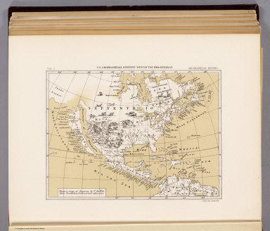
1889 North America, 1782. Exploration Book From map of North America by Thomas Jeff … |

1877 Astronomical observatory, Ogden, Utah. Exploration Book Plan and elevation of the astronomical o … |

1877 Topographical sketch, observatory site, … Exploration Book Topographical sketch showing observatory … |

1877 Winnemucca, Ft. Fred Steele, Laramie, Gr … Exploration Book Sketch of Winnemucca, Nevada showing pos … |

1877 Pioche, Virginia City, Hughes, Colorado … Exploration Book Sketch of Pioche, Nevada showing positio … |

1877 Beaver, Cheyenne, Fort Union, Georgetown … Exploration Book Sketch of Beaver, Utah showing position … |

1875 1875. Progress Map Of The Geographical S … National Atlas 1875 Progress Map Of The Geographical Su … |

1875 Plate 35. Indians. Indian Reservations, … [Historical Atlas, National Atlas] Plate 35. Indians. Indian Reservations, … |

1875 Facsimile: Part of the Great Colonial Ma … National Atlas (Facsimile) Schomburgk - Great Colonial … |

1874 Espagne, Portugal. World Atlas Carte Generale de l'Espagne et du Portug … |