Browse All

1876 Map of Dubois County. State Atlas Map of Dubois County. (Published by Bask … |

1876 Map of Harrison County. State Atlas Map of Harrison County. (Published by Ba … |

1876 Plan of Newburgh, Warrick Co. (with) Boo … State Atlas Plan of Newburgh, Warrick Co. (with) Pla … |

1876 Plan of Green Castle, Putnam Co. (with) … State Atlas Plan of Green Castle, Putnam Co. (with) … |

1876 Green River from the Union Pacific Rail … Geologic Atlas Green River from the Union Pacific Rail … |

1876 Green River from the Union Pacific Rail … Geologic Atlas Green River from the Union Pacific Rail … |

1876 Structure sections through the Uinta Mou … Geologic Atlas Structure sections through the Uinta Mou … |

1876 Displacement diagrams ... through the Ui … Geologic Atlas Displacement diagrams derived from the S … |

1876 Stereogram of the displacements of the U … Geologic Atlas Stereogram of the displacements of the e … |

1876 Bird's-eye view of a part of the Uinta U … Geologic Atlas Bird's-eye view of a part of the Uinta U … |

1876 Stereogram of the displacements of the U … Geologic Atlas Stereogram of the displacements of the Y … |

1876 Structure sections, displacement diagram … Geologic Atlas No. 1. Structure section through the Asp … |

1876 Geological map of Indiana. Climatologica … State Atlas Geological map of Indiana. Climatologica … |

1876 Western Hemisphere. State Atlas Western Hemisphere. (Published by Baskin … |

1876 Eastern Hemisphere. State Atlas Eastern Hemisphere. (Published by Baskin … |

1876 Congressional districts. Judicial distri … State Atlas Congressional districts. Judicial distri … |

1876 Senatorial districts. Representative dis … State Atlas Senatorial districts. Representative dis … |

1876 New railroad map of the United States an … State Atlas New railroad map of the United States an … |

1876 Population - United States census, 1870. … State Atlas Population - United States census, 1870. … |

1876 Population - United States census, 1870. … State Atlas Population - United States census, 1870. … |

1876 Agricultural productions colored by grad … State Atlas Agricultural productions colored by grad … |

1876 Vital statistics, United States census, … State Atlas Vital statistics, United States census, … |

1876 New sectional and township map of Indian … State Atlas New sectional and township map of Indian … |

1876 Map of Steuben County (Indiana) State Atlas Map of Steuben County (Indiana. Publishe … |

1876 Town of Angola (with) Fremont, Pleasant … State Atlas Town of Angola, Steuben Co., Ind. (with) … |

1876 Map of Lagrange County (with) La Grange, … State Atlas Map of Lagrange County. (with) La Grange … |

1876 Map of Elkhart County. State Atlas Map of Elkhart County. (Published by Bas … |

1876 Town of Elkhart, Elkhart Co. (with) Gosh … State Atlas Town of Elkhart, Elkhart Co. (with) Gosh … |

1876 Map of St. Joseph County. State Atlas Map of St. Joseph County. (Published by … |

1876 Map of La Porte County. State Atlas Map of La Porte County. (Published by Ba … |

1876 Plan of South Bend (with) Mishawaka, Bre … State Atlas Plan of South Bend, St. Joseph Co. (with … |

1876 Map of Porter County (with) Chesterton, … State Atlas Map of Porter County. (with) Corporate t … |
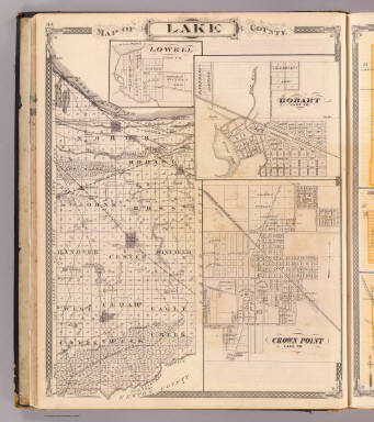
1876 Map of Lake County (with) Lowell, Hobart … State Atlas Map of Lake County. (with) Lowell ... (w … |

1876 City of Valparaiso (with) Monticello, Fr … State Atlas City of Valparaiso. (with) Monticello, W … |

1876 City of La Porte ... Michigan City, La P … State Atlas City of La Porte, La Porte Co. Michigan … |

1876 Map of Starke County (with) Knox, North … State Atlas Map of Starke County. (with) Knox ... (w … |

1876 Map of Marshall County. State Atlas Map of Marshall County. (Published by Ba … |

1876 Plan of Warsaw (with) Pierceton, Plymout … State Atlas Plan of Warsaw, Kosciusko Co., Ind. (wit … |

1876 Map of Kosciusko County. State Atlas Map of Kosciusko County. (Published by B … |

1876 Map of Noble County. State Atlas Map of Noble County. (Published by Baski … |

1876 Kendallville, Noble Co. Ligonier, Map of … State Atlas Kendallville, Noble Co. Ligonier, Noble … |

1876 Map of De Kalb County. State Atlas Map of De Kalb County. (Published by Bas … |

1876 Columbia City, Whitley Co., Ind. (with) … State Atlas Columbia City, Whitley Co., Ind. (with) … |

1876 Map of Allen County. State Atlas Map of Allen County. (Published by Baski … |

1876 Map of the City of Fort Wayne (with) Ced … State Atlas Map of the City of Fort Wayne, Allen Co. … |

1876 Map of Whitley County. State Atlas Map of Whitley County. (Published by Bas … |

1876 Map of Auburn, De Kalb Co., Ind. (with) … State Atlas Map of Auburn, De Kalb Co., Ind. (with) … |

1876 Map of Fulton County (with) Rochester, F … State Atlas Map of Fulton County. (with) Rochester, … |

1876 Map of Pulaski County. State Atlas Map of Pulaski County. (Published by Bas … |

1876 Outline Map of Lehigh County. County Atlas Outline Map of Lehigh County. |