Browse All

1825 Alabama. National Atlas Carte geographique, statistique et histo … |

1872 United States ... South Eastern States. World Atlas United States North America According to … |

1909 Alabama. State Atlas Alabama. (Published by George F. Cram, C … |

1851 Entrance Mobile Bay. Chart Atlas Entrance to Mobile Bay. From a trigonome … |

1852 Mobile Bay. Chart Atlas Preliminary sketch of Mobile Bay. U.S. C … |

1875 Mississippi & Alabama. National Atlas Cram's Rail Road & Township Map of Miss. … |

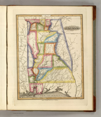
1845 Alabama. World Atlas Alabama. (Written and engraved by Jos. P … |

1891 Chattanooga Campaign. Military Atlas The Chattanooga Campaign of August and S … |

1891 Chattanooga Campaign. Military Atlas The Chattanooga Campaign of August and S … |

1891 Chattanooga Campaign. Military Atlas The Chattanooga Campaign of August and S … |

1927 Alabama. National Atlas Rand McNally junior auto road map Alabam … |

1848 Map of the State of Alabama. World Atlas Map of the State of Alabama. |
1822 Alabama. World Atlas Alabama. Drawn and Published by F. Lucas … |

1824 Map of the Country belonging to the Cher … World Atlas Map of the Country belonging to the Cher … |

1857 Alabama. National Atlas Alabama. No. 31. Published by J.H. Colto … |

1835 Map of the State of Alabama. World Atlas Map of the State of Alabama. By David H. … |

1826 Map of Louisiana Mississippi And Alabama … National Atlas Map of Louisiana Mississippi And Alabama … |

1872 Alabama, Arkansas, Louisiana, and Missis … State Atlas Atlas of the United States. Alabama, Ark … |

1838 Alabama. National Atlas Alabama. Entered ... 1838, by T.G. Bradf … |

1849 New Map of Alabama with its Roads & Dist … World Atlas A New Map of Alabama with its Roads & Di … |

1865 County map of Georgia, and Alabama World Atlas County map of Georgia, and Alabama. Ente … |

1865 County map of North Carolina. Map of sou … World Atlas County map of North Carolina. (Scale: 1: … |

1874 County map of the States of Georgia and … World Atlas County map of the States of Georgia and … |

1877 County map of the States of Georgia and … World Atlas County map of the States of Georgia and … |

1860 Georgia and Alabama. World Atlas Johnson's Georgia And Alabama By Johnson … |

1850 Alabama. World Atlas A New Map of Alabama. |

1857 A New Map of Alabama World Atlas A New Map of Alabama. With its Roads & D … |

1927 Alabama National Atlas Alabama. (Copyrighted by) National Map C … |

1868 County map of Georgia and Alabama World Atlas County map of Georgia and Alabama. Enter … |

1895 Gen. map XII. Military Atlas General topographical map. Sheet XII. Ju … |

1895 Gen. map XIII. Military Atlas General topographical map. Sheet XIII. J … |

1895 Gen. map XIV. Military Atlas General topographical map. Sheet XIV. Ju … |

1841 Alabama. World Atlas Alabama. Engraved by G.W. Boynton. Enter … |

1831 Alabama, Georgia. National Atlas Map of the states of Alabama and Georgia … |

1775 The Coast of West Florida and Louisiana. Regional Atlas The Coast of West Florida and Louisiana. … |

1830 Ala., Miss., La., Ark. School Atlas Alabama, Mississippi, Louisiana & Arkans … |

1883 E. United States 8. World Atlas Eastern United States. No. 8. Letts's po … |

1883 E. United States 9. World Atlas Eastern United States. No. 9. Letts's po … |

1804 Mississippi Territory. World Atlas Mississippi Territory. Drawn by S. Lewis … |

1812 Mississippi Territory. World Atlas Mississippi Territory. Drawn by S. Lewis … |

1873 Alabama, Arkansas, Louisiana, and Missis … State Atlas Atlas of the United States. Alabama, Ark … |

1834 Floride, Delta du Mississippi canal. National Atlas Carte generale de la Floride et du Delta … |

1834 Baies, Florides, Golfe du Mexique. National Atlas Plans hydrographiques des baies, rades, … |

1834 Canal du Muscle-Shoal. National Atlas Canal du Muscle-Shoal. Plan general du t … |

1863 (Alabama, Georgia, Florida) School Atlas (Map of Alabama, Georgia and part of Flo … |

1903 52. Center Negro population 1880-1900. Statistical Atlas Sketch map showing the position of the c … |

1890 Georgia, Alabama. World Atlas County map of the states of Georgia and … |

1823 Alabama, Miss., La. National Atlas Alabama, Mississippi and Louisiana. N. & … |

1752 Carte de la Louisiane. World Atlas Carte de la Louisiane. Par le Sr. d'Anvi … |

1870 Georgia, Alabama. [State Atlas, World Atlas] County map of Georgia, and Alabama. Ente … |