Browse All

1837 XXXI Section. Umgebung von Fahrafeld und … Regional Atlas XXXI Section. Umgebung von Fahrafeld und … |

1837 XXXII Section. Umgebung von Pernitz V.U. … Regional Atlas XXXII Section. Umgebung von Pernitz V.U. … |

1837 XXXIII Section. Umgebung von Pottenstein … Regional Atlas XXXIII Section. Umgebung von Pottenstein … |

1837 XXXIV Section. Umgebung von Baden und Tr … Regional Atlas XXXIV Section. Umgebung von Baden und Tr … |

1837 XXXV Section. Umgebung von Salenau und L … Regional Atlas XXXV Section. Umgebung von Salenau und L … |

1837 XXXVI Section. Umgebung von Hundsheim un … Regional Atlas XXXVI Section. Umgebung von Hundsheim un … |

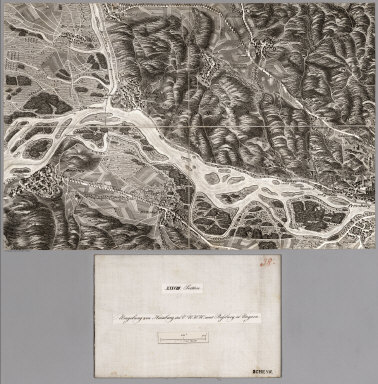
1837 XXXVII Section. Umgebung von Gutenstein … Regional Atlas XXXVII Section. Umgebung von Gutenstein … |
1837 XXXVIII Section. Umgebung von Hainburg i … Regional Atlas XXXVIII Section. Umgebung von Hainburg i … |

1837 XXXIX Section. Umgebung von Schlosshof i … Regional Atlas XXXIX Section. Umgebung von Schlosshof i … |

1837 XL Section. Umgebung von Piesting und Fi … Regional Atlas XL Section. Umgebung von Piesting und Fi … |

1837 XLI Section. Wiener_Neustadt und Umgebun … Regional Atlas XLI Section. Wiener_Neustadt und Umgebun … |

1837 XLII Section. Umgebung von Rohr im V.U.W … Regional Atlas XLII Section. Umgebung von Rohr im V.U.W … |

1837 XLIII Section. Umgebung von Schwarzau un … Regional Atlas XLIII Section. Umgebung von Schwarzau un … |

1837 XLIV Section. Umgebung von Puchberg und … Regional Atlas XLIV Section. Umgebung von Puchberg und … |

1837 XLV Section. Umgebung von Ebenfurt V.U.W … Regional Atlas XLV Section. Umgebung von Ebenfurt V.U.W … |

1837 XLVI Section. Umgebung von Schneeberg im … Regional Atlas XLVI Section. Umgebung von Schneeberg im … |

1837 XLVII Section. Umgebung von Neunkirchen … Regional Atlas XLVII Section. Umgebung von Neunkirchen … |

1837 XLVIII Section. Umgebung von Froschder V … Regional Atlas XLVIII Section. Umgebung von Froschder V … |

1837 XLIX Section. Umgebung von Schottwien, R … Regional Atlas XLIX Section. Umgebung von Schottwien, R … |

1837 L Section. Umgebung von Seebenstein V.U. … Regional Atlas L Section. Umgebung von Seebenstein V.U. … |

1837 LI Section. Umgebung von Feistritz, Thom … Regional Atlas LI Section. Umgebung von Feistritz, Thom … |

1837 LII Section. Umgebung von Kirchberg am W … Regional Atlas LII Section. Umgebung von Kirchberg am W … |

1837 LIII Section. Umgebung von Monichkirchen … Regional Atlas LIII Section. Umgebung von Monichkirchen … |

1837 LIV Section. Umgebung von Hochwolkersdor … Regional Atlas LIV Section. Umgebung von Hochwolkersdor … |

1837 LV Section. Umgebung von Stickelberg im … Regional Atlas LV Section. Umgebung von Stickelberg im … |

1837 LVI Section. Umgebung von Krumbach und K … Regional Atlas LVI Section. Umgebung von Krumbach und K … |

1837 LVII Section. Umgebung von Hochneukirche … Regional Atlas LVII Section. Umgebung von Hochneukirche … |

1837 LVIII Section. Umgebung von Gschaid in O … Regional Atlas LVIII Section. Umgebung von Gschaid in O … |

1837 LIX Section. Umgebung des Wechselgebirge … Regional Atlas LIX Section. Umgebung des Wechselgebirge … |

1837 LX Section. Umgebung von Prein im V.U.W. … Regional Atlas LX Section. Umgebung von Prein im V.U.W. … |

1837 LXI Section. Umgebung von St. Aegydi im … Regional Atlas LXI Section. Umgebung von St. Aegydi im … |

1837 LXII Section. Umgebung von Anna und Jose … Regional Atlas LXII Section. Umgebung von Anna und Jose … |

1837 LXIII Section. Umgebung von Rauchsteinfe … Regional Atlas LXIII Section. Umgebung von Rauchsteinfe … |

1837 Salzburg National Atlas Salzburg. Entworfen und bearbeitet von W … |

1838 Hallein National Atlas Hallein. Entworfen und bearbeitet von Wo … |

1838 Lienz National Atlas Lienz. Entworfen und bearbeitet von Woer … |

1838 Padua National Atlas Padua. Entworfen und bearbeitet von Woer … |

1846 Fluss u. Berg-Karte von Deutschland. (Ri … World Atlas No. XXIV. Stieler's Hand-Atlas (No. 18.) … |

1850 Sud-Ostliches Deutschland .... (Southeas … World Atlas No. XXXII. Stieler's Hand-Atlas (No. 25) … |

1850 Der Oesterreichische Kaiser-Staat. (Aust … World Atlas Stieler's Hand-Atlas (No. 26). Der Oeste … |

1850 Europaeisches. (Baltic Countries and Rus … World Atlas No. XL. Stieler's Hand-Atlas (No. 37a). … |

1788 German Empire. World Atlas A new map of the German Empire, and the … |

1788 German Empire. World Atlas A new map of the German Empire, and the … |

1875 Osterreichisch. Ungarische Monarchie. World Atlas Osterreichisch. Ungarische Monarchie. Be … |

1808 Germany. World Atlas Germany. |

1817 Austrian Dominions. World Atlas Austrian Dominions. |

1875 Sud-Ostliches Deutschland nebst einem Th … World Atlas Sud-Ostliches Deutschland nebst einem Th … |

1807 Austria. World Atlas Austria. |

1794 Austria. World Atlas A Map of the Circle of Austria. |

1823 Vindelicia, Rhaetia et Noricum Antiqua. World Atlas Vindelicia, Rhaetia et Noricum Antiqua. |