REFINE


Who What Where When


WHERE

  1. Agua Caliente (Calif.) (1)
  2. Alameda (Calif.) (6)
  3. Alameda County (Calif.) (9)
  4. Alaska (1)
  5. Albany (Calif.) (2)
  6. Algeria (1)
  7. Altamont (Calif.) (1)
  8. Alvarado (Union City, Cal … (1)
  9. Alviso (San Jose, Calif.) (1)
  10. Arizona (19)
  11. Armona (Calif.) (1)
  12. Armona Region (Calif.) (1)
  13. Asti (Calif.) (1)
  14. Atlantic Seaboard (1)
  15. Badger (Calif.) (1)
  16. Baja California (1)
  17. Baja California (Mexico : … (1)
  18. Baja California (Mexico : … (2)
  19. Benicia (Calif.) (1)
  20. Berenda (Calif.) (1)
  21. Berkeley (Calif.) (9)
  22. Bloomfield (Calif.) (1)
  23. Bloomfield Region (Calif. … (1)
  24. Bodega (Calif.) (1)
  25. Bodega Bay (1)
  26. Bodega Bay Region (Calif. … (1)
  27. Borden (Calif.) (1)
  28. California, Gulf of (2)
  29. California, Northern (4)
  30. California, Northern. (1)
  31. California, Southern (2)
  32. Caruthers Region (Calif.) (1)
  33. Catalina Harbor (Calif.) (1)
  34. Centerville (Fremont, Cal … (1)
  35. Centerville (Fresno Count … (1)
  36. Central America (2)
  37. Central California (7)
  38. Cloverdale (Calif.) (2)
  39. Cloverdale Region (Calif. … (1)
  40. Coalinga Region (Calif.) (1)
  41. Colorado (10)
  42. Cordelia (Calif.) (1)
  43. Cotati (Calif.) (2)
  44. Cotati Region (Calif.) (1)
  45. Davis Region (Calif.) (1)
  46. Denver Region (Colo.) (1)
  47. Denverton (Calif.) (1)
  48. Dinuba (Calif.) (2)
  49. Dixon (Calif.) (1)
  50. Dublin (Calif.) (1)
  51. Duncans Mills (Calif.) (1)
  52. Earlimart (Calif.) (1)
  53. Easton (Calif.) (1)
  54. Easton Region (Calif.) (2)
  55. El Dorado County (Calif.) (3)
  56. El Verano (Calif.) (1)
  57. El Verano Region (Calif.) (1)
  58. Elmira (Calif.) (1)
  59. Emeryville (Calif.) (2)
  60. Exeter (Calif.) (1)
  61. Fairfield (Calif.) (1)
  62. Forestville (Calif.) (1)
  63. Fort Ross Region (Calif.) (1)
  64. Fowler (Calif.) (1)
  65. Fowler Region (Calif.) (1)
  66. Fremont (Calif.) (2)
  67. Fresno (Calif.) (12)
  68. Fresno County (Calif.) (63)
  69. Fulton (Calif.) (1)
  70. Fulton Region (Calif.) (1)
  71. Geyserville (Calif.) (1)
  72. Geyserville Region (Calif … (2)
  73. Gilroy (Calif.) (1)
  74. Glen Ellen (Calif.) (1)
  75. Golden Gate Park (San Fra … (2)
  76. Goshen (Calif.) (1)
  77. Grangeville (Calif.) (1)
  78. Great Salt Lake (2)
  79. Guerneville (Calif.) (1)
  80. Guerneville Region (Calif … (1)
  81. Hanford (Calif.) (4)
  82. Hawaii (2)
  83. Hayward (Calif.) (3)
  84. Healdsburg (Calif.) (2)
  85. Healdsburg Region (Calif. … (1)
  86. Humboldt Bay (Calif.) (1)
  87. Huron (Calif.) (2)
  88. Iceland (1)
  89. Idaho (8)
  90. Indian Territory (1)
  91. Irvington (Fremont, Calif … (1)
  92. Kenwood (Calif.) (1)
  93. Kern County (Calif.) (3)
  94. Kings Canyon National Par … (2)
  95. Kings County (Calif.) (30)
  96. Kingsburg (Calif.) (2)
  97. Kingsburg Region (Calif.) (1)
  98. La Vina (Calif.) (1)
  99. Lake County (Calif.) (2)
  100. Lake Tahoe (2)
  101. Laton Region (Calif.) (1)
  102. Lemoore (Calif.) (2)
  103. Lexington (Calif.) (1)
  104. Lindsay (Calif.) (1)
  105. Livermore (Calif.) (1)
  106. Los Angeles Basin (1)
  107. Los Angeles County (Calif … (4)
  108. Los Gatos (Calif.) (1)
  109. Louisiana (1)
  110. Madera (Calif.) (1)
  111. Madera County (Calif.) (23)
  112. Malaga (Calif.) (1)
  113. Malaga Region (Calif.) (2)
  114. Mariposa County (Calif.) (10)
  115. Market Street (San Franci … (1)
  116. Mendocino County (Calif.) (2)
  117. Merced, Lake (San Francis … (2)
  118. Mexico (15)
  119. Mexico, North (1)
  120. Mission Creek Fault (Cali … (2)
  121. Mission San Jose (Fremont … (1)
  122. Mississippi (1)
  123. Mississippi River Delta (1)
  124. Mono Lake (1)
  125. Monson (Calif.) (1)
  126. Montana (2)
  127. Monterey (Calif.) (2)
  128. Monterey Bay (Calif.) (1)
  129. Monterey Bay Region (Cali … (2)
  130. Monterey Harbor (Calif.) (1)
  131. Mountain View (Calif.) (1)
  132. Nebraska (1)
  133. Netherlands (1)
  134. Nevada (59)
  135. New Mexico (9)
  136. New Orleans (La.) (1)
  137. New York (1)
  138. Newark (Calif.) (1)
  139. North America (3)
  140. North Beach (San Francisc … (1)
  141. Norway (1)
  142. Oakland (Calif.) (18)
  143. Occidental (Calif.) (1)
  144. Orange Cove Region (Calif … (1)
  145. Oregon (41)
  146. Pacific (6)
  147. Pacific Coast (1)
  148. Parlier Region (Calif.) (1)
  149. Petaluma (Calif.) (3)
  150. Petaluma Region (Calif.) (1)
  151. Piedmont (Calif.) (1)
  152. Pixley (Calif.) (1)
  153. Placer (Calif.) (1)
  154. Placer County (Calif.) (1)
  155. Plano (Calif.) (1)
  156. Pleasanton (Calif.) (2)
  157. Porterville (Calif.) (1)
  158. Porterville Region (Calif … (1)
  159. Rancho Cotate (Calif.) (1)
  160. Rancho Laguna de la Merce … (2)
  161. Rancho Laguna de Tache (C … (1)
  162. Raymond (Madera County, C … (1)
  163. Redlands (Calif.) (1)
  164. Reedley (Calif.) (1)
  165. Reedley Region (Calif.) (1)
  166. Rio Vista (Calif.) (1)
  167. Riverside County (Calif.) (4)
  168. Sacramento (Calif.) (1)
  169. San Andreas Fault (Calif … (15)
  170. San Bernardino (Calif.) (1)
  171. San Bernardino County (Ca … (5)
  172. San Blas Region (Mexico) (2)
  173. San Diego (Calif.) (1)
  174. San Diego Bay (Calif.) (2)
  175. San Diego Bay Region (Cal … (2)
  176. San Diego County (Calif.) (1)
  177. San Francisco (Calif.) (93)
  178. San Francisco Bay (Calif. … (1)
  179. San Francisco Bay Area (1)
  180. San Francisco Bay Area ( … (10)
  181. San Jose (Calif.) (8)
  182. San Leandro (Calif.) (2)
  183. San Lorenzo (Calif.) (2)
  184. San Mateo County (Calif.) (3)
  185. San Pedro (Los Angeles, C … (1)
  186. San Pedro Bay (Calif.) (1)
  187. San Simeon Bay (Calif.) (1)
  188. Sanger (Calif.) (1)
  189. Sanger Region (Calif.) (1)
  190. Santa Barbara (Calif.) (3)
  191. Santa Clara (Calif.) (3)
  192. Santa Clara County (Cali … (21)
  193. Santa Cruz (Calif.) (2)
  194. Santa Cruz Anchorage (Cal … (1)
  195. Santa Cruz County (Calif. … (1)
  196. Santa Rosa (Calif.) (6)
  197. Sebastopol (Calif.) (1)
  198. Sebastopol Region (Calif. … (1)
  199. Selma (Calif.) (1)
  200. Selma Region (Calif.) (1)
  201. Sequoia National Forest ( … (1)
  202. Sequoia National Park (Ca … (1)
  203. Sierra National Forest (C … (1)
  204. Sierra Nevada (3)
  205. Sierra Nevada (California … (9)
  206. Solano County (Calif.) (9)
  207. Sonoma (Calif.) (2)
  208. Sonoma County (Calif.) (73)
  209. Sonoma Region (Calif.) (2)
  210. Sonora (Mexico : State) (1)
  211. Southwest, New (1)
  212. Springville (Calif.) (1)
  213. Stewarts Point Region (Ca … (1)
  214. Suisun City (Calif.) (1)
  215. Sunol (Calif.) (1)
  216. Tahoe, Lake, Region (Cali … (1)
  217. Texas (4)
  218. Tipton (Calif.) (1)
  219. Traver (Calif.) (1)
  220. Traver Region (Calif.) (3)
  221. Trinidad (Calif.) (2)
  222. Trinidad Bay (Calif.) (1)
  223. Tulare (Calif.) (2)
  224. Tulare County (Calif.) (81)
  225. Tuolumne County (Calif.) (4)
  226. U.S. West (30)
  227. Union City (Calif.) (1)
  228. United States (24)
  229. Utah (18)
  230. Vacaville (Calif.) (1)
  231. Vallejo (Calif.) (2)
  232. Ventura County (Calif.) (1)
  233. Visalia (Calif.) (3)
  234. Visalia Region (Calif.) (1)
  235. Washington (8)
  236. Washington Square (San Fr … (1)
  237. Western U. S. (1)
  238. Western U.S. (2)
  239. Western United States (2)
  240. Windsor (Calif.) (1)
  241. Windsor Region (Calif.) (1)
  242. World (1)
  243. Wyoming (2)
  244. Yellowstone National Park (1)
  245. Yolo County (Calif.) (7)
  246. Yosemite National Park (15)
  247. Yosemite National Park (C … (1)
  248. Yosemite National ParkSie … (1)
  249. Yosemite Valley (2)
  250. Yosemite Valley (Calif.) (1)
Show Less 
REFINE 

Browse All : Atlas Map of California

651-700 of 805
Plat no. 57 (San Francisco. (Compiled an...
Plat 57 [San Francisco)
1876
City Atlas
Full Title
Plat no. 57 (San Francisco. (Compiled and published by Wm. P. Humphreys & Co., A.B. Holcombe, W.C. Kewen. Eng. by Worley & Bracher ... Phila, Pa. Printed by F. Bourquin ... Phila, Pa. 1876.)
Publisher
W. Humphreys
Plat no. 58 (San Francisco. (Compiled an...
Plat 58 [San Francisco)
1876
City Atlas
Full Title
Plat no. 58 (San Francisco. (Compiled and published by Wm. P. Humphreys & Co., A.B. Holcombe, W.C. Kewen. Eng. by Worley & Bracher ... Phila, Pa. Printed by F. Bourquin ... Phila, Pa. 1876.)
Publisher
W. Humphreys
Plat no. 59 (San Francisco. (Compiled an...
Plat 59 [San Francisco)
1876
City Atlas
Full Title
Plat no. 59 (San Francisco. (Compiled and published by Wm. P. Humphreys & Co., A.B. Holcombe, W.C. Kewen. Eng. by Worley & Bracher ... Phila, Pa. Printed by F. Bourquin ... Phila, Pa. 1876.)
Publisher
W. Humphreys
Plat no. 60 (San Francisco. (Compiled an...
Plat 60 [San Francisco)
1876
City Atlas
Full Title
Plat no. 60 (San Francisco. (Compiled and published by Wm. P. Humphreys & Co., A.B. Holcombe, W.C. Kewen. Eng. by Worley & Bracher ... Phila, Pa. Printed by F. Bourquin ... Phila, Pa. 1876.)
Publisher
W. Humphreys
Plat no. 61 (San Francisco. (Compiled an...
Plat 61 [San Francisco)
1876
City Atlas
Full Title
Plat no. 61 (San Francisco. (Compiled and published by Wm. P. Humphreys & Co., A.B. Holcombe, W.C. Kewen. Eng. by Worley & Bracher ... Phila, Pa. Printed by F. Bourquin ... Phila, Pa. 1876.)
Publisher
W. Humphreys
Plat no. 62 (San Francisco. (Compiled an...
Plat 62 [San Francisco)
1876
City Atlas
Full Title
Plat no. 62 (San Francisco. (Compiled and published by Wm. P. Humphreys & Co., A.B. Holcombe, W.C. Kewen. Eng. by Worley & Bracher ... Phila, Pa. Printed by F. Bourquin ... Phila, Pa. 1876.)
Publisher
W. Humphreys
Plat no. 63 (San Francisco. (Compiled an...
Plat 63 [San Francisco)
1876
City Atlas
Full Title
Plat no. 63 (San Francisco. (Compiled and published by Wm. P. Humphreys & Co., A.B. Holcombe, W.C. Kewen. Eng. by Worley & Bracher ... Phila, Pa. Printed by F. Bourquin ... Phila, Pa. 1876.)
Publisher
W. Humphreys
Rand McNally Road map, California. Copyr...
Road map of California
1940
National Atlas
Author
[Rand McNally and Company, State Farm Insurance Companies Travel Bureau]
Full Title
Rand McNally Road map, California. Copyright by Rand McNally & Company, Chicago, Ill. Lithographed in the U.S.A. (to accompany) State Farm Road Atlas: United States, Canada, Mexico,Central and South America. Copyright 1940 by Rand McNally & Company, Chicago, Ill.
Publisher
State Farm Insurance Companies Travel Bureau
Die Vereinigten Staaten Von Nord-Amerika...
1875
World Atlas
Author
Stieler, Adolf
Full Title
Die Vereinigten Staaten Von Nord-Amerika In 6 Blattern Im Maassstabe Von 1:3.700.000. Von A. Petermann. Bl. 4. Bearbeitet v. H. Habenicht. Gest v. Eberhardt, Kuhn, Metzeroth & Weiler. Gotha: Justus Perthes. 1873.
Publisher
Justus Perthes
Mexico, Texas und Californien. (with) Di...
Mexico, Texas, Californien, C. America.
1855
World Atlas
Author
[Geographisches Institut (Weimar, Germany), Kiepert, Heinrich, 1818-1899]
Full Title
Mexico, Texas und Californien. (with) Die Republiken von Central-America im Maasstab der Hauptkarte. (with) Haupt-Gold-District in Californien im doppelten maastab der Hauptkarte... (with) Plateau von Mexico ... Bearbeitet und gezeichnet von H. Kiepert. Situation und Schrift gestochen von K. Madel, Terrain von C. Jungmann. Weimar, Verlag des Geographischen Instituts, 1855.
Publisher
Weimar Geo Inst.
Oregon and Upper California. Published b...
Oregon & Upper California.
1848
World Atlas
Author
Mitchell, Samuel Augustus
Full Title
Oregon and Upper California. Published by S. Augustus Mitchell, N.E. corner of Market & Seventh Streets. Philadelphia. 1848. Entered according to Act of Congress in the year 1845 by H.N. Burroughs in the ... District Court of the eastern district of Pennsylvania.
Publisher
S.A. Mitchell
Map of the state of California, the terr...
California, Oregon, Utah, New Mexico.
1850
World Atlas
Full Title
Map of the state of California, the territories of Oregon & Utah, and the chief part of New Mexico. Entered according to Act of Congress in the year 1845 by H.N. Burroughs in the ... District Court of the eastern district of Pennsylvania. (1850)
Publisher
Thomas, Cowperthwait & Co.
A new map of the state of California, th...
California, Oregon, Washington, Utah, Ne...
1858
World Atlas
Full Title
A new map of the state of California, the territories of Oregon, Washington, Utah and New Mexico. Published by Charles Desilver, no. 251 Market Street, Philadelphia. Entered according to Act of Congress in the year 1856 by Charles Desilver in the ... District Court of the eastern district of Pennsylvania. (1858)
Publisher
Charles Desilver
A new map of the state of California, th...
California, Oregon, Washington, Utah, Ne...
1858
World Atlas
Full Title
A new map of the state of California, the territories of Oregon, Washington, Utah and New Mexico. Published by Charles Desilver, no. 251 Market Street, Philadelphia. Entered according to Act of Congress in the year 1856 by Charles Desilver in the ... District Court of the eastern district of Pennsylvania. (1858)
Publisher
Cushings & Bailey
(County and Road) Map of California.
1938
[State Atlas, Statistical Atlas]
Author
[Thomas Bros., Thomas Brothers]
Full Title
(County and Road) Map of California.
Publisher
Thomas Bros.
Map of the state of California, compiled...
California.
1892
County Atlas
Author
Thompson, Thos. H.
Full Title
Map of the state of California, compiled expressly for Thos. H. Thompson, publisher, Tulare, Cal. Issued with the Tulare County atlas. Lith. Britton & Rey, S.F. (1892)
Publisher
T.H. Thompson
Map of Tulare County, California. 1892. ...
Tulare County, California.
1892
County Atlas
Author
Thompson, Thos. H.
Full Title
Map of Tulare County, California. 1892. Thos. H. Thompson, Tulare, Cal.
Publisher
T.H. Thompson
Township 15 South, Range 25 East, Tulare...
T.15S R.25E.
1892
County Atlas
Full Title
Township 15 South, Range 25 East, Tulare Co., California. (Compiled, drawn and published by Thos. H. Thompson, Tulare, Cal., 1892)
Publisher
T.H. Thompson
Township 15 South, Range 26 East, Tulare...
T.15S R.26E.
1892
County Atlas
Full Title
Township 15 South, Range 26 East, Tulare Co., California. (Compiled, drawn and published by Thos. H. Thompson, Tulare, Cal., 1892)
Publisher
T.H. Thompson
Township 15 South, Range 27 East, Tulare...
T.15S R.27E.
1892
County Atlas
Full Title
Township 15 South, Range 27 East, Tulare Co., California. (Compiled, drawn and published by Thos. H. Thompson, Tulare, Cal., 1892)
Publisher
T.H. Thompson
Township 15 South, Township 14 South, Ra...
T.14-15S R.28-29E.
1892
County Atlas
Full Title
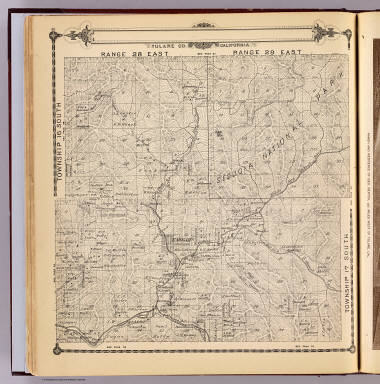
Township 15 South, Township 14 South, Range 28 East, Range 29 East, Tulare Co., California. (Compiled, drawn and published by Thos. H. Thompson, Tulare, Cal., 1892)
Publisher
T.H. Thompson
Township 15 South, Township 14 South, Ra...
T.14-15S R.30-31E.
1892
County Atlas
Full Title
Township 15 South, Township 14 South, Range 30 East, Range 31 East, Tulare Co., California. (Compiled, drawn and published by Thos. H. Thompson, Tulare, Cal., 1892)
Publisher
T.H. Thompson
Township 17 South ... Township 14 South,...
T.14-17S R.32-35E.
1892
County Atlas
Full Title
Township 17 South ... Township 14 South, Range 32 East ... Range 35 East, Tulare Co., California. (with) Map of Lucerne Colony, Tulare County ... (Compiled, drawn and published by Thos. H. Thompson, Tulare, Cal., 1892)
Publisher
T.H. Thompson
Township 16 South, Range 22 East, Tulare...
T.16S R.22E.
1892
County Atlas
Full Title
Township 16 South, Range 22 East, Tulare Co., California. (with) Map of Mt. Whitney Colony ... (with) Map of Level Orchard Land Colony ... (with) Map of Mack's Addition to Orosi Colony ... (Compiled, drawn and published by Thos. H. Thompson, Tulare, Cal., 1892)
Publisher
T.H. Thompson
Township 16 South, Range 23 East, Tulare...
T.16S R.23E.
1892
County Atlas
Full Title
Township 16 South, Range 23 East, Tulare Co., California. (Compiled, drawn and published by Thos. H. Thompson, Tulare, Cal., 1892)
Publisher
T.H. Thompson
Township 16 South, Range 24 East, Tulare...
T.16S R.24E.
1892
County Atlas
Full Title
Township 16 South, Range 24 East, Tulare Co., California. (Compiled, drawn and published by Thos. H. Thompson, Tulare, Cal., 1892)
Publisher
T.H. Thompson
Map of the town of Monson, Tulare County...
T.16S R.24E.
1892
County Atlas
Full Title
Map of the town of Monson, Tulare County. (with) Map of Lindsay, Tulare County. (with) Map of Zumwalt's subdivision ... (with) Map of Galicia Vineyard ... (Compiled, drawn and published by Thos. H. Thompson, Tulare, Cal., 1892)
Publisher
T.H. Thompson
Township 16 South, Range 25 East, Tulare...
T.16S R.25E.
1892
County Atlas
Full Title
Township 16 South, Range 25 East, Tulare Co., California. (Compiled, drawn and published by Thos. H. Thompson, Tulare, Cal., 1892)
Publisher
T.H. Thompson
Township 16 South, Range 26 East, Tulare...
T.16S R.26E.
1892
County Atlas
Full Title
Township 16 South, Range 26 East, Tulare Co., California. (Compiled, drawn and published by Thos. H. Thompson, Tulare, Cal., 1892)
Publisher
T.H. Thompson
Township 16 South, Range 27 East, Tulare...
T.16S R.27E.
1892
County Atlas
Full Title
Township 16 South, Range 27 East, Tulare Co., California. (Compiled, drawn and published by Thos. H. Thompson, Tulare, Cal., 1892)
Publisher
T.H. Thompson
Township 16 South, Township 17 South, Ra...
T.16-17S R.28-29E.
1892
County Atlas
Full Title
Township 16 South, Township 17 South, Range 28 East, Range 29 East, Tulare Co., California. (Compiled, drawn and published by Thos. H. Thompson, Tulare, Cal., 1892)
Publisher
T.H. Thompson
Township 16 South, Township 17 South, Ra...
T.16-17S R.30-31E.
1892
County Atlas
Full Title
Township 16 South, Township 17 South, Range 30 East, Range 31 East, Tulare Co., California. (Compiled, drawn and published by Thos. H. Thompson, Tulare, Cal., 1892)
Publisher
T.H. Thompson
Township 17 South, Range 21 East, Tulare...
T.17S R.21E.
1892
County Atlas
Full Title
Township 17 South, Range 21 East, Tulare Co., California. (with) Map of Vina Colony ... (with) Map of Oakview Colony ... (with) Map of Holliday Addition ... (with) Map of Sciarone Subdivision ... (all) Tulare County. (Compiled, drawn and published by Thos. H. Thompson, Tulare, Cal., 1892)
Publisher
T.H. Thompson
Township 17 South, Range 22 East, Tulare...
T.17S R.22E.
1892
County Atlas
Full Title
Township 17 South, Range 22 East, Tulare Co., California. (Compiled, drawn and published by Thos. H. Thompson, Tulare, Cal. 1892)
Publisher
T.H. Thompson
Township 17 South, Range 23 East, Tulare...
T.17S R.23E.
1892
County Atlas
Full Title
Township 17 South, Range 23 East, Tulare Co., California. (Compiled, drawn and published by Thos. H. Thompson, Tulare, Cal. 1892)
Publisher
T.H. Thompson
Map of Traver, Tulare County. (with) Map...
Traver, Tulare County.
1892
County Atlas
Full Title
Map of Traver, Tulare County. (with) Map of Coe Colony, Tulare Co. (with) Map of Kitchener Colony, Tulare County. (with) Map of Traver Colony, Tulare County. (1892)
Publisher
T.H. Thompson
Township 17 South, Range 24 East, Tulare...
T.17S R.24E.
1892
County Atlas
Full Title
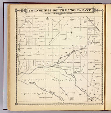
Township 17 South, Range 24 East, Tulare Co., California. (Compiled, drawn and published by Thos. H. Thompson, Tulare, Cal. 1892)
Publisher
T.H. Thompson
Township 17 South, Range 25 East, Tulare...
T.17S R.25E.
1892
County Atlas
Full Title
Township 17 South, Range 25 East, Tulare Co., California. (Compiled, drawn and published by Thos. H. Thompson, Tulare, Cal. 1892)
Publisher
T.H. Thompson
Township 17 South, Range 26 East, Tulare...
T.17S R.26E.
1892
County Atlas
Full Title
Township 17 South, Range 26 East, Tulare Co., California. (Compiled, drawn and published by Thos. H. Thompson, Tulare, Cal. 1892)
Publisher
T.H. Thompson
Township 17 South, Range 27 East, Tulare...
T.17S R.27E.
1892
County Atlas
Full Title
Township 17 South, Range 27 East, Tulare Co., California. (Compiled, drawn and published by Thos. H. Thompson, Tulare, Cal. 1892)
Publisher
T.H. Thompson
California. (to accompany) Bradstreet's ...
California
1885
National Atlas
Author
Bradstreet Company
Full Title
California. (to accompany) Bradstreet's Pocket Atlas Of The United States. Published Exclusively for Macullar, Parker & Company, Boston, Massachusetts ... New York: The Bradstreet Company, 1885. (on verso) Entered ... 1879, by The Bradstreet Company ... Washington.
Publisher
Bradstreet Co.
Eastern Murray Fracture Zone and Transve...
1969
Geologic Atlas
Author
[U.S. Geological Survey, Alpha, Tau Rho]
Full Title
Eastern Murray Fracture Zone and Transverse Ranges.
Publisher
U.S. Geological Survey
Oblique Map of the Northern California C...
1979
Geologic Atlas
Author
[U.S. Geological Survey, Alpha, Tau Rho, Gerin, Marybeth]
Full Title
Oblique Map of the Northern California Continental Margin.
Publisher
U.S. Geological Survey
Southern California Borderland.
1970
Geologic Atlas
Author
[U.S. Geological Survey, Alpha, Tau Rho]
Full Title
Southern California Borderland.
Publisher
U.S. Geological Survey
Oblique Map of Southern California, Sant...
1982
Geologic Atlas
Author
[U.S. Geological Survey, Alpha, Tau Rho]
Full Title
Oblique Map of Southern California, Santa Barbara to San Deigo.
Publisher
U.S. Geological Survey
Southern California Borderland Oblique M...
1978
Geologic Atlas
Author
[U.S. Geological Survey, Alpha, Tau Rho]
Full Title
Southern California Borderland Oblique Map of the Northwestern Part.
Publisher
U.S. Geological Survey
Ventura-Oxnard Offshore.
1972
Geologic Atlas
Author
[U.S. Geological Survey, Alpha, Tau Rho]
Full Title
Ventura-Oxnard Offshore.
Publisher
U.S. Geological Survey
San Francisco - Reno (upper map). Los An...
1939
[Ephemera, Pamphlet]
Author
[United Air Lines, White, Ruth Taylor]
Full Title
San Francisco - Reno (upper map). Los Angeles - Boulder Dam (lower map).
Publisher
United Air Lines
California.
California.
1883
World Atlas
Author
Cram, George Franklin
Full Title
California.
Publisher
A.C. Shewey and Co.
(A new map of Mexico and adjacent provin...
Mexico 3.
1810
Regional Atlas
Author
[Arrowsmith, Aaron, Humboldt, Alexander von, 1769-1859]
Full Title
(A new map of Mexico and adjacent provinces compiled from original documents by A. Arrowsmith, 1810. Sheet 3). London, Published 5th October 1810 by A. Arrowsmith, 10 Soho Square. (Engraved by E. Jones)
Publisher
A. Arrowsmith
651-700 of 805