1856
The Cities Of Pittsburgh ... Allegheny .
…
World Atlas
The Cities Of Pittsburgh And Allegheny,
…
|

1956
Shell Metropolitan Cincinnati and Vicini
…
National Atlas
Shell Map of Metropolitan Cincinnati (co
…
|

1956
Downtown Cincinnati.
National Atlas
Downtown Cincinnati. (Verso to) Shell Me
…
|

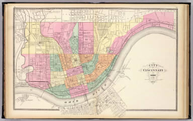
1889
Cincinnati.
World Atlas
Map of Cincinnati.
|

1886
Pittsburgh, Pennsylvania. Cincinnati, Oh
…
World Atlas
The Cities Of Pittsburgh and Allegheny w
…
|

1874
Pittsburgh, Pennsylvania. Cincinnati, Oh
…
World Atlas
The Cities Of Pittsburgh and Allegheny w
…
|

1866
Pittsburgh, Pennsylvania. Cincinnati, Oh
…
World Atlas
The Cities of Pittsburgh and Allegheny w
…
|

1901
Cincinnati.
World Atlas
Map of Cincinnati.
|

1874
Plan of Cincinnati.
National Atlas
Plan of Cincinnati. Entered ... 1874 by
…
|

1845
Ohio.
World Atlas
Neueste Karte von Ohio mit seinen Canael
…
|

1869
Storrs.
County Atlas
Storrs. (with) Cheviot, Green Township.
…
|

1869
Spencer; Madisonville.
County Atlas
Spencer. Madisonville, Columbia Township
…
|

1869
Columbia.
County Atlas
Columbia, Spencer Township. (with) Mount
…
|

1869
Mill Creek.
County Atlas
Mill Creek. (with) Winton Place. (with)
…
|

1869
Corryville.
County Atlas
Corryville, Mill Creek Township (1869)
|

1869
Cincinnati outline.
County Atlas
Outline map of Cincinnati. Accompanying
…
|

1869
Cincinnati 1, ward 16.
County Atlas
Cincinnati part I embracing 16th wards.
…
|

1869
Cincinnati 2, wards 6, 8 15.
County Atlas
Cincinnati part II embracing 6th, 8th &
…
|

1869
Cincinnati 4, wards 2, 4, 14.
County Atlas
Cincinnati part VI embracing 2nd, 4th &
…
|

1869
Cincinnati 5, wards 1, 3.
County Atlas
Cincinnati part V embracing 1st & 3d war
…
|

1869
Cincinnati 6, wards 9, 13.
County Atlas
Cincinnati part VI embracing 9th & 13th
…
|

1869
Cincinnati 7, wards 17, 20.
County Atlas
Cincinnati part VII embracing 17th & par
…
|

1869
Cincinnati 8, 3, wards 20, 5, 5, 10.
County Atlas
Cincinnati part VIII embracing part of 2
…
|

1869
Cincinnati 9, wards 11, 19.
County Atlas
Cincinnati part IX embracing 11th & 19th
…
|

1869
Cincinnati 10, wards 12, 18.
County Atlas
Cincinnati part X embracing 12th & 18th
…
|

1877
Upper Ohio River and Valley part XXVI, 4
…
Regional Atlas
Upper Ohio River and Valley part XXVI, 4
…
|

1877
Cincinnati, Ohio and vicinity.
Regional Atlas
Cincinnati, Ohio and vicinity. (... comp
…
|

1857
Pittsburgh and Allegheny, Pennsylvania.
…
National Atlas
The Cities of Pittsburgh and Allegheny w
…
|

1876
Pan Handle Route
County Atlas
Map of the Pittsburgh, Cincinnati and St
…
|

1872
City of Cincinnati, Ohio.
State Atlas
City of Cincinnati, Ohio. 1872. (Publish
…
|

1874
Plan of Cincinnati and vicinity
World Atlas
Plan of Cincinnati and vicinity. Entered
…
|

1877
Plan of Cincinnati and vicinity
World Atlas
Plan of Cincinnati and vicinity. Entered
…
|

1868
Plan of Cincinnati and Vicinity
World Atlas
Plan of Cincinnati and Vicinity. Entered
…
|

1857
Cincinnati & Vicinity. Louisville Jeffer
…
National Atlas
Cincinnati & Vicinity. Louisville Jeffer
…
|

1890
Cincinnati.
World Atlas
Plan of Cincinnati and vicinity. Copyrig
…
|

1877
Upper Ohio River and Valley part XXV, 43
…
Regional Atlas
Upper Ohio River and Valley part XXV, 43
…
|

1870
Cincinnati.
[State Atlas, World Atlas]
Plan of Cincinnati and vicinity. Entered
…
|

1880
Cincinnati.
World Atlas
Plan of Cincinnati and vicinity. Entered
…
|

1877
Cincinnati.
National Atlas
Gray's New Map of Cincinnati by Frank A.
…
|

1846
New Map Of Ohio.
World Atlas
A New Map Of Ohio with its Canals Roads
…
|

1865
Pittsburgh, Pennsylvania. Cincinnati, Oh
…
World Atlas
The Cities of Pittsburgh and Allegheny w
…
|

1869
Pittsburgh, Pennsylvania. Cincinnati, Oh
…
World Atlas
The Cities of Pittsburgh and Allegheny w
…
|

1860
Plan Of Cincinnati And Vicinity.
World Atlas
Plan Of Cincinnati And Vicinity. 32. Ent
…
|

1924
Cleveland. Cincinnati.
National Atlas
Commercial Atlas of America. Rand McNall
…
|

1836
New Map Of Ohio.
World Atlas
A New Map Of Ohio with its Canals, Roads
…
|

1884
Cincinnati.
World Atlas
Plan of Cincinnati and vicinity. Copyrig
…
|

1845
New Map Of Ohio.
World Atlas
A New Map Of Ohio with its Canals, Roads
…
|

1903
Cincinnati.
National Atlas
Rand, McNally & Co.'s Cincinnati and Env
…
|

1886
Cincinnati.
World Atlas
Plan of Cincinnati and vicinity. Copyrig
…
|

1858
Ohio, Indiana, Kentucky, and Tennessee.
World Atlas
Ohio, Indiana, Kentucky, and Tennessee.
…
|