Browse All

1862 74. Llangollen. National Atlas 74. Llangollen. |
1861 75. Harlech. National Atlas 75. Harlech. |

1859 76. Bardsey Island. National Atlas 76. Bardsey Island. |

1863 77. Holyhead. National Atlas 77. Holyhead. |

1861 78. Bangor. National Atlas 78. Bangor. |

1860 79. Denbigh. National Atlas 79. Denbigh. |

1860 80. Northwich. National Atlas 80. Northwich. |

1860 81. Buxton. National Atlas 81. Buxton. |

1859 82. Chesterfield. National Atlas 82. Chesterfield. |

1858 83. Lincoln. National Atlas 83. Lincoln. |

1848 84. Louth. National Atlas 84. Louth. |

1854 85. Patrington. National Atlas 85. Patrington. |

1854 86. Hull. National Atlas 86. Hull. |

1863 87. Doncaster. National Atlas 87. Doncaster. |

1861 88. Huddersfield. National Atlas 88. Huddersfield. |

1859 89. Bolton. National Atlas 89. Bolton. |

1859 90. Southport. National Atlas 90. Southport. |

1863 91. Lancaster. National Atlas 91. Lancaster. |

1863 92. Skipton. National Atlas 92. Skipton. |

1862 93. York. National Atlas 93. York. |

1862 94. Beverley. National Atlas 94. Beverley. |

1863 95. Scarborough. National Atlas 95. Scarborough. |

1863 96. Helmsley. National Atlas 96. Helmsley. |

1863 97. Richmond. National Atlas 97. Richmond. |

1865 98. Kendal. National Atlas 98. Kendal. |

1865 99. Ravenglass. National Atlas 99. Ravenglass. |

1874 100. Isle of Man. National Atlas 100. Isle of Man. |

1869 101. Cockermouth. National Atlas 101. Cockermouth. |

1868 102. Appleby. National Atlas 102. Appleby. |

1868 103. Durham. National Atlas 103. Durham. |

1869 104. Whitby. National Atlas 104. Whitby. |

1867 105. Newcastle. National Atlas 105. Newcastle. |

1869 106. Haltwhistle. National Atlas 106. Haltwhistle. |

1869 107. Carlisle. National Atlas 107. Carlisle. |

1870 108. Wooler. National Atlas 108. Wooler. |

1869 109. Alnwick. National Atlas 109. Alnwick. |

1868 110. Berwick. National Atlas 110. Berwick. |

1796 Map of England and Wales. World Atlas An Accurate Map Of England and Wales Wit … |

1795 Map Of England and Wales. World Atlas An Accurate Map Of England and Wales Wit … |

1758 England And Wales World Atlas England And Wales. (to accompany) Atlas … |

1905 Ubersichtskarte von Groszbritannien und … World Atlas Ubersichtskarte von Groszbritannien und … |

1905 England und Wales, Sudliche Halfte World Atlas England und Wales, Sudliche Halfte. Juni … |

1905 England und Wales, Nordliche Halfte World Atlas England und Wales, Nordliche Halfte. Sep … |

1859 England. World Atlas Map of England. Entered according to Act … |

1854 Palaeontological map (British Islands). Physical Atlas Palaeontological map (British Islands. B … |

1856 Ethnographic, Gt. Brit., Ireland. Physical Atlas Ethnographic map of Great Britain and Ir … |

1855 Britischen Inseln. World Atlas Die Britischen Inseln, oder die Vereinig … |

1856 England. World Atlas England. (with) London mit seinen nachst … |
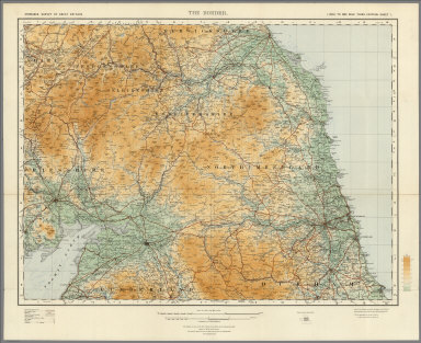
1921 Sheet 1. The Border. National Atlas Sheet 1. The Border. |

1921 Sheet 2. England North West. National Atlas Sheet 2. England North West. |