Browse All

1875 Grossbritannien. Sudliches Blatt: Englan … World Atlas Grossbritannien Im Maassstabe Von 1:1.50 … |

1875 Composite: Grossbritannien. World Atlas (Composite of) Grossbritannien Im Maasss … |

1811 England and Wales. World Atlas An Accurate Map of England and Wales Wit … |

1850 Die Brittischen Inseln und Die Nord-See. … World Atlas No. XVII. Stieler's Hand-Atlas (No. 15a. … |

1850 England und Wales. (England and Wales). World Atlas No. XVIII. Stieler's Hand-Atlas (No. 15b … |

1822 England and Wales School Atlas England & Wales. (to accompany) The Juve … |

1907 British Isles, Comparative Value of Land … Statistical Atlas British Isles, Comparative Value of Land … |

1907 British Isles - Industrial. Agricultural … Statistical Atlas British Isles - Industrial. Agricultural … |

1852 The Mountains, Table Lands, Plains & Val … Physical Atlas The Mountains, Table Lands, Plains & Val … |

1808 England and Wales. World Atlas England and Wales. |

1817 United Kingdoms of Great Britain and Ire … World Atlas United Kingdoms of Great Britain and Ire … |

1817 England and Wales. World Atlas England and Wales. |

1808 Britain, or the United Kingdom of Englan … World Atlas Britain, or the United Kingdom of Englan … |

1808 England and Wales. World Atlas England and Wales. |

1794 A New Map of Great Britain and Ireland. World Atlas A New Map of Great Britain and Ireland. |

1805 England and Wales. World Atlas England and Wales. |

1801 Dioceses of England. World Atlas The Dioceses of England with their Alter … |

1800 Britannia Romana. World Atlas Britannia Romana. |

1819 Saxon England. World Atlas Saxon England. |

1823 Die Brittischen Inseln. (British Isles). World Atlas No. XVII. Stielers Hand-Atlas (No. 15). … |
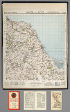
1947 Sheet 64. Berwick-upon-Tweed. National Atlas Sheet 64. Berwick-upon-Tweed. |

1947 Sheet 71. Alnwick. National Atlas Sheet 71. Alnwick. |

1947 Sheet 75. Dumfries. National Atlas Sheet 75. Dumfries. |

1947 Sheet 76. Carlisle. National Atlas Sheet 76. Carlisle. |

1947 Sheet 77. Hexham. National Atlas Sheet 77. Hexham. |
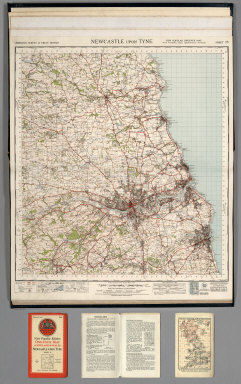
1947 Sheet 78. Newcastle upon Tyne. National Atlas Sheet 78. Newcastle upon Tyne. |

1947 Sheet 82. Keswick. National Atlas Sheet 82. Keswick. |

1947 Sheet 83. Penrith. National Atlas Sheet 83. Penrith. |

1947 Sheet 84. Teesdale. National Atlas Sheet 84. Teesdale. |

1947 Sheet 85. Durham. National Atlas Sheet 85. Durham. |

1947 Sheet 86. Redcar and Whitby. National Atlas Sheet 86. Redcar and Whitby. |

1940 Sheet 87. Isle of Man. (also known as Sh … National Atlas Sheet 87. Isle of Man. (also known as Sh … |

1947 Sheet 88. Barrow in Furness. National Atlas Sheet 88. Barrow in Furness. |

1947 Sheet 89. Lancaster and Kendal. National Atlas Sheet 89. Lancaster and Kendal. |

1947 Sheet 90. Askrigg and Settle. National Atlas Sheet 90. Askrigg and Settle. |

1947 Sheet 91. Ripon. National Atlas Sheet 91. Ripon. |

1947 Sheet 92. Pickering. National Atlas Sheet 92. Pickering. |

1947 Sheet 93. Scarborough. National Atlas Sheet 93. Scarborough. |

1947 Sheet 94. Preston. National Atlas Sheet 94. Preston. |

1947 Sheet 95. Blackburn and Burnley. National Atlas Sheet 95. Blackburn and Burnley. |

1947 Sheet 96. Leeds and Bradford. National Atlas Sheet 96. Leeds and Bradford. |

1947 Sheet 97. York. National Atlas Sheet 97. York. |

1947 Sheet 98. Market Weighton. National Atlas Sheet 98. Market Weighton. |

1947 Sheet 99. Hull. National Atlas Sheet 99. Hull. |

1947 Sheet 100. Liverpool. National Atlas Sheet 100. Liverpool. |

1947 Sheet 101. Manchester. National Atlas Sheet 101. Manchester. |

1947 Sheet 102. Huddersfield. National Atlas Sheet 102. Huddersfield. |

1947 Sheet 103. Doncaster. National Atlas Sheet 103. Doncaster. |

1947 Sheet 104. Gainsborough. National Atlas Sheet 104. Gainsborough. |

1946 Sheet 105. Grimsby. National Atlas Sheet 105. Grimsby. |