Who What Where WhenWHERE
|
Author
Burr, David H., 1803-1875
Full Title
Map of Georgia & Alabama Exhibiting the Post Offices, Post Roads, Canals, Rail Roads, &c. By David H. Burr. (Late Topographer to the Post Office.) Geographer to the House of Representatives of the U.S. John Arrowsmith. Entered ... July 10th, 1839, by David H. Burr ... District of Columbia.
Publisher
John Arrowsmith
Author
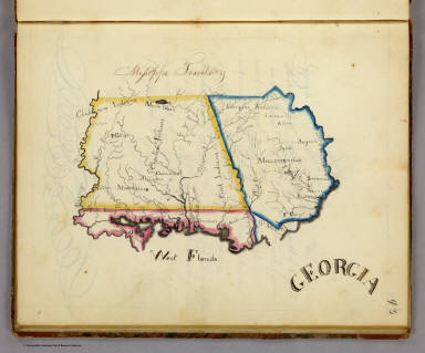
Henshaw, Frances A.
Full Title
Georgia.
Publisher
Manuscript
Author
Asher & Adams
Full Title
Asher & Adams' Georgia & Alabama. Entered according to Act of Congress in the year 1874 by Asher & Adams ... at Washington. (New York, 1874)
Publisher
Asher and Adams
Author
Mitchell, Samuel Augustus Jr.
Full Title
County Map of the States of Georgia and Alabama. (insets) Savannah, Georgia. City of Atlanta, the Capitol of Georgia. Entered ... 1874 by S. Augustus Mitchell ... Washington.
Publisher
Ziegler & McCurdy
Author
Johnson, A.J.
Full Title
Johnson's Georgia And Alabama Published By Johnson and Ward.
Publisher
Johnson and Ward
Author
[Jones, C.H., Hamilton, T.H., Williams, J.David]
Full Title
Map of South Carolina, Georgia, Florida, Alabama, Mississippi, and Louisiana.
Publisher
J. David Williams
Author
Johnson, A.J.
Full Title
Johnson's Georgia and Alabama. Entered ... 1863.
Publisher
A.J. Johnson
Author
[Ruger, Edward, United States. War Department]
Full Title
Sheet no. 1. Map of the battle-field of Chickamauga, September 19th, 1863 between the United States forces commanded by Maj. Gen. W.S. Rosecrans and the rebel army under Gen. Braxton Bragg. Compiled under the direction of Col. W.E. Merrell ... by Edward Ruger ... Sheet no. 2. Map of the battle-field of Chickamauga, September 20th, 1863 ... (with) Map showing the expedition of the 15th Army Corps, Maj. Gen. P.J. Osterhaus, commanding, Turkeytown Valley, Ala., October 24-26, 1864. (with) Battle of Chickamauga, Walker Co., Georgia, Sept. 19 and 20, 1863. From original in the possession of General Braxton Bragg, C.S. Army. Julius Bien & Co., Lith., N.Y. (1891-1895)
Publisher
U.S. Government Printing Office
Author
United States. War Department
Full Title
Topographical sketch of the battle of Bethel, Va., June 10th, 1861. (with) Position, Left Wing, 16th Army Corps, September 3d to 5th, 1864 near Lovejoy's Station, Ga. (with) July 22, 1864. To accompany official report of Maj. Gen. Frank P. Blair ... by Lieut Levi Coffman. (with) Position of the 17th Army Corps before Atlanta, Ga., July 22d 1864 ... (with) Position near Jonesborough, Ga. occupied by 2nd Division, 15th Army Corps from August 30th to September 2, 1864. (with) Sketch of the siege of Blakely, Ala. invested April 2d. by the forces under Maj. Gen. F. Steele. Assault April 9th 1865. Drawn by Gen. C.C. Andrews, May 1866. (with) Position of the Left Wing, 16th Army Corps near Jonesborough, Ga. (with) Position of the Left Wing, 16th Army Corps, September 10, 1864. (with) Line of march of Left Wing, 16th Army Corps from April 29 to May 4, 1864. (with) Position, Left Wing, 16th Army Corps, Resaca, Ga., May 14th, 15th and 16th, 1864. (with) Position, Left Wing, 16th Army Corps ... July 4, 1864. (with) Position, 16th Army Corps, May 16, 1864. (with) Position, Left Wing, 16th Army Corps ... May 26 to June 1st 1864. (with) Position, Left Wing, 16th A.C. near Owen's Mill, Ga., June 1st to 5th 1864. (with) Position of 16th Army Corps from July 26th to August 26th 1864. Julius Bien & Co., Lith., N.Y. (1891-1895)
Publisher
U.S. Government Printing Office
Author
[Palfrey, John C., United States. War Department]
Full Title
"A." Plan of siege operations against Fort Morgan, Ala., by the U.S. forces under Maj. Gen. Gordon Granger, August, 1864. Capt. John C. Palfrey, Corps of Engr's.. Lieut. A.H. Burnham, Lieut. Chas. J. Allen ... in charge of works. Surveyed and drawn by Capt. W.H. Wheeler, Lt. S.E. McGregory ... (with) Diagram of battle-field at Harrisburg, Miss. Battle fought July 14th, 1864. Drawn by Capt. D.W. Wellman. (with) Map of the roads and adjacent country between Stubb's Plantation and Brice's Cross-roads, Miss. (with) Snake Creek Gap, Ga. (with) Sketch of vicinity of 2d. Cav. Div. camp. K. Garrard ... (with) Defense of Fort Morgan by Brig. Gen. R.L. Page, P.A.C.S., August 1864. A true copy of the engineers' record, J. Gallimard ... (with) Defense of Fort Morgan, entrance of Mobile Bay ... (with) Map of the battle of Fredericksburg, Va., December 13, 1862. (with) Map of battle-field of Mechanicsville and Cold Harbor, Va. Julius Bien & Co., Lith., N.Y. (1891-1895)
Publisher
U.S. Government Printing Office
Author
[Poe, Orlando M., United States. War Department]
Full Title
Map of Savannah, Ga. and vicinity. Illustrating the operations of the army under command of Maj. Gen. W.T. Sherman resulting in the fall of that city December 21, 1864. Compiled under the direction of ... O.M. Poe ... from captured maps, Coast Survey maps and surveys made during the progress of the siege. Drawn by Maj. E.F. Hoffman, A.D.C. and Capt. H.A. Ulffers, A.A.G. ... Sept. 17, 1881. (with) Map showing the route of march of the 2d Division, 15th Army Corps from November 12th to December 21st 1864. (with) Rebel defenses in front of the 14th and 20th Army Corps before the evacuation of Savannah, Ga. John Rziha, Capt. 19th U.S. Infty. (with) Map of the city of Selma, Ala. and its defenses. Captured by assault by the Cavalry Corps, M.D.M., April 2d. 1865. Bvt. Maj. Gen. J.H. Wilson, com'd'g. Surveyed and drawn by Capt. H.E. Noyes ... Julius Bien & Co., Lith., N.Y. (1891-1895)
Publisher
U.S. Government Printing Office
Author
United States. War Department
Full Title
No. 10. Map of the defenses of the city of Mobile. Rebel line of works at Blakely, Ala., captured by the Army of West Mississippi, April 9, 1865. Position and approaches by the Union forces. Expedition from Messinger's Ferry toward Canton, Miss., October 14-20, 1863. (with) Campaign maps, numbers 1 to 11 inclusive, showing position of 20th Army Corps on march from Atlanta, Ga. to Savannah, Ga., with dates and Union and rebel defenses, from surveys of Topographical Engineers 20th Army Corps. Position of troops by Lieut. Col. C.W. Asmussen ... December 1864. (with) Position occupied by troops from French's division at the crossing of the Chattahoochee River. S.G. French, Major-General, C.S. Army. Julius Bien & Co., Lith., N.Y. (1891-1895)
Publisher
U.S. Government Printing Office
Author
[Peseux, M., United States. War Department]
Full Title
Battle-fields in front of Nashville, Tenn., where the United States forces commanded by Major-General Geo. H. Thomas, defeated and routed the rebel army under General Hood, December 15th and 16th 1864. Surveyed and drawn under the direction of Gen. Tower by M. Peseux, C.S. Mergell, auth. (with) Battle-field in front of Franklin, Tenn., where the United States forces ... under the command of Maj. Gen. J.M. Schofield, severely repulsed the rebel army commanded by Lieutenant-General Hood, November 30th 1864. (with) Map of the battle-field of Waynesborough, Va., fought March 2d. 1865. Union cavalry commanded by Maj. Gen. P.H. Sheridan ... Confederate forces commanded by Lieut. Gen. J.A. Early. Surveyed and drawn under the direction of ... G.L. Gillespie ... by H.C. Koch. (with) Sketch of West Point, Ga. and line of defenses. Under supervision of Lieut. Heywood ... (with) Sketch of Saunders' Ford, Ala., on Mulberry Fork of the Black Warrior River. Surveyed and drawn by H.S. Heywood ... (with) Sketch of the camp of the Cav. Corps, M.D.M., extending from Eastport, Miss. to Gravelly Springs, Ala. from field notes of H.S. Heywood ... (with) Battle-field of Waynesborough, Va., 2d March 1865. Prepared by ... G.L. Gillespie ... 1873. Surveyed by John B. McMaster ... drawn by George B. Strauch. Julius Bien & Co., Lith., N.Y. (1891-1895)
Publisher
U.S. Government Printing Office
Author
[Gillespie, George L., United States. War Department]
Full Title
Engineer' Office, Military Division of the Gulf, map no. 6. Central Virginia, showing Maj. Gen. P.H. Sheridan's campaigns and marches of the Cavalry under his command in 1864-1865. Drawn and lithographed under the direction of ... Geo. L. Gillespie ... October 1865. Engineer Office, Military Division of the Gulf, map no. 3. Battle-field of Dinwiddie C.H., fought Friday March 31st 1865 ... Surveyed, drawn and lithographed under direction of ... G.L. Gillespie ... July 1865. Surveyed and drawn by Henry C. Koch. Drawn for stone by C.W. Drury. (with) Map of Montgomery, Ala. and its defenses. Drawn by Lieut H.S. Heywood ... from original projection by Brig. Gen. Leadbetter, C.S.A. (with) Sketch of Columbus, Ga. and its defenses. From survey made by Lieut. H.S. Heywood ... (with) Sketch of the battle-field of Ebenezer Church, Ala. Battle fought on the 1st day of April 1865 between the U.S. forces under Bvt. Maj. Gen. Wilson and the C.S. forces under Lieut. Gen. Forrest. Julius Bien & Co., Lith., N.Y. (1891-1895)
Publisher
U.S. Government Printing Office
Author
[Asmussen, Charles W., United States. War Department]
Full Title
Campaign maps exhibiting the line of march of the 20th Corps from Savannah, Ga. to Goldsborough, N.C., with the plans of the battle-fields of Averysborough and Bentonville, N.C., from surveys of Topographical Engineers 20th Corps. Position of troops by Lieut. Col. C.W. Asmussen ... Rough sketch of Taylor's store, Ala. and surrounding country. Julius Bien & Co., Lith., N.Y. (1891-1895)
Publisher
U.S. Government Printing Office
Author
[Abbot, Henry L., United States. War Department]
Full Title
Department of the Gulf. Map no. 5. Approaches to New Orleans, prepared by order of Maj. Gen. N.P. Banks (by) Henry L. Abbot, Capt. and Chief Top. Engrs., Feb. 14th, 1863. (with Fairburn, Ga., Aug. 15-16, 1864). (with) Position of Army of Tennessee near Atlanta, Ga., July 22, 1864. (with) Map of Spanish Fort, Ala., made during the siege by Lieut. J.A. Chalaron ... (with) Diagrams illustrating the different positions occupied by the 4th Division, 17th Army Corps, during the battle of Atlanta, Ga., July 22, 1864. (with) Part of Paulding County, showing the position of the Left Wing, 16th A.C., June 4, 1864. (with) Section of a map showing the lines new New Hope Church, Ga., 1864. From Chief Engineer's Office, Army of Mississippi, by Capt. W.J. Morris, Chief Engineer. (with) Topographical sketch of the position of the Second Division, 14th Army Corps, in front of Savannah, Ga., December 11th, 1864. Brig. Gen. Jas. D. Morgan, commanding Division. Surveyed and drawn by Chas. Petri ... (with) Map of the vicinity of Mechanicsville, Va. (with Spanish Fort, Ala., March 29-April 8, 1865. Chas. G. Johnson). (with) Spanish Fort, 1865. Drawn during siege by assistant surgeon Bull, C.S. Army. Julius Bien & Co., Lith., N.Y. (1891-1895)
Publisher
U.S. Government Printing Office
Author
United States. War Department
Full Title
Topographical map of Clarksville, Tenn. Copied from the original plan prepared under the direction of Col. W.E. Merrill ... by Maj. James R. Willett ... From a survey by John H. Willett, Dec., 1864 ... 1865. Traced by W. Claypoole. Dalton, Ga. Copied from the original plan by Maj. Willett from a survey by R.M. Radford ... (with) Topographical map of Johnsonville, Tenn ... 1865. (with) Franklin, Tenn .... survey by Charles Peseux ... (with) Topographical map of Columbia, Tenn and vicinity ... (with) Gallatin, Tenn ... (with) Decatur, Ala. ... (with) Topographical sketch of Athens, Ala ... (with) Huntsville, Ala ... Surveyed by Jno. Willett and Chas. Peseux ... Julius Bien & Co., Lith., N.Y. (1891-1895)
Publisher
U.S. Government Printing Office
Author
Johnson, A.J.
Full Title
Johnson's Georgia and Alabama. Published by A. J. Johnson, New York. 53. 54. Entered according to the Act of Congress, in the year 1863, by A.J. Johnson in the Clerk's Office of the District Court of the United States for the Southern District of New York.
Publisher
A.J. Johnson.
Author
Asher & Adams
Full Title
Asher & Adams' Georgia & Alabama. Entered according to Act of Congress 1874 by Asher & Adams in the Office of the Librarian of Congress at Washington.
Publisher
Asher & Adams.
Author
Tanner, Henry S.
Full Title
Louisiana and Mississippi. By H.S. Tanner. American Atlas. Engraved & Published by H.S. Tanner, Philadelphia. Entered according to Act of Congress, 20th Day of December, 1820, by H.S. Tanner, of the State of Pennsylvania.
Publisher
Henry Tanner
Author
Tanner, Henry S.
Full Title
Georgia and Alabama. By H.S. Tanner. 1825. American Atlas. Published by H.S. Tanner, Philadelphia. Entered according to Act of Congress, 20th Day of August, 1823, by H.S. Tanner, of the State of Pennsylvania. Engraved by H.S. Tanner & Assistants.
Publisher
Henry Tanner
Author
Fullarton, A. & Co.
Full Title
United States North America According to Calvin, Smith & Tanner. By G.H. Swanston Edinr. The South Eastern States Comprising Mississippi, Alabama, Tennessee, Georgia, Nth. & Sth. Carolina, and part of Florida, Virginia & Kentucky. LVIII. Engd. by G.H. Swanston Edinburgh. A. Fullarton & Co. Edinburgh, London & Dublin.
Publisher
A. Fullarton & Co.
Author
[Kellogg, Sanford Cobb, 1842-, Mergell, C. S., United States. Army. Corps of Engineers]
Full Title
The Chattanooga Campaign of August and September 1863, enlarged from a map compiled in 1865, by C.S. Mergell, under the direction of Col. W.E. Merrill, 1st U.S. V.V. Eng'rs, and published by the Chief of Engineers of the Army in 1874. Drawn by J. von Glumer. Positions of troops located in 1891 by Captain S.C. Kellogg, 5th Cavalry. Julius Bien & Co. lith. (Washington, D.C.: U.S. Government Printing Office, 1891)
Publisher
U.S. Government Printing Office
Author
Melish, John
Full Title
Map of the Country belonging to the Cherokee and Creek Indians From the Original Drawing in the War Department. J. Melish del. (1824)
Publisher
No publisher.
Author
Mitchell, Samuel Augustus Jr.
Full Title
County map of Georgia, and Alabama. Entered ... 1860 by S. Augustus Mitchell, Jr. ... Pennsylvania.
Publisher
S.A. Mitchell Jr.
Author
Mitchell, Samuel Augustus Jr.
Full Title
County map of North Carolina. (Scale: 1:2,800,000). Map of South Carolina. (Scale: 1:2,550,000). (inset) 31. Map of Charleston Harbor. County map of Florida. (Scale:1:3,700,000). Entered ... 1860 by S. Augustus Mitchell, Jr. ... Pennsylvania.
Publisher
S.A. Mitchell Jr.
Author
Mitchell, Samuel Augustus Jr.
Full Title
County map of the States of Georgia and Alabama. Entered ... 1874, by S. Augustus Mitchell ... Washington. (with inset maps) Savannah, Georgia. City of Atlanta, the capital of Georgia.
Publisher
S.A. Mitchell Jr.
Author
Mitchell, Samuel Augustus Jr.
Full Title
County map of the States of Georgia and Alabama. Entered ... 1876 by S. Augustus Mitchell, . ... Washington. (inset maps): Savannah Georgia. (with reference to squares), and City of Atlanta, the capital of Georgia.
Publisher
S.A. Mitchell Jr.
Author
Johnson, A.J.
Full Title
Johnson's Georgia And Alabama By Johnson & Browning. No. 28-29.
Publisher
Johnson and Browning
Author
Mitchell, Samuel Augustus Jr.
Full Title
County map of Georgia and Alabama. Entered ... 1867 by S. Augustus Mitchell, Jr. ... Pennsylvania.
Publisher
S.A. Mitchell Jr.
Author
[Julius Bien & Co., United States. War Department]
Full Title
General topographical map. Sheet XII. Julius Bien & Co., Lith., N.Y. (1891-1895)
Publisher
U.S. Government Printing Office
Author
[Julius Bien & Co., United States. War Department]
Full Title
General topographical map. Sheet XIII. Julius Bien & Co., Lith., N.Y. (1891-1895)
Publisher
U.S. Government Printing Office
Author
[Julius Bien & Co., United States. War Department]
Full Title
General topographical map. Sheet XIV. Julius Bien & Co., Lith., N.Y. (1891-1895)
Publisher
U.S. Government Printing Office
Author
[Hinton, Isaac Taylor, 1799-1847, Simpkin & Marshall]
Full Title
Map of the states of Alabama and Georgia. (with) Plan of Savannah. London, published Oct. 15, 1831 by I.T. Hinton & Simpkin & Marshall. Engraved & printed by Fenner Sears & Co. (1832)
Publisher
[Simpkin & Marshall, Thomas Wardle]
Author
Letts, Son & Co.
Full Title
Eastern United States. No. 8. Letts's popular atlas. Letts, Son & Co. Limited, London. (1883)
Publisher
Letts, Son & Co.
Full Title
(Map of Alabama, Georgia and part of Florida. Raleigh: Branson, Farrar & Co., Publishers. Biblical Recorder Print. 1863)
Publisher
Branson, Farrar & Co.
Author
Gannett, Henry, 1846-1914
Full Title
Sketch map showing the position of the center of the Negro population and the median point in 1880, 1890 and 1900. Compiled by Henry Gannett, Geographer. (United States Census Office, 1903). Julius Bien & Co., N.Y.
Publisher
U.S. Census Office
Full Title
County map of the states of Georgia and Alabama. (with) Savannah, Georgia. (with) City of Atlanta, the capitol of Georgia. Copyright 1887 by Wm. M. Bradley & Bro. (1890)
Publisher
John Y. Huber & Co.
Author
Mitchell, Samuel Augustus
Full Title
County map of Georgia, and Alabama. Entered ... 1870 by S. Augustus Mitchell, Jr. ... Pennsylvania.
Publisher
[R.A. Campbell, S.A. Mitchell, Jr.]
Author
Mitchell, Samuel Augustus
Full Title
County map of the states of Georgia and Alabama. (with) Savannah, Georgia. (with) City of Atlanta, the capitol of Georgia. Entered ... 1879 by S. Augustus Mitchell ... Washington. (1880)
Publisher
S.A. Mitchell
Author
Tanner, Henry S.
Full Title
Georgia and Alabama By H.S. Tanner. Published by H.S. Tanner, Philadelphia. Engraved by H.S. Tanner & Assistants. Entered ... 20th day of August 1823, by H.S. Tanner... Pennsylvania. American Atlas.
Publisher
Henry Tanner
Author
Tanner, Henry S.
Full Title
Georgia and Alabama By H.S. Tanner. Published by H.S. Tanner, Philadelphia. Engraved by H.S. Tanner & Assistants. Entered ... 20th day of August 1823, by H.S. Tanner... Pennsylvania. American Atlas.
Publisher
Henry Tanner
Author
Tanner, Henry S.
Full Title
Georgia and Alabama By H.S. Tanner. Improved to 1825. Published by H.S. Tanner, Philadelphia. Engraved by H.S. Tanner & Assistants. Entered ... 20th day of August 1823, by H.S. Tanner... Pennsylvania. American Atlas.
Publisher
Henry Tanner
Author
Tanner, Henry S.
Full Title
Georgia and Alabama. (engraved by) J. Knight. Sc. (to accompany) A New Pocket Atlas of the United States With The Roads and Distances, Designed For the Use of Travelers. By H.S. Tanner. Philadelphia: Published by the Author. 1828. (on verso) ...on the seventeenth day of November ... 1828, Henry S. Tanner ... hath deposited ... a book ... Pennsylvania.
Publisher
H.S.Tanner
Author
Cram, George Franklin
Full Title
New Rail Road and County Map of Alabama, Georgia, Sth. Carolina & Northern Florida.
Publisher
A.C. Shewey and Co.
Author
Tanner, Henry S.
Full Title
Georgia And Alabama By H.S. Tanner. Improved To 1825. American Atlas. Entered ... 20th day of August 1823, by H.S. Tanner ... Pennsylvania. Published by H.S. Tanner, Philadelphia. Engraved by H.S. Tanner & Assistants.
Publisher
Henry Tanner
Author
[Johnston, Alexander Keith, 1804-1871, Rogers, Henry Darwin]
Full Title
States Of South Carolina, Georgia, Alabama, And Florida. By Prof. H.D. Rogers & A. Keith Johnston, F.R.S.E. Entered in Sta. Hall. London ... & according to an act of Congress ... 1857, by H.D. Rogers ... Massachusetts. London, John Murray, Albemarle Street, Edinburgh, W. & A.K. Johnston. Engraved by W. & A.K. Johnston, Edinburgh.
Publisher
Edward Stanford
Author
Tanner, Henry S.
Full Title
Georgia and Alabama By H.S. Tanner. Published by H.S. Tanner, Philadelphia. Engraved by H.S. Tanner & Assistants. Entered ... 20th day of August 1823, by H.S. Tanner... Pennsylvania. American Atlas.
Publisher
Henry Tanner
|