Who What Where WhenWHO
WHEN
|
Author
Mitchell, Samuel Augustus
Full Title
Map Of North and South Carolina And Georgia, Constructed from the Latest Authorities. Published by S. Augustus Mitchell Philadelphia. 1831. J.H. Young Sc.
Publisher
S.A. Mitchell
Author
Burr, David H., 1803-1875
Full Title
Map of Georgia & Alabama Exhibiting the Post Offices, Post Roads, Canals, Rail Roads, &c. By David H. Burr. (Late Topographer to the Post Office.) Geographer to the House of Representatives of the U.S. John Arrowsmith. Entered ... July 10th, 1839, by David H. Burr ... District of Columbia.
Publisher
John Arrowsmith
Author
Colton, G.W.
Full Title
The City Of Savannah Georgia. (with) The City of Charleston South Carolina. Published By J.H. Colton & Co. No. 172 William St. New York. Entered ... 1855 by J.H. Colton & Co. ... New York. No. 28.
Publisher
J.H. Colton
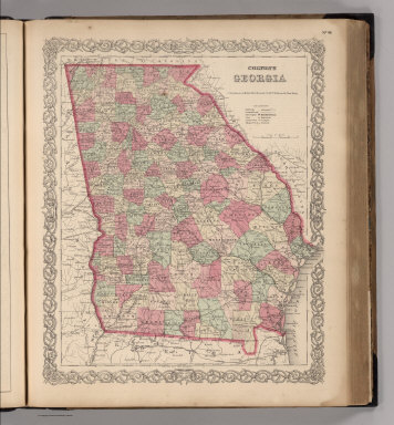
Author
Colton, G.W.
Full Title
Georgia. Published By J.H. Colton & Co. No. 172 William St. New York. Entered ... 1855 by J.H. Colton & Co. ... New York. No. 29.
Publisher
J.H. Colton
Author
[Reid, John, Winterbotham, W.]
Full Title
Georgia, from the latest Authorities. B. Tanner, sculpt. N.Y. Published by J. Reid, L. Wayland & C. Smith.
Publisher
John Reid
Author
Henshaw, Frances A.
Full Title
Georgia.
Publisher
Manuscript
Author
Schonberg & Co.
Full Title
North Carolina. South Carolina and Georgia.
Publisher
Schonberg & Co.
Author
Schonberg & Co.
Full Title
Schonberg's Map of Georgia. Entered ... 1866 ... New York.
Publisher
Schonberg & Co.
Author
Shell Oil Company
Full Title
Shell Map of Georgia (cover title). Shell Highway Map of Georgia. 7-DD-1956-2.
Publisher
Shell Oil Company
Author
Shell Oil Company
Full Title
Savannah. Augusta. Macon. Chattanooga (Tennessee). Atlanta. (Verso to) Shell Highway Map of Georgia.
Publisher
Shell Oil Company
Author
Shell Oil Company
Full Title
Metropolitan Atlanta and Vicinity. (Verso to) Shell Street Map of Atlanta.
Publisher
Shell Oil Company
Author
Vandermaelen, Philippe, 1795-1869
Full Title
Partie des Etats Unis. Amer. Sep. no. 57. Dresse et dessinee par Ph. Vandermaelen, lithographie par H. Ode ... 1825. (Quatrieme partie. - Amer. sept. Bruxelles. 1827)
Publisher
Ph. Vandermaelen
Author
Instituto Geographico di Agostini
Full Title
U.R.S.S. Sezione Europea. (insets) Leningrado; Mosca.
Publisher
Instituto Geographico di Agostini
Author
Cram, George Franklin
Full Title
Railroad and County Map of Georgia. Geo. F. Cram. Engraver and Publisher, Chicago.
Publisher
George F. Cram
Author
Colton, G.W.
Full Title
The City of Savannah, Georgia. The City of Charleston, South Carolina. Published by G. W & C. B. Colton & Co., No. 182 William St. New York.
Publisher
G. W & C. B. Colton & Co.
Author
Colton, G.W.
Full Title
Colton's Georgia. Published By G. W & C. B. Colton & Co., No. 182 William St. New York.
Publisher
G. W & C. B. Colton & Co.
Author
Society for the Diffusion of Useful Knowledge (Great Britain)
Full Title
North America sheet XII. Georgia with parts of North & South Carolina, Tennessee, Alabama & Florida. Published under the superintendence of the Society for the Diffusion of Useful Knowledge. J. & C. Walker sculpt. Published Novr. 1st. 1833 by Baldwin & Cradock, 47 Paternoster Row, London. Printed by Russell, Penge. (London: Chapman & Hall, 1844)
Publisher
Chapman and Hall
Author
Colton, G.W.
Full Title
Colton's Georgia. Published By G. W & C. B. Colton & Co., No. 172 William St. New York.
Publisher
G. W & C. B. Colton & Co.
Author
Colton, G.W.
Full Title
Colton's Turkey in Asia and the Caucasian Provinces of Russia. Published By G. W & C. B. Colton & Co., No. 172 William St. New York.
Publisher
G. W & C. B. Colton & Co.
Author
Colton, G.W.
Full Title
Colton's Georgia. Published by G.W. & C.B. Colton & Co., No. 172 William St. New York.
Publisher
G.W. & C.B. Colton
Author
Asher & Adams
Full Title
Asher & Adams' Georgia & Alabama. Entered according to Act of Congress in the year 1874 by Asher & Adams ... at Washington. (New York, 1874)
Publisher
Asher and Adams
Author
Cram, George Franklin
Full Title
Georgia.
Publisher
George F. Cram
Author
Mitchell, Samuel Augustus
Full Title
A New Map of Georgia, with its Roads & Distances. Published by Thomas, Cowperthwait & Co., No. 253 Market Street, Philadelphia. Entered ... 1850, by Thomas, Cowperthwait & Co. ... Pennsylvania.
Publisher
Thomas, Cowperthwait & Co.
Author
Mitchell, Samuel Augustus Jr.
Full Title
County Map of the States of Georgia and Alabama. (insets) Savannah, Georgia. City of Atlanta, the Capitol of Georgia. Entered ... 1874 by S. Augustus Mitchell ... Washington.
Publisher
Ziegler & McCurdy
Author
Meyer, Joseph, 1796-1856
Full Title
Neueste Karte von Georgia mit seinen Strassen, Eisenbahnen und Entfernungen, 1845. Aus der Geographischen Graviranstalt des Bibliographischen Instituts zu Hildburghausen, Amsterdam, Paris u. Philadelphia, (1860)
Publisher
Bibliographischen Instituts
Author
Johnson, A.J.
Full Title
Johnson's Georgia And Alabama Published By Johnson and Ward.
Publisher
Johnson and Ward
Author
Mitchell, Samuel Augustus
Full Title
A new map of Georgia, with its Roads & Distances. Published by Thomas, Cowperthwait & Co. No. 253 Market Street, Philadelphia. Entered ... 1850 by Thomas, Cowperthwait & Co. ... Pennsylvania.
Publisher
Cowperthwait, Desilver & Butler
Author
Bartholomew, John
Full Title
(Index to) U.S.S.R. Caucasus, Crimea. Conic Projection, Standard parallels 38 (degree) and 56 (degree) N. 1:2,500,000.
Publisher
[Houghton Mifflin Co., John Bartholomew & Son LTD.]
Author
Bartholomew, John
Full Title
U.S.S.R. Caucasus Crimea. The Geographical Institute Edinburgh. Edited by John Bartholomew, M.C., LL.D. (Copyright), John Bartholomew & Son, LTD. (inset map) Krym (Crimea) Continuation on same scale.
Publisher
[Houghton Mifflin Co., John Bartholomew & Son LTD.]
Author
[Jones, C.H., Hamilton, T.H., Williams, J.David]
Full Title
Map of South Carolina, Georgia, Florida, Alabama, Mississippi, and Louisiana.
Publisher
J. David Williams
Author
[Jones, C.H., Hamilton, T.H., Williams, J.David]
Full Title
Turkey in Asia (Asia Minor) and Transcaucasia.
Publisher
J. David Williams
Author
[Bayer, Herbert, Container Corporation of America]
Full Title
Georgia. U.S. States. (inset) (Vicinity of Atlanta).
Publisher
Container Corporation of America
Author
[Carey, Mathew, Warner, Benjamin]
Full Title
Georgia.
Publisher
M. Carey and B. Warner
Author
[Breese, Samuel, 1802-1873, Morse, Sidney E. (Sidney Edwards), 1794-1871]
Full Title
Georgia. Entered ... 1842 by Sidney E. Morse and Samuel Breese ... New York. (New York: Published by Harper & Brothers, 1845)
Publisher
Harper & Brothers
Author
[Vorzet, Ed.Dumas, Le Comte de Paris]
Full Title
Planche I. Carte Generale du Theatre de la Guerre. (inset) Cote de la Georgie. Dessine par Ed. Dumas Vorzet. Michel Levy, freres. Editeurs. Imp. Becquet, Paris. Grave par L. Wuhrer, R. Gay-Lussac 52.
Publisher
Michel Levy Freres
Author
[Howe, Samuel Gridley, Ruggles, Samuel P.]
Full Title
Map of South Carolina and Georgia.
Publisher
New England Institution for the Education of the Blind
Author
Johnson, A.J.
Full Title
Johnson's Georgia and Alabama. Entered ... 1863.
Publisher
A.J. Johnson
Author
Ruhle von Lilienstern, August
Full Title
Europaeisch Russland. Berlin. 1824 von R v L.
Publisher
C.G. Luderitz
Author
[Michler, Nathaniel, United States. War Department]
Full Title
Battle-field of Youngs Branch or Manassas Plains, battle fought July 21st, 1861. Tracing forwarded to the Chief of Engineers U.S.A. by Maj. N. Michler ... Map of the rebel fortifications at Columbus, Ky., surveyed under the direction of Brig. Genl. Geo. W. Cullum, Chief of Staff and engineers, Dept. of the Mississippi, 1862. (with) Map showing the position of the batteries used by the U.S. forces in the reduction of Fort Pulaski, April 10th & 11th, 1862. Accompanying Report of Brig. Gen. Quincy A. Gillmore, U.S. Vols. (with) Siege of Fort Pulaski, map of the mouth of Savannah River and adjacent islands ... (with) Action at Front Royal, Va., May 23d. 1862. Accompanying Report of Lieut. Col. Charles Parham, Twenty-ninth Pennsylvania Infantry. (with) Sketch of Fort Pickens, Florida, by Lt. Langdon ... 1861. (with) Reconnaissance of the battle-field at Bull Run, Va., fought July 21, 1861. Made on March 14, 1862 by Henry L. Abbot ... (with) Skirmishes near Bailey's Cross-roads, Va., August 28-30, 1861. Accompanying Report of Major S.G. Champlin ... (with) Accompanying Report of Brig. Gen. Louis Blenker, U.S. Vols., of information obtained from scouting parties, dated Hunter's Chapel, Va., Nov. 5, 1861. Julius Bien & Co., Lith., N.Y. (1891-1895)
Publisher
U.S. Government Printing Office
Author
[Michler, Nathaniel, United States. War Department]
Full Title
10. New map of Tennessee by Capt. Michler, Topl. Engineers, U.S.A. (with) 9. Topographical sketch of the battle-field of Stone's River near Murphreesborough, Tenn., December 31st 1862 to January 3d. 1863. Maj. Gen. W.S. Rosecrans ... Forces of the United States. General Braxton Bragg commanding enemy's forces. (with) Position of 1st Division 3rd Corps at noon December 13, 1862. Drawn by direction of Brig. Gen. D.B. Birney ... (by) J.C. Briscoe ... (with) Position held by the 1st Division 3rd Corps after having repulsed the enemy December 13, 1862. Drawn by direction of Brig. Gen. D.B. Birney ... (by) J.C. Briscoe ... (with) Map of Huntersville line commanded by Col. Wm. L. Jackson. (with) Sketch showing the positions of Liddell's division consisting of Walthall's and Govan's brigades in the Battle of Chickamauga, September 18, 19 and 20, 1863. Accompanying report of Brig. Gen. St. John R. Liddell, C.S. Army. Julius Bien & Co., Lith., N.Y. (1891-1895)
Publisher
U.S. Government Printing Office
Author
United States. War Department
Full Title
Map of the approaches to Petersburg and their defenses, 1863. By order of the Engineer Bureau, Col. J.F. Gilmer ... Col. W.H. Stevens ... Capt. Chas. H. Dimmock, C.S.E., in charge of defenses, Petersburg, Va. Map of the battle-field of Gettysburg, Pa. July 1, 2 and 3, 1863. (with) B. Sketch showing route of the Burnside Expedition. Accompanying report of Maj. Gen. J.G. Foster, C.S. Army ... (with) C. Sketch showing the route to New Berne pursued by the Burnside Expedition, March 13 and 14, 1862. (with) Map showing the positions of Maj. Gen. S.G. French's forces at Lovejoy's Station, Ga. from Sept. 3d. to Sept. 8th, 1864. Julius Bien & Co., Lith., N.Y. (1891-1895)
Publisher
U.S. Government Printing Office
Author
[Brown, S. Howell, Confederate States of America. Army of Northern Virginia, Confederate States of America. Army]
Full Title
Map of the battle-field of Gettysburg with positions of troops, July 2nd, 1863. Topl. Office, A.N.V., by L. Howell Brown ... copied by Hoffmann. Accompanying report of Gen. R.E. Lee, C.S. Army. (with) Sketch of the battle of Gettysburg, July 1st, 2nd and 3rd, 1863 to accompany report of Lieut. Gen. R.S. Ewell ... by Jed. Hotchkiss. (with) Sketch of the second battle of Winchester, June 13th, 14th and 15th, 1863 ... by Jed. Hotchkiss. (with. Marietta Region) Accompanying report of Brig. Gen. K. Garrard. (with Dallas Region) Marked "McPherson" by Gen. Sherman. (with Dallas Region) Marked "McPherson" by Gen. Sherman. (with) Sketch of routes, 2nd Corps A.N.V. from Fredericksburg, Va. to Gettysburg, Pa. and return to Orange C.H., Va. from June 4th 1863 to August 1st, 1863. To accompany report of Lieut. Gen. R.S. Ewell ... by Jed. Hotchkiss. (with) Texas Coast showing points of occupation of expedition under Maj. Gen. N.P. Banks, November 1863. (with Dallas Region). Marked "McPherson" by Gen. Sherman. Julius Bien & Co., Lith., N.Y. (1891-1895)
Publisher
U.S. Government Printing Office
Author
[Ruger, Edward, United States. War Department]
Full Title
Sheet no. 1. Map of the battle-field of Chickamauga, September 19th, 1863 between the United States forces commanded by Maj. Gen. W.S. Rosecrans and the rebel army under Gen. Braxton Bragg. Compiled under the direction of Col. W.E. Merrell ... by Edward Ruger ... Sheet no. 2. Map of the battle-field of Chickamauga, September 20th, 1863 ... (with) Map showing the expedition of the 15th Army Corps, Maj. Gen. P.J. Osterhaus, commanding, Turkeytown Valley, Ala., October 24-26, 1864. (with) Battle of Chickamauga, Walker Co., Georgia, Sept. 19 and 20, 1863. From original in the possession of General Braxton Bragg, C.S. Army. Julius Bien & Co., Lith., N.Y. (1891-1895)
Publisher
U.S. Government Printing Office
Author
[Morris, Walter J., United States. War Department]
Full Title
Map of the fall campaigns of the Army of Missouri, Maj. Gen. Sterling Price, commanding in Sept., Oct., Nov. 1864. Capt. T.J. Mackey, Chf. Engr. (with) No. 2. Map of the battle of Chickamauga showing the positions of the Confederate and Federal armies on the 19th September, 1863 ... by Walter J. Morris ... (with) No. 3. Map of the battle of Chickamauga ... 19th September 1863 ... by Walter J. Morris ... (with Marietta Region, Georgia). Accompanying letter of Maj. Gen. J.M. Scholfield ... (with Peach Tree Creek Region, Georgia) Marked "Thomas" by Gen. Sherman. (with) Mine Run, Va. and vicinity, 1863. (with) No. 1. Map showing the positions of the Confederate Army and that of the Federal Army at midnight on the 18th of September, 1863, the night previous to the general engagements of the 19th and 20th Sept., or the Battle of Chickamauga ... by Walter J. Morris ... (with) Map of the engagement at Wauhatchie, Tenn., October 28th and 29th, 1863 and of the operations of the 11th and 12th Army Corps preliminary thereto. Accompanying report of Maj. Gen. Joseph Hooker. Julius Bien & Co., Lith., N.Y. (1891-1895)
Publisher
U.S. Government Printing Office
Author
[Anstey, E. G., Confederate States of America. Army, Rockwell, Cleveland, United States. War Department]
Full Title
Map no. 1. The Chickamauga Campaign, August 16-September 22, 1863. E.G. Anstey, draughtsman. Accompanying report of Gen. Braxton Bragg, C.S. Army. Topographical map of the approaches and defenses of Knoxville, E. Tennessee, showing the positions occupied by the United States and Confederate forces during the siege. Surveyed by direction of Capt. O.M. Poe ... during Dec., Jan. and Feb., 1863-4 by Cleveland Rockwell, Sub. Asst., U.S. Coast Survey, R.H. Talcott, aide. (with Dallas Line, Georgia). Accompanying letter of Maj. Gen. Jas. B. McPherson ... (with Dallas Line, Georgia). Original marked "McPherson May 27." From original in possession of Gen. W.T. Sherman. (with) Sketch of roads from Gen. McCook's hdqrs. near junction of Acworth and Dallas and Marietta roads to Acworth and Big Shanty and R.R. ... 1864. From original in possession of Gen. W.T. Sherman. Julius Bien & Co., Lith., N.Y. (1891-1895)
Publisher
U.S. Government Printing Office
Author
[Howard, Oliver O., Mergell, C. S., United States. War Department]
Full Title
Map of the battle-field of Chattanooga. Prepared to accompany report of Maj. Gen. U.S. Grant. By direction of Brig. Gen. W.F. Smith ... 1864. Compiled and drawn by C.S. Mergell. Position of troops, etc. drawn by E. Hergesheimer. Map accompanying report of Maj. Gen. O.O. Howard. (with) McPherson's crossing at Roswell. From original in possession of Gen. W.T. Sherman. (with Marietta Region by) C.W. Skinner. Accompanying letter of Brig. Gen. Garrard. (with Chattahoochee River) marked "Schofield" in Gen. Sherman's handwriting. Julius Bien & Co., Lith., N.Y. (1891-1895)
Publisher
U.S. Government Printing Office
Author
[Bush, H. M., United States. War Department]
Full Title
Map of the country between Vicksburg and Meridian, Miss. showing the route followed by the Seventeenth Army Corps under the command of Maj. Gen. J.B. McPherson in February, 1864. Surveyed by Lt. H.M. Bush and assistants S. Davis and S.W. Dunning under the direction of Capt. A. Hickenlooper, Chf. Engr. (with) Sketch of the city of Atlanta and line of defenses. L.P. Grant, Capt. Engs. (with) Sketch of battery. L.P. Grant, Capt. Engs. (with) Map of Smith's Island, N.C. Prepared under the direction of Capt. Wm. H. James, Chf. Engr. by Lieut. B.L. Blackford, Top. Engr., Nov., 1863. Accompanying letter of Maj. Gen. W.H.C. Whiting, C.S. Army. Julius Bien & Co., Lith., N.Y. (1891-1895)
Publisher
U.S. Government Printing Office
Author
United States. War Department
Full Title
Map of the battle-field of the Wilderness, Va., May 5th, 6th and 7th., 1864 showing the field of operations of the Army of the Potomac commanded by Gen. George G. Meade, U.S.A. Surveyed under the orders of Bvt. Col. J.C. Duane ... by Bvt. Maj. C.W. Howell ... Assisted by Messrs. L. C. Oswell, L. Bell and R.B. Talfor. Map of the battle-field of Spotsylvania C.H., Va. ... From May 8th to 21st, 1864. Surveyed under the orders of Bvt. Col. J.C. Duane ... by Bvt. Maj. C. W. Howell ... Assisted by Messrs L.C. Oswell, L. Bell and R.B. Talfor. Map of the country in the vicinity of Todd's Tavern, Va. with the position of the 2nd Corps, Army of the Potomac, May 8th, 1864 ... Map of the battle-fields of North Anna ... from May 3d to 27th, 1864 .. Map of the battle-fields of the Totopotomoy and Bethesda Church, Va. ... from May 28th to June 2d 1864 ... Positions of the Army of the Ohio in front of Dalton, Ga., May 8 and 9, 1864. Accompanying letter of Maj. Gen. J.M. Schofield, U.S. Army. Julius Bien & Co., Lith., N.Y. (1891-1895)
Publisher
U.S. Government Printing Office
Author
United States. War Department
Full Title
Map of the vicinity of Petersburg, Va., 1862. "Copy of map furnished General Gillmore ... June 9, 1864." Accompanying letter of Maj. Gen. B.F. Butler ... (with) No. 15. The Atlanta Campaign, operations of the 4th Army Corps from June 15th to July 3d 1864. Accompanying report of Maj. Gen. O.O. Howard ... (with) No. 16. The Atlanta Campaign, operations of the 4th Army Corps from July 3d to 5th 1864. (with) No. 17. The Atlanta Campaign, operations of the 4th Army Corps from July 5th to 18th 1864. (with) Position of the Army of the Tennessee from May 27th to June 4th 1864. (with) Battle ground of the Army of the Tennessee under command of the late Maj. Gen. James B. McPherson before Atlanta, Ga., July 22d 1864. (with) Battle-ground of the Army of the Tennessee under the command of Maj. Gen. O.O. Howard before Atlanta, Ga., July 28th 1864 ... C.B. Reese, Capt. of Engineers ... (with) No. 18. The Atlanta Campaign, operations of the 4th Army Corps from July 18th to 27th 1864. Julius Bien & Co., Lith., N.Y. (1891-1895)
Publisher
U.S. Government Printing Office
Author
United States. War Department
Full Title
Map illustrating the operations of the Army under command of General W.T. Sherman in Georgia From May the 5th to September the 4th 1864. Compiled and drawn under the direction of Bvt. Brig. Gen. O.M. Poe ... by J. v. Glumer. Map illustrating the first epoch of the Atlanta Campaign. Embracing the region from the Tennessee River to the Oostanaula River ... Commanding United States forces Major-General W.T. Sherman, commanding rebel forces Lieut. General J.E. Johnston. Compiled by Edward Ruger. Map showing the roads followed by the Army of the Tennessee in its march from Chattanooga, Tenn. to Atlanta, Ga. ... Made under the direction of Capt. C.B. Reese ... Drawn and compiled by Capt. I. Helmle ... Accompanying report of Maj. Gen. O.O. Howard ... Julius Bien & Co., Lith., N.Y. (1891-1895)
Publisher
U.S. Government Printing Office
|