Browse All

1876 Map of Pulaski County. State Atlas Map of Pulaski County. (Published by Bas … |

1865 County map of Ohio and Indiana World Atlas County map of Ohio and Indiana. Drawn & … |

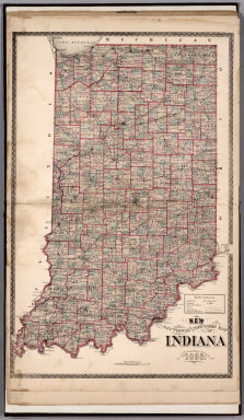
1874 New Sectional and Township Map of Indian … County Atlas New Sectional and Township Map of Indian … |

1907 Indiana. County Atlas Indiana. Rand McNally & Co.'s New 11 x 1 … |

1874 County map of Ohio and Indiana World Atlas County map of Ohio and Indiana. Drawn an … |

1877 County map of Ohio and Indiana World Atlas County map of Ohio and Indiana. Drawn an … |

1860 Ohio and Indiana. World Atlas Johnson's Ohio And Indiana, By Johnson & … |

1850 Indiana. World Atlas A New Map of Indiana. |

1857 A New Map of Indiana World Atlas A New Map of Indiana. With its Roads & D … |

1927 Illinois. Indiana National Atlas Illinois. (Copyrighted by) National Map … |

1868 County map of Ohio and Indiana World Atlas County map of Ohio and Indiana. Drawn an … |

1895 Gen. map XV. Military Atlas General topographical map. Sheet XV. Jul … |

1895 Gen. map XVI. Military Atlas General topographical map. Sheet XVI. Ju … |

1832 Indiana, Ohio. National Atlas Map of the states of Indiana and Ohio, w … |

1883 E. United States 4. World Atlas Eastern United States. No. 4. Letts's po … |

1883 E. United States 5. World Atlas Eastern United States. No. 5. Letts's po … |

1863 (Indiana, Ohio, Kentucky) School Atlas (Map of parts of Indiana, Ohio and Kentu … |

1903 15. Center of population. Statistical Atlas Sketch map showing the center of populat … |

1890 Indiana World Atlas Indiana. Copyright 1887 by Wm. M. Bradle … |

1823 Ohio, Indiana. National Atlas Ohio and Indiana. N. & S.S. Jocelyn Sc. … |

1870 Ohio, Indiana. [State Atlas, World Atlas] County map of Ohio and Indiana. Drawn an … |

1880 Ohio, Indiana. World Atlas County & township map of the states of O … |

1840 Indiana. World Atlas Indiana. |

1825 Ohio and Indiana. World Atlas Ohio and Indiana By H.S. Tanner. Engrave … |

1833 Ohio and Indiana. World Atlas Ohio and Indiana By H.S. Tanner. Engrave … |

1966 Karst. Sinking Stream. French Lick, Ind. … Physical Atlas Karst. Sinking Stream. French Lick, Ind. … |

1966 Landforms Due to Wind. Coastal Dunes-Blo … Physical Atlas Landforms Due to Wind. Coastal Dunes-Blo … |

1860 Indiana. World Atlas A New Map of the State of Indiana Exhibi … |

1940 Road map of Indiana National Atlas Rand McNally Road map, Indiana. Copyrigh … |

1822 Ohio, Indiana and Michigan School Atlas Ohio, Indiana and Michigan.Young & Delle … |

1851 Ohio, Indiana en Kentucky. National Atlas Atlas de Vereenigde Staten No. 5. Ohio, … |

1885 Indiana National Atlas Indiana. (to accompany) Bradstreet's Poc … |

1828 Ohio and Indiana National Atlas Ohio And Indiana. (to accompany) A New P … |

1939 Iowa City - Chicago. Chicago - Toledo. [Ephemera, Pamphlet] Iowa City - Chicago. Chicago - Toledo. |

1883 Indiana. World Atlas Indiana. |

1825 Ohio and Indiana. World Atlas Ohio And Indiana By H.S. Tanner. America … |

1838 Indiana and Ohio World Atlas Indiana & Ohio. G.W. Boynton & Co. Sc. ( … |

1843 Indiana National Atlas Indiana. (to accompany) Supplement To Th … |

1845 Indiana National Atlas Indiana. Entered ... 1843 by Sidney E. M … |

1873 Indiana. World Atlas Gray's Atlas Map of Indiana. |

1827 Ohio, Indiana & Illinois and Part of the … National Atlas Map of the States of Ohio, Indiana & Ill … |

1882 Indiana. National Atlas Gray's New Map of Indiana by Frank A. Gr … |

1878 Indiana. National Atlas Cram's Rail Road & Township Map of India … |

1877 Indiana. County Atlas New Sectional and Township Map of Indian … |

1891 Map of Indiana. 63 World Atlas Map of Indiana. Copyright 1891 by Matthe … |
1882 Sectional and Township Map of Indiana. 1 … County Atlas Sectional and Township Map of Indiana. 1 … |

1939 Rand McNally Road map: Indiana National Atlas Rand McNally Road map: Indiana. Copyrigh … |

1874 Indiana. County Atlas New Sectional and Township Map of Indian … |

1881 No. 32: Map Of The Ohio River Regional Atlas No. 32: Map Of The Ohio River, Reduced f … |

1881 No. 33-34: Map Of The Ohio River Regional Atlas No. 33-34: Map Of The Ohio River, Reduce … |