Who What Where WhenWHO
|
Author
[Andreas, A. T. (Alfred Theodore), 1839-1900, Baskin, Forster and Company]
Full Title
Map of Pulaski County. (Published by Baskin, Forster & Co. Lakeside Building Chicago, 1876. Engraved & Printed by Chas. Shober & Co. Props. of Chicago Lithographing Co.)
Publisher
Baskin, Forster & Co.
Author
Mitchell, Samuel Augustus Jr.
Full Title
County map of Ohio and Indiana. Drawn & Engraved by W.H. Gamble Philad. Entered ... 1863 by S. Augustus Mitchell, Jr. ... Pennsylvania.
Publisher
S.A. Mitchell Jr.
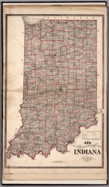
Author
Higgins, Belden & Co.
Full Title
New Sectional and Township Map of Indiana Published by Higgins Belden & Co. Lakeside Building, Chicago, 1874. D.L. Bourquin Eng. Chicago. Entered ... 1874 by Higgins Belden & Co. ... Washington D.C.
Publisher
Higgins, Belden & Co.
Author
Wangersheim, W.
Full Title
Indiana. Rand McNally & Co.'s New 11 x 14 Map of Indiana. ... Copyright 1907 by Rand, McNally & Co.
Publisher
Rushville Publishing Co.
Author
Mitchell, Samuel Augustus Jr.
Full Title
County map of Ohio and Indiana. Drawn and engraved by W.H. Gamble, Phila. . Entered ... 1874, by S. Augustus Mitchell ... Washington.
Publisher
S.A. Mitchell Jr.
Author
Mitchell, Samuel Augustus Jr.
Full Title
County map of Ohio and Indiana. Drawn and engraved by W.H. Gamble Philada. Entered ... 1877 by S. Augustus Mitchell, . ... Washington.
Publisher
S.A. Mitchell Jr.
Author
Johnson, A.J.
Full Title
Johnson's Ohio And Indiana, By Johnson & Browning. No. 36-37.
Publisher
Johnson and Browning
Author
Mitchell, Samuel Augustus
Full Title
A New Map of Indiana.
Publisher
Thomas, Cowperthwait & Co.
Author
Mitchell, Samuel Augustus
Full Title
A New Map of Indiana. With its Roads & Distances. Published by Charles Desilver, No. 251 Market Street, Philadelphia. Entered ... 1856 by Charles Desilver ... Pennsylvania.
Publisher
Charles DeSilver
Author
National Map Company
Full Title
Illinois. (Copyrighted by) National Map Company, Indianapolis. (Scale 1:1,800,000) (inset) Chicago. Indiana. (Copyrighted by) National Map Company, Indianapolis. (Scale 1:1,300,000) (insets) Lake Co. ; Marion Co. (to accompany) Official Paved Road and Commercial Survey of the United States.
Publisher
National Map Company
Author
Mitchell, Samuel Augustus Jr.
Full Title
County map of Ohio and Indiana. Drawn and Engraved by W.H. Gamble Phila. Entered ... 1867 by S. Augustus Mitchell, Jr. ... Pennsylvania.
Publisher
S.A. Mitchell Jr.
Author
[Julius Bien & Co., United States. War Department]
Full Title
General topographical map. Sheet XV. Julius Bien & Co., Lith., N.Y. (1891-1895)
Publisher
U.S. Government Printing Office
Author
[Julius Bien & Co., United States. War Department]
Full Title
General topographical map. Sheet XVI. Julius Bien & Co., Lith., N.Y. (1891-1895)
Publisher
U.S. Government Printing Office
Author
[Hinton, Isaac Taylor, 1799-1847, Simpkin & Marshall]
Full Title
Map of the states of Indiana and Ohio, with part of Michigan Territory. (with) Plan of Cincinnati. London, published June 1 by I.T. Hinton & Simpkin & Marshall. Engraved & printed by Fenner Sears & Co. (1832)
Publisher
[Simpkin & Marshall, Thomas Wardle]
Author
Letts, Son & Co.
Full Title
Eastern United States. No. 4. Letts's popular atlas. Letts, Son & Co. Limited, London. (1883)
Publisher
Letts, Son & Co.
Author
Letts, Son & Co.
Full Title
Eastern United States. No. 5. Letts's popular atlas. Letts, Son & Co. Limited, London. (1883)
Publisher
Letts, Son & Co.
Full Title
(Map of parts of Indiana, Ohio and Kentucky. Raleigh: Branson, Farrar & Co., Publishers. Biblical Recorder Print. 1863)
Publisher
Branson, Farrar & Co.
Author
Gannett, Henry, 1846-1914
Full Title
Sketch map showing the center of population June 1st 1900. Compiled by Henry Gannett, Geographer. (United States Census Office, 1903). Julius Bien & Co., N.Y.
Publisher
U.S. Census Office
Full Title
Indiana. Copyright 1887 by Wm. M. Bradley & Bro. (1890)
Publisher
John Y. Huber & Co.
Full Title
Ohio and Indiana. N. & S.S. Jocelyn Sc. (New-Haven: N. & S.S. Jocelyn. 1823)
Publisher
N. & S.S. Jocelyn
Author
Mitchell, Samuel Augustus
Full Title
County map of Ohio and Indiana. Drawn and engraved by W.H. Gamble, Phila. Entered ... 1870 by S. Augustus Mitchell, Jr. ... Pennsylvania.
Publisher
[R.A. Campbell, S.A. Mitchell, Jr.]
Author
Mitchell, Samuel Augustus
Full Title
County & township map of the states of Ohio and Indiana. Entered ... 1879 by S. Augustus Mitchell ... Washington. (1880)
Publisher
S.A. Mitchell
Author
Greenleaf, Jeremiah
Full Title
Indiana.
Publisher
G.R. French
Author
Tanner, Henry S.
Full Title
Ohio and Indiana By H.S. Tanner. Engraved & Published by H.S. Tanner, Philadelphia. Improved to 1825. Entered ... 24th day of May 1819, by Tanner, Vallance, Kearny & Co. ... Pennsylvania. American Atlas.
Publisher
Henry Tanner
Author
Tanner, Henry S.
Full Title
Ohio and Indiana By H.S. Tanner. Engraved & Published by Tanner, Vallance, Kearny & Co. No. 10 Library St. Philadelphia. Entered ... 24th day of May 1819, by Tanner, Vallance, Kearny & Co. ... Pennsylvania. American Atlas.
Publisher
Henry Tanner
Author
[Scovel, James L., O'Brien, Emmett J]
Full Title
Karst. Sinking Stream. French Lick, Ind. (on opposite page) Sinking Stream. Mitchell, Ind.
Publisher
John Wiley & Sons Inc.
Author
[Scovel, James L., O'Brien, Emmett J]
Full Title
Landforms Due to Wind. Coastal Dunes-Blowouts. Dune Acres, Ind. (with aerial view on opposite page).
Publisher
John Wiley & Sons Inc.
Author
Mitchell, Samuel Augustus
Full Title
A New Map of the State of Indiana Exhibiting Its Internal Improvements, Roads, Distances, &c. By J.H. Young. Philadelphia: Published By Charles Desilver, No. 714 Chesnut Street. Entered according to Act of Congress in the year 1860 by Charles Desilver in the Clerk's office if the District Court of the Eastern District of Pennsylvania. 31.
Publisher
Charles Desilver.
Author
[Rand McNally and Company, State Farm Insurance Companies Travel Bureau]
Full Title
Rand McNally Road map, Indiana. Copyright by Rand McNally & Company, Chicago, Ill. Lithographed in the U.S.A. (to accompany) State Farm Road Atlas: United States, Canada, Mexico,Central and South America. Copyright 1940 by Rand McNally & Company, Chicago, Ill.
Publisher
State Farm Insurance Companies Travel Bureau
Author
[Carey, Henry Charles, Lea, Isaac]
Full Title
Ohio, Indiana and Michigan.Young & Delleker, Sc. (to accompany) The Juvenile Atlas or a Series Of Maps, To Illustrate the Old and New Worlds ...1822.
Publisher
H.C. Carey & I. Lea
Author
Hillebrands, A.J.
Full Title
Atlas de Vereenigde Staten No. 5. Ohio, Indiana en Kentucky.
Publisher
[J. Oomkens, J. Zoon]
Author
Bradstreet Company
Full Title
Indiana. (to accompany) Bradstreet's Pocket Atlas Of The United States. Published Exclusively for Macullar, Parker & Company, Boston, Massachusetts ... New York: The Bradstreet Company, 1885. (on verso) Entered ... 1879, by The Bradstreet Company ... Washington.
Publisher
Bradstreet Co.
Author
Tanner, Henry S.
Full Title
Ohio And Indiana. (to accompany) A New Pocket Atlas of the United States With The Roads and Distances, Designed For the Use of Travelers. By H.S. Tanner. Philadelphia: Published by the Author. 1828. (on verso) ...on the seventeenth day of November ... 1828, Henry S. Tanner ... hath deposited ... a book ... Pennsylvania.
Publisher
H.S.Tanner
Author
[United Air Lines, White, Ruth Taylor]
Full Title
Iowa City - Chicago. Chicago - Toledo.
Publisher
United Air Lines
Author
Cram, George Franklin
Full Title
Indiana.
Publisher
A.C. Shewey and Co.
Author
Tanner, Henry S.
Full Title
Ohio And Indiana By H.S. Tanner. American Atlas. Engraved & Published by H.S. Tanner, Philadelphia. Improved To 1825. Entered ... 24th day of May 1819, by Tanner, Vallance, Kearny & Co. ... Pennsylvania.
Publisher
Henry Tanner
Author
Bradford, Thomas G.
Full Title
Indiana & Ohio. G.W. Boynton & Co. Sc. (to accompany) A Comprehensive Atlas, Geographical, Historical & Commercial. By T.G. Bradford. William D. Ticknor, Boston. Wiley & Long, New-York. Entered ... 1835, by Thos. G. Bradford ... Massachusetts.
Publisher
[William D. Ticknor, Wiley & Long]
Author
[Morse, Sidney E., Breese, S.]
Full Title
Indiana. (to accompany) Supplement To The New-York Observer. The Cerographic Atlas Of The United States. No.3. 1845. Entered ... 1843, by Sidney E. Morse and Samuel Breese ... New-York.
Publisher
Sidney E. Morse & Co.
Author
[Morse, Sidney E., Breese, Samuel]
Full Title
Indiana. Entered ... 1843 by Sidney E. Morse and Samuel Breese ... New York. (New York: Published by Harper & Brothers, 1845). (to accompany) Morse's Cerographic Maps. No. IV.
Publisher
Harper and Brothers
Author
Gray, O.W.
Full Title
Gray's Atlas Map of Indiana.
Publisher
Stedman, Brown & Lyon
Author
Finley, Anthony
Full Title
Map of the States of Ohio, Indiana & Illinois and Part of the Michigan Territory, Complied from the Latest Athorities.
Publisher
Anthony Finley
Author
[Gray, Frank A., Gray, O.W.]
Full Title
Gray's New Map of Indiana by Frank A. Gray. Copyright 1882 by O.W. Gray & Son.
Publisher
Stedman & Brown
Author
Cram, George Franklin
Full Title
Cram's Rail Road & Township Map of Indiana.
Publisher
George F. Cram
Author
Kingman Brothers.
Full Title
New Sectional and Township Map of Indiana, Published by Kingman Bros. 1877.
Publisher
Kingman Brothers.
Author
Appleton, D. & Co.
Full Title
Map of Indiana. Copyright 1891 by Matthews-Northrup Co. ... Buffalo, New York. (to accompany) The Library Atlas Of Modern Geography ... New York, D. Appleton And Company 1892. (on upper margin) Indiana. 63.
Publisher
D. Appleton & Co.
Author
Beers, J.H. & Co.
Full Title
Sectional and Township Map of Indiana. 1882.
Publisher
J.H. Beers
Author
[Rand McNally and Company, State Farm Insurance Companies Travel Bureau]
Full Title
Rand McNally Road map: Indiana. Copyright by Rand McNally & Company, Chicago, Ill. Lithorgaphed in the U.S.A. U.3604. (to accompany) State Farm road atlas : United States, Canada, Mexico.
Publisher
State Farm Insurance Companies Travel Bureau
Author
Higgins, Belden & Co.
Full Title
New Sectional and Township Map of Indiana. Published by Higgins Belden & Co. Lakeside Building, Chicago, 1874.
Publisher
Higgins, Belden & Co.
Author
[U.S. Army Corps of Engineers, Moser, C.]
Full Title
No. 32: Map Of The Ohio River, Reduced from the following surveys ... 1837-8, Lieut. Sanders ... 1844, C.A. Fuller ... 1867-8, W.M. Roberts ... Made under the direction of Major W.E. Merrill, Corps of Engineers, By C. Moser.
Publisher
Corps of Engineers
Author
[U.S. Army Corps of Engineers, Moser, C.]
Full Title
No. 33-34: Map Of The Ohio River, Reduced from the following surveys ... 1837-8, Lieut. Sanders ... 1844, C.A. Fuller ... 1867-8, W.M. Roberts ... Made under the direction of Major W.E. Merrill, Corps of Engineers, By C. Moser.
Publisher
Corps of Engineers
|