Browse All

1884 Ireland, Scotland. World Atlas Ireland in provinces and counties. Count … |

1790 A map of the Kingdom of Ireland (Norther … World Atlas A map of the Kingdom of Ireland, divided … |

1790 A map of the Kingdom of Ireland (Souther … World Atlas (A map of the Kingdom of Ireland, divide … |

1790 Composite: Ireland. World Atlas (Composite map) A map of the Kingdom of … |

1859 Ireland. World Atlas Ireland. Entered according to Act of Con … |

1930 Iles Britanniques. World Atlas Iles Britanniques. Carte 15. Dessine par … |

1930 Ecosse et Irlande. World Atlas Ecosse et Irlande. Carte 17. Imp. Dufren … |

1845 Ireland. World Atlas Ireland. Philadelphia: Published by Care … |

1812 British Isles. World Atlas British Isles. (with inset map) Shetland … |

1813 Ireland. World Atlas Ireland. Drawn under the direction of Mr … |

1824 Carte des Iles Britanniques. World Atlas Carte des Iles Britanniques, formees de … |

1824 Carte des Iles Britanniques. World Atlas Carte des Iles Britanniques, formees de … |

1826 Brittannicae Insule ex Aevi Romani Monum … Classical Atlas Brittannicae Insule ex Aevi Romani Monum … |

1886 Ireland, Scotland. World Atlas Ireland in provinces and counties. Count … |
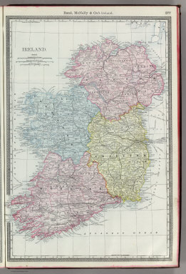
1889 Ireland. National Atlas Rand, McNally & Co.'s Ireland. |

1847 Great Britain and Ireland. . World Atlas Sharpe's Corresponding Maps. Great Brita … |

1847 Ireland. World Atlas Sharpe's Corresponding Maps. Ireland. Lo … |

1854 Ireland. World Atlas Ireland. Edinburgh. Published by A. & C. … |

1854 Ireland. World Atlas Ireland. Edinburgh. Published by A. & C. … |

1911 British Isles (Political). World Atlas The British Isles (Political). (with) Sh … |

1911 Ireland. World Atlas Ireland. (with) Dublin. Keith Johnston's … |

1851 Ireland. World Atlas Ireland. The Illustrations by J. Marchan … |

1824 Ireland. World Atlas Ireland. Young & Delleker Sc. Published … |

1886 Ireland and Scotland. World Atlas Johnson's Ireland. Published by Alvin J. … |

1818 Ireland. World Atlas Ireland as Represented in the Imperial P … |

1860 County Map Of Scotland. World Atlas County Map Of Scotland. 63. (with) inset … |

1878 British Isles. World Atlas British Isles. (inset) The Orkney and Sh … |

1967 58-59. Great Britain and Ireland. The Wo … World Atlas 58-59. Great Britain and Ireland. The Wo … |

1882 Isles Britanniques. World Atlas Isles Britanniques. Atlas St. Cyr. G. Hu … |

1750 Britannicae Insulae. World Atlas Britannicae Insulae in quibus Albion seu … |

1754 Isles Britanniques. World Atlas Les Isles Britanniques qui comprennent l … |

1750 Royaume d'Irlande. World Atlas Royaume d'Irlande divise en ses quatre P … |

1757 Iles Britaniques routes. World Atlas Carte des grandes routes d'Angleterre, d … |