Browse All

1890 Kentucky, Tennessee. World Atlas County map of Kentucky and Tennessee. Co … |

1877 Upper Ohio River and Valley part XXV, 43 … Regional Atlas Upper Ohio River and Valley part XXV, 43 … |

1823 Kentucky, Tennessee. National Atlas Kentucky and Tennessee. N. & S.S. Jocely … |

1870 Kentucky, Tennessee. [State Atlas, World Atlas] County map of Kentucky, and Tennessee. E … |

1880 Kentucky, Tennessee. World Atlas County map of Kentucky and Tennessee. Dr … |

1840 Kentucky And Tennessee. World Atlas Kentucky And Tennessee. |

1796 Kentuckey. National Atlas Kentuckey. W. Barker sculp. |

1811 Kentucky. World Atlas Kentucky, Reduced from Elihu Barker's La … |

1823 Kentucky, Tennessee. World Atlas Kentucky, Tennessee. By H.S. Tanner. Pub … |

1823 Kentucky, Tennessee and part of Illinois … World Atlas Kentucky, Tennessee and part of Illinois … |

1833 Kentucky and Tennessee. World Atlas Kentucky and Tennessee. By H.S. Tanner. … |

1795 Kentucky. World Atlas Kentucky, Reduced from Elihu Barker's La … |

1796 Kentucky. World Atlas Kentucky, Reduced from Elihu Barker's La … |

1966 Horizontal Strata. Big Clifty, KY. Physical Atlas Horizontal Strata. Big Clifty, KY. |

1966 Karst. Karst Topography. Mammoth Cave, K … Physical Atlas Karst. Karst Topography. Mammoth Cave, K … |

1966 Karst. Karst Topography. Coastal Plain. … Physical Atlas Karst. Karst Topography. Coastal Plain. … |

1862 Kentucky. World Atlas A New Map of the State of Kentucky from … |

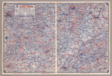
1940 Road map of Kentucky-Tennessee National Atlas Rand McNally Road map, Kentucky - Tennes … |

1822 Kentucky and Tennessee School Atlas Kentucky and Tennessee. Young & Delleker … |

1851 Ohio, Indiana en Kentucky. National Atlas Atlas de Vereenigde Staten No. 5. Ohio, … |

1885 Kentucky National Atlas Kentucky. (to accompany) Bradstreet's Po … |

1828 Kentucky and Tennessee National Atlas Kentucky and Tennessee. (engraved by) J. … |

1883 New Rail Road and County Map of Kentucky … World Atlas New Rail Road and County Map of Kentucky … |

1825 Kentucky And Tennessee. World Atlas Kentucky And Tennessee By H.S. Tanner. I … |

1838 Kentucky World Atlas Kentucky. (to accompany) A Comprehensive … |

1845 Kentucky and Tennessee National Atlas Kentucky and Tennessee. (to accompany) S … |

1845 Kentucky and Tennessee National Atlas Kentucky and Tennessee. Entered ... 1845 … |

1873 Kentucky and Tennessee. World Atlas Gray's Atlas Map of Kentucky and Tenness … |

1827 Kentucky and Tennessee. National Atlas Map of Kentucky and Tennessee, Construct … |

1876 Kentucky and Tennessee. National Atlas Gray's New Map of Kentucky and Tennessee … |

1878 Kentucky and Tennessee. National Atlas Cram's Rail Road & Township Map of Kentu … |

1895 Gauley Bridge. Military Atlas Military reconnaissance, vicinity of Gau … |

1895 Island No. 10, New Madrid. Military Atlas Map showing the system of rebel fortific … |

1891 Map of Kentucky and Tennessee. 66 World Atlas Map of Kentucky and Tennessee. Copyright … |
1939 Rand McNally Road map: Kentucky - Tennes … National Atlas Rand McNally Road map: Kentucky - Tennes … |

1881 No. 21: Map Of The Ohio River Regional Atlas No. 21: Map Of The Ohio River, Reduced f … |

1881 No. 22: Map Of The Ohio River Regional Atlas No. 22: Map Of The Ohio River, Reduced f … |

1881 No. 23: Map Of The Ohio River Regional Atlas No. 23: Map Of The Ohio River, Reduced f … |

1881 No. 24: Map Of The Ohio River Regional Atlas No. 24: Map Of The Ohio River, Reduced f … |

1881 No. 25: Map Of The Ohio River Regional Atlas No. 25: Map Of The Ohio River, Reduced f … |

1881 No. 26-27: Map Of The Ohio River Regional Atlas No. 26-27: Map Of The Ohio River, Reduce … |

1881 No. 28: Map Of The Ohio River Regional Atlas No. 28: Map Of The Ohio River, Reduced f … |

1881 No. 29-30: Map Of The Ohio River Regional Atlas No. 29-30: Map Of The Ohio River, Reduce … |

1881 No. 31: Map Of The Ohio River Regional Atlas No. 31: Map Of The Ohio River, Reduced f … |

1881 No. 32: Map Of The Ohio River Regional Atlas No. 32: Map Of The Ohio River, Reduced f … |

1881 No. 33-34: Map Of The Ohio River Regional Atlas No. 33-34: Map Of The Ohio River, Reduce … |

1881 No. 35-36: Map Of The Ohio River Regional Atlas No. 35-36: Map Of The Ohio River, Reduce … |

1881 No. 37: Map Of The Ohio River Regional Atlas No. 37: Map Of The Ohio River, Reduced f … |

1881 No. 38: Map Of The Ohio River Regional Atlas No. 38: Map Of The Ohio River, Reduced f … |

1881 No. 39: Map Of The Ohio River Regional Atlas No. 39: Map Of The Ohio River, Reduced f … |