Who What Where WhenREMOVEWHAT
|
Author
[Geological Survey (U.S.), Massachusetts. Topographical Survey Commission]
Full Title
Massachusetts. Martha's Vineyard sheet. Preliminary edition subject to corrections. U.S. Geological Survey, J.W. Powell, Director. State of Massachusetts ... commissioners. Henry Gannett, Chief Geographer. Marcus Baker, geographer in charge. Triangulation and coast line by the U.S. Coast and Geodetic Survey. Topography by E.B. Clark. Surveyed in 1887. Forbes Co., Boston & N.Y. (1890)
Publisher
Topographical Survey Commission
Author
[Geological Survey (U.S.), Massachusetts. Topographical Survey Commission]
Full Title
Massachusetts. Barnstable sheet. Preliminary edition subject to corrections. U.S. Geological Survey, J.W. Powell, Director. State of Massachusetts ... commissioners. Henry Gannett, Chief Geographer. Marcus Baker, geographer in charge. Triangulation, coast line and topography of north coast by the U.S. Coast and Geodetic Survey, the remainder by E.B. Clark, assistant topographer. Forbes Co., Boston & N.Y. (1890)
Publisher
Topographical Survey Commission
Author
[Geological Survey (U.S.), Massachusetts. Topographical Survey Commission]
Full Title
Massachusetts. Muskeget sheet. Preliminary edition subject to corrections. U.S. Geological Survey, J.W. Powell, Director. State of Massachusetts ... commissioners. Henry Gannett, Chief Geographer. Marcus Baker, geographer in charge. Triangulation and coast line by the U.S. Coast and Geodetic Survey. Topography by E.B. Clark. Surveyed in 1887. Forbes Co., Boston & N.Y. (1890)
Publisher
Topographical Survey Commission
Author
[Geological Survey (U.S.), Massachusetts. Topographical Survey Commission]
Full Title
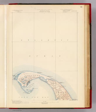
Massachusetts. Provincetown sheet. Preliminary edition subject to corrections. U.S. Geological Survey, J.W. Powell, Director. State of Massachusetts ... commissioners. Henry Gannett, Chief Geographer. Marcus Baker, geographer in charge. Triangulation by the U.S. Coast and Geodetic and Borden surveys. Coast line by the U.S. Coast Survey. Topography by the U.S. Geological Survey and U.S. Coast Survey. Surveyed in 1887. Forbes Co., Boston & N.Y. (1890)
Publisher
Topographical Survey Commission
Author
[Geological Survey (U.S.), Massachusetts. Topographical Survey Commission]
Full Title
Massachusetts. Wellfleet sheet. Preliminary edition subject to corrections. U.S. Geological Survey, J.W. Powell, Director. State of Massachusetts ... commissioners. Henry Gannett, Chief Geographer. Marcus Baker, geographer in charge. Triangulation by the U.S. Coast and Geodetic Survey. Topography by the U.S. Coast and Geodetic Survey and by E.B. Clark. Surveyed in 1887. Forbes Co., Boston & N.Y. (1890)
Publisher
Topographical Survey Commission
Author
[Geological Survey (U.S.), Massachusetts. Topographical Survey Commission]
Full Title
Massachusetts. Yarmouth sheet. Preliminary edition subject to corrections. U.S. Geological Survey, J.W. Powell, Director. State of Massachusetts ... commissioners. Henry Gannett, Chief Geographer. Marcus Baker, geographer in charge. Triangulation and coast line by the U.S. Coast and Geodetic Survey. Topography by E.B. Clark. Surveyed in 1886-7. Forbes Co., Boston & N.Y. (1890)
Publisher
Topographical Survey Commission
Author
[Geological Survey (U.S.), Massachusetts. Topographical Survey Commission]
Full Title
Massachusetts. Nantucket sheet. Preliminary edition subject to corrections. U.S. Geological Survey, J.W. Powell, Director. State of Massachusetts ... commissioners. Henry Gannett, Chief Geographer. Marcus Baker, geographer in charge. Triangulation and coast line by the U.S. Coast and Geodetic Survey. Topography by E.B. Clark, assistant topographer. Surveyed in 1887. Forbes Co., Boston & N.Y. (1890)
Publisher
Topographical Survey Commission
Author
[Geological Survey (U.S.), Massachusetts. Topographical Survey Commission]
Full Title
Massachusetts. Chatham sheet. Preliminary edition subject to corrections. U.S. Geological Survey, J.W. Powell, Director. State of Massachusetts ... commissioners. Henry Gannett, Chief Geographer. Marcus Baker, geographer in charge. Compiled chiefly from U.S. Coast and Geodetic Survey. Forbes Co., Boston & N.Y. (1890)
Publisher
Topographical Survey Commission
Author
[Bradford, Thomas G., Goodrich, S.G.]
Full Title
Massachusetts. Engraved by G.W. Boynton. Entered ... 1838 by T.G. Bradford ... Massachusetts.
Publisher
C.D. Strong
Author
[Bradford, Thomas G., Goodrich, S.G.]
Full Title
Boston. Engraved by G.W. Boynton.
Publisher
C.D. Strong
Author
Johnson, A.J.
Full Title
Johnson's Massachusetts, Connecticut, and Rhode Island. Published by A. J. Johnson, New York. 34. 35. Entered according to the Act of Congress, in the year 1864, by A.J. Johnson in the Clerk's Office of the District Court of the United States for the Southern District of New York.
Publisher
A.J. Johnson.
Author
Tanner, Henry S.
Full Title
Map of the States of Maine, New Hampshire, Vermont, Massachusetts, Connecticut, & Rhode Island. By H.S. Tanner. American Atlas. Engraved and Published by H.S. Tanner, Philadelphia. Entered according to Act of Congress, 14th Day of Novr. 1820, by H.S. Tanner, of the State of Pennsylvania.
Publisher
Henry Tanner
Author
[Bourquin, Frederick, Mitchell, Samuel Augustus, Tanner, Henry S.]
Full Title
Massachusetts and Rhode Island: Published By S. Augustus Mitchell, N.E. corner of Market & 7th Streets, Philada., 1846. Entered according to Act of Congress in the 1846, by H.N. Burroughs, - in the Clerk's Office of the District Court of the Eastern District of Pennsylvania. 8.
Publisher
S. Augustus Mitchell.
Author
Asher & Adams
Full Title
Asher & Adams' New Hampshire, Vermont, Massachusetts, Rhode Island, and Connecticut. Entered according to Act of Congress 1874 by Asher & Adams in the Office of the Librarian of Congress at Washington.
Publisher
Asher & Adams.
Author
Lucas, Fielding Jr.
Full Title
Massachusetts. 11. H.S. Tanner, sc. (1816)
Publisher
[Fielding Lucas, Philip H. Nicklin.]
Full Title
Carte geographique, statistique et historique de Massachusetts. Massachusetts. Fonderie et Imprimerie de J. Carez. (1825)
Publisher
J. Carez
Author
Fullarton, A. & Co.
Full Title
Northern Ports & Harbours in the United States. By J. Bartholomew, F.R.G.S. (with) six maps. LX. A. Fullarton & Co. London and Edinburgh.
Publisher
A. Fullarton & Co.
Full Title
Massachusetts and Rhode Island. (Published by George F. Cram, Chicago, Ill. 1909)
Publisher
E.A. Davis
Author
Bache, A. D.
Full Title
Wellfleet Harbor, Massachusetts. From a trigonometrical survey under the direction of A.D. Bache, Superintendent of the Survey of the Coast of the United States. Triangulation by Capt. T.J. Cram, Topl. Engs. & C.M. Eakin assts. Topography by H.L. Whiting and J.B. Gluck, assistants. Hydrography by the party under the command of Lieut. C.H. McBlair, U.S.N. assistant. Published in 1853. Drng. by W.M.C. Fairfax, asst. J.J. Ricketts and M.C. Gritzner. Eng. by S. Siebert, E.F. Woodward and S.E. Stull. Electrotype copy no. 1 by G. Mathiot, U.S.C.S. (with logo) U.S. Coast Survey Office.
Publisher
U.S.
Author
Bache, A. D.
Full Title
Nantucket Harbor. From a trigonometrical survey under the direction of A.D. Bache, Superintendent of the Survey of the Coast of the United States. Triangulation by A.D. Bache and C.M. Eakin assistant. Topography by H.L. Whiting assistant. Hydrography by the party under the command of C.H. Davis Lieutenant, U.S. Navy. Published in 1848. Reduction by J.M. Wampler, draughtsman. Views by J. Robertson. Engraving of topography by F. Dankworth & O.A. Lawson, assisted by J.H. Young. Views by A.O. Lawson. Lettering by J. Knight & W. Smith. Printed by H. Benner. Electrotype copy no. 1 by G. Mathiot, U.S.C.S. (with logo) U.S. Coast Survey Office.
Publisher
U.S.
Author
Bache, A. D.
Full Title
Preliminary sketch showing the positions of Davis' Shoal and other dangers recently discovered by the Coast Survey and the soundings on the Old South Shoal, Bass Rip, Old Man, Pochick Rip &c. By the hydrographic parties under the command of Lieut. C.H. Davis, U.S. Navy in 1846, '47 & '48, Lieut. C.H. McBlair, U.S.N. in 1849, '50, '51 & '52 and Lieut. H.S. Stellwagen, U.S.N. in 1853, assistants U.S.C.S. A.D. Bache Superintendent. 1853. (with logo) U.S. Coast Survey Office.
Publisher
U.S.
Author
Bache, A. D.
Full Title
The Harbor of Hyannis. From a trigonometrical survey under the direction of A.D. Bache, Superintendent of the Survey of the Coast of the United States. Triangulation by C.M. Eakin assistant. Topography by W.M. Boyce assistant. Hydrography by J.N. Maffitt, Lieut. U.S. Navy, under the direction of Chas. H. Davis, Lieutenant U.S. Navy. Published in 1850. Reduction by Wm. Luce draughtsman. Engraved by Sherman & Smith, N.Y. Sailing directions &c. by W. Smith U.S.C.S. Electrotype copy no. 1 by G. Mathiot, U.S.C.S. (with logo) U.S. Coast Survey Office.
Publisher
U.S.
Author
Bache, A. D.
Full Title
Edgartown Harbor. Founded upon a trigonometrical survey under the direction of A.D. Bache, Superintendent of the Survey of the Coast of the United States. Triangulation by C.M. Eakin assistant. Topography by H.L. Whiting assistant. Hydrography by the party under the command of Lieutenant C.H. Davis, U.S. Navy. Published in 1848. Reduction of topography by M.I. McClery assistant ... hydrography by Jno. Robertson. Views by O.A. Lawson. Printed by H. Benner. Electrotype copy no. 2 by G. Mathiot, U.S.C.S. (with logo) U.S. Coast Survey Office.
Publisher
U.S.
Author
Bache, A. D.
Full Title
The harbor of Holmes' Hole ... The harbor of Tarpaulin Cove. Founded upon a trigonometrical survey under the direction of A.D. Bache, Superintendent of the Survey of the Coast of the United States. Triangulation by C.M. Eakin assistant. Topography by H.L. Whiting assistant. Hydrography by the party under the command of G.S. Blake, Lieutenant, U.S. Navy. Published in 1847. Final reduction for engineering by M.I. McClery, draughtsman. Engraved by Sherman & Smith, N.Y. Printed by H. Benner. Electrotype copy no. 1 by G. Mathiot, U.S.C.S. (with logo) U.S. Coast Survey Depot.
Publisher
U.S.
Author
Bache, A. D.
Full Title
The harbor of New Bedford. Founded upon a trigonometrical survey under the direction of Alex. D. Bache, Superintendent of the Survey of the Coast of the United States. Triangulation by C.M. Eakin assistant. Topography by H.L. Whiting assistant. Hydrography under the direction of G.S. Blake, Lieut. Comg., U.S. Navy. Published in 1846. Republished in 1850. Drawn by H.L. Whiting assistant. Engraved by Sherman & Smith, New York. Printed by H. Benner. Electrotype copy no. 5 by G. Mathiot, U.S.C.S. (with logo) U.S. Coast Survey Depot.
Publisher
U.S.
Full Title
Massachusetts. (with) Map of the country in the vicinity of Boston. (Written and engraved by Jos. Perkins. 1845)
Publisher
Tanner's Geographical Establishment
Author
Rand McNally and Company
Full Title
Rand McNally junior auto road map Massachusetts, Connecticut, Rhode Island. Copyright by Rand McNally & Co., Chicago, Ill. (1927)
Publisher
Rand McNally
Author
Rand McNally and Company
Full Title
New York and vicinity. Buffalo and vicinity. Boston and vicinity. Copyright by Rand McNally & Co., Chicago, Ill. (1927)
Publisher
Rand McNally
Author
Greenleaf, Jeremiah
Full Title
Massachusetts, Rhode Island, And Connecticut.
Publisher
J. Greenleaf.
Author
Lucas, Fielding Jr.
Full Title
Massachusetts. Drawn & Published by F. Lucas Jr., Baltimore. (1822)
Publisher
Fielding Lucas
Author
Marshall, John
Full Title
Carte des Provinces Septles. des Etats-Unis. (1807)
Publisher
Dentu, Imprimeur-Libraire.
Author
Marshall, John
Full Title
Boston et Ses Environs. (1807)
Publisher
Dentu, Imprimeur-Libraire.
Author
Marshall, John
Full Title
Boston and Its Environs. Engraved for Washington's Life. Plate I. Engd. by F. Vallance. Philada. Published by C.P. Wayne. 1806.
Publisher
C.P. Wayne
Author
Melish, John
Full Title
Sketch of the Action on the Heights of Charlestown (Boston), June 17th 1775, between His Majesty's Troops, under the command of Genl. Howe, and a large body of American Rebels. Copied by I.A. Chapman, from an original Sketch, taken by Henry De Berniere of the 14th Regiment of Infantry, now in the hands of J. Cist Esq. Engraved by Kneass, Young & Co. for the Analeche Magazine. Published by M. Thomas Philada. (1824)
Publisher
M. Thomas.
Author
Colton, G.W.
Full Title
Massachusetts and Rhode Island. No. 12. Published by J.H. Colton & Co., No 172 William St., New York. Entered according to the Act of Congress in the year 1855 by J.H. Colton & Co. in the Clerk's Office of the District Court of the United States for the Southern District of New York.
Publisher
J.H. Colton
Author
Colton, G.W.
Full Title
Map of Boston and Adjacent Cities. No. 13. Published by J.H. Colton & Co., No 172 William St., New York. Entered according to the Act of Congress in the year 1855 by J.H. Colton & Co. in the Clerk's Office of the District Court of the United States for the Southern District of New York.
Publisher
J.H. Colton
Author
[Mitchell, Samuel Augustus, Tanner, Henry S.]
Full Title
Massachusetts and Rhode Island: by H.S. Tanner. (with) Boston. Published by S. Augustus Mitchell, N.E. corner of Market & 7th sts., Philada., 1846. Entered ... 1841 by H.S. Tanner ... Pennsylvania.
Publisher
S.A. Mitchell
Author
Burr, David H., 1803-1875
Full Title
Massachusetts. Rhode Island. And Connecticut. Entered ... Febr. 17th in the year 1835 by Thomas Illman ... New York.
Publisher
D.S. Stone
Author
Bradford, Thomas G.
Full Title
Massachusetts. Entered ... 1838, by T.G. Bradford ... Massachusetts. Engraved by G.W. Boynton.
Publisher
[Weeks, Jordan & Co., Wiley and Putnam.]
Author
Bradford, Thomas G.
Full Title
Boston. Engraved by G.W. Boynton.
Publisher
[Weeks, Jordan & Co., Wiley and Putnam.]
Author
Finley, Anthony
Full Title
Map of Massachusetts Connecticut And Rhode Island Constructed from the Latest Authorities. 1825. Drawn by D.H. Vance. Engraved by J.H. Young. Published by A. Finley Philada. 1825.
Publisher
Anthony Finley
Author
[Gray, Ormando Willis, Lloyd, H.H., Walling, H. F.]
Full Title
Atlas of the United States. New England and New York. (Published by Stedman, Brown & Lyon, Cincinnati. 1872. Entered ... 1872, by H.F. Walling, and O.W. Gray, and H.H. Lloyd & Co. ... Washington)
Publisher
Stedman, Brown & Lyon
Author
W. & A.K. Johnston Limited
Full Title
Vermont, New Hampshire, Massachusetts, Rhode Island, & Connecticut.
Publisher
W. & A.K. Johnston Limited
Author
Mitchell, Samuel Augustus
Full Title
Massachusetts & Rhode Island: Published By S. Augustus Mitchell. N.E. corner of Market & 7th. Streets. Philadelphia. (inset map) Boston.
Publisher
S.A. Mitchell
Author
Mitchell, Samuel Augustus Jr.
Full Title
County map of Massachusetts, Connecticut, and Rhode Island. Drawn & Engraved by W.H. Gamble Philad. Entered ... 1862 by S. Augustus Mitchell, Jr. ... Pennsylvania.
Publisher
S.A. Mitchell Jr.
Author
[Walker, G.H., Walker, O.W.]
Full Title
Massachusetts. Atlas Plate No. 1.
Publisher
Geo.H. Walker & Co.
Author
[Walker, G.H., Walker, O.W.]
Full Title
Massachusetts. Atlas Plate No. 2.
Publisher
Geo.H. Walker & Co.
Author
[Walker, G.H., Walker, O.W.]
Full Title
Massachusetts. Atlas Plate No. 3.
Publisher
Geo.H. Walker & Co.
Author
[Walker, G.H., Walker, O.W.]
Full Title
Massachusetts. Atlas Plate No. 5.
Publisher
Geo.H. Walker & Co.
|