Browse All

1948 Shell Highway Map of Oklahoma. National Atlas Shell Map of Oklahoma (cover title). She … |

1948 Various Regions and Cities in Oklahoma. National Atlas Enid. Muskogee. Oklahoma City. Ardmore. … |

1827 Partie des Etats-Unis. Amer. Sep. 55. World Atlas Partie des Etats-Unis. Amer. Sep. no. 55 … |

1889 Indian Territory (Oklahoma) World Atlas Railroad and County Map of Indian Territ … |

1889 Oklahoma Country in the Indian Territory … World Atlas Map of the Oklahoma Country in the India … |

1886 Indian Territory. World Atlas Colton's Indian Territory. Published By … |

1874 Indian Territory World Atlas Colton's Indian Territory. Published By … |

1874 Arkansas, Indian Terr. National Atlas Asher & Adams' Arkansas and portion of I … |

1874 Indian Terr., Texas NW portion. National Atlas Asher & Adams' Indian Territory and Texa … |

1901 Oklahoma and Indian Territory. World Atlas Oklahoma and Indian Terr. |

1953 Oklahoma. World Atlas Oklahoma. U.S. State. |
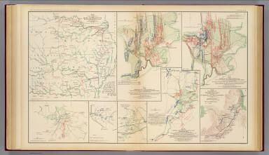
1895 Army of Missouri campaigns. Military Atlas Map of the fall campaigns of the Army of … |

1909 Oklahoma. State Atlas Oklahoma from the latest state and feder … |

1855 Texas. World Atlas Texas. (with) Plan der Galveston Bay. Dr … |

1875 Indian. Ty. National Atlas Cram's Rail Road & Township Map of India … |

1927 Oklahoma. National Atlas Rand McNally junior auto road map Oklaho … |

1817 Arkansa Ter. World Atlas Arkansa Ter. Drawn and Published by F. L … |

1906 Oklahoma, Texas. World Atlas Oklahoma, Texas (North). Texas (South). |

1927 Oklahoma National Atlas Oklahoma. (Copyrighted by) National Map … |

1895 Kansas, Texas, Indian Territory. Military Atlas Engineer Bureau, War Department. Section … |

1895 Gen. map XXIV. Military Atlas General topographical map. Sheet XXIV. J … |

1895 Gen. map XXV. Military Atlas General topographical map. Sheet XXV. Ju … |

1847 Texas. School Atlas Map of the state of Texas. Engraved to i … |

1929 143-44. N.M., Okla., Tex. World Atlas Stati Uniti, United States of America, N … |

1890 Texas. World Atlas County map of the state of Texas. Showin … |

1890 Indian Territory. World Atlas Indian Territory. Copyright 1887 by Wm. … |

1880 Texas. World Atlas County map of the state of Texas. Showin … |

1880 Indian Terr. World Atlas Indian Territory. Entered ... 1879 by S. … |

1899 Plate CXLII. Map of Indian Territory, Sh … [Geologic Atlas, Geology Book] Plate CXLII. Map of Indian Territory, Sh … |

1859 A New Map of Kansas. World Atlas A New Map of Kansas by W.H. Holmes. Publ … |

1859 Nebraska, Kansas, New Mexico, and Indian … World Atlas A New Map of Nebraska, Kansas, New Mexic … |

1940 Road map of Oklahoma National Atlas Rand McNally Road map, Oklahoma. Copyrig … |

1935 Oklahoma. National Atlas Oklahoma. |

1883 Indian Territory (Oklahoma). World Atlas Indian Ty. |

1873 Indian Territory. World Atlas Gray's Atlas Map of Indian Territory. |

1827 Missouri and the Territory of Arkansas. National Atlas Map of the State of Missouri and the Ter … |

1876 Texas and the Indian Territory. National Atlas Gray's Map of Texas and the Indian Terri … |

1878 Indian Territory (Oklahoma). National Atlas Cram's Rail Road & Township Map of India … |

1891 Map of Texas, Oklahoma and Indian Territ … World Atlas Map of Texas, Oklahoma and Indian Territ … |

1939 Rand McNally Road map: Oklahoma National Atlas Rand McNally Road map: Oklahoma. Copyrig … |

1846 Map Of Texas. World Atlas Map Of Texas From the most recent author … |

1869 Indian Territories. World Atlas Colton's Indian Territory. Drawn from ma … |

1852 Arkansas, Oklahoma, Texas. National Atlas (Arkansas, Oklahoma, Texas). |

1948 Nebraska. Oklahoma. World Atlas Nebraska. 1366. Oklahoma. 5357. |

1874 Indian Territory (Oklahoma). Nebraska. World Atlas Gray's Atlas Map of Indian Territory (Ok … |

1924 Oklahoma. National Atlas Commercial Atlas of America. Rand McNall … |

1924 Oklahoma. National Atlas Commercial Atlas of America. Rand McNall … |

1924 AutoTrails Map, Texas, Oklahoma, Louisia … National Atlas Commercial Atlas of America. Rand McNall … |

1854 Texas. National Atlas Texas. H. Lange's Atlas v. Nord Amerika … |

1884 Texas. World Atlas County map of the state of Texas. Showin … |