Who What Where WhenREMOVE |
REFINE
Browse All : Atlas Map of Oregon and California
1-41 of 41
Author
Duflot de Mofras, Eugene
Full Title
Carte De La Cote De L'Amerique Sur L'Ocean Pacifique Septentrional Le Territoire De L'Oregon, Les Californies, La Mer Vermeille, Partie des Territoires de la Compagnie de la Baie d'Hudson, Et De L'Amerique Russe. Dressee par Mr. Duflot de Mofras, Attache a la Legation de France a Mexico; Pour servir a l'intelligence de son Voyage d'exploration Publie Par Ordre Du Roi, sous les Auspices De Mr. Le Marechal Duc De Dalmatie, Mr. Le Ministre Des Affaires Etrangeres. Paris, 1844. Le plan grave par Jacobs. L'ecriture gravee par Hacq. Publie par Arthus Bertrand.
Publisher
Arthus Bertrand
Author
Schonberg & Co.
Full Title
Schonberg's Map of California, Oregon & Nevada with Part of Idaho, Utah & Arizona. Entered ... 1866 .. New York.
Publisher
Schonberg & Co.
Author
Vancouver, George, 1757-1798
Full Title
Cote nord-ouest de l'Amerique. Reconnue par le Cape. Vancouver. 2e. partie, depuis 38015' de latitude septle. et 237027' de longitude jusqu'a 45046' de late. et 236015' de longe. (with) Baie de la Trinidad. Voyage de Vancouver. No. 5. (Paris: Depot-general de la Marine, 1828)
Publisher
Depot de la Marine
Author
Mitchell, Samuel Augustus
Full Title
A new map of the State of California, the Territories of Oregon & Utah, and the Chief part of New Mexico. Entered ... 1853, by Thomas, Cowperthwait & Co. ... Pennsylvania.
Publisher
Thomas, Cowperthwait & Co.
Author
Mitchell, Samuel Augustus
Full Title
A new map of the state of California, the territories of Oregon, Washington, Utah and New Mexico. Published by Thomas, Cowperthwait & Co., no. 253 Market Street, Philadelphia. Entered ... 1853 by Thomas, Cowperthwait & Co. ... Pennsylvania.
Publisher
Cowperthwait, Desilver & Butler
Author
[Bourquin, Frederick, Mitchell, Samuel Augustus, Tanner, Henry S.]
Full Title
Oregon, Upper California & New Mexico. Published by S. Augustus Mitchell, N.E. Corner of Market & 7th. Streets Philadelphia. 1849. Entered according to Act of Congress in the 1845 by H.N. Burroughs - in the Clerk's Office of the Eastern District of Penna. 36.
Publisher
S. Augustus Mitchell.
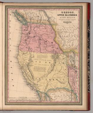
Author
Mitchell, Samuel Augustus
Full Title
A New Map of the States of California, the Territories of Oregon, Washington, Utah & New Mexico. Published By Charles Desilver, No. 714 Chestnut Street, Philadelphia. Entered according to Act of Congress in the year 1856 by Charles Desilver in the Clerk's office if the District Court of the Eastern District of Pennsylvania. 37.
Publisher
Charles Desilver.
Author
Mitchell, Samuel Augustus
Full Title
Oregon and Upper California. Published by S. Augustus Mitchell, N.E. corner of Market & Seventh Streets. Philadelphia. 1847. Entered according to Act of Congress in the year 1845 by H.N. Burroughs in the ... District Court of the eastern district of Pennsylvania.
Publisher
S.A. Mitchell
Author
Mitchell, Samuel Augustus
Full Title
Oregon, Upper California & New Mexico. Published by S. Augustus Mitchell, N.E. corner of Market & 7th Sts. Philadelphia. 1849. Entered according to Act of Congress in the year 1845 by H.N. Burroughs in the ... District Court of the eastern district of Penna.
Publisher
S.A. Mitchell
Full Title
A new map of the state of California, the territories of Oregon & Utah, and the chief part of New Mexico. Entered according to Act of Congress in the year 1850 by Thomas, Cowperthwait & Co. in the ... District Court of the eastern district of Pennsylvania. (1852)
Publisher
Thomas, Cowperthwait & Co.
Full Title
A new map of the state of California, the territories of Oregon, Washington, Utah and New Mexico. Published by Thomas, Cowperthwait & Co., no. 253 Market Street, Philadelphia. Entered according to Act of Congress in the year 1853 by Thomas, Cowperthwait & Co. in the ... District Court of the eastern district of Pennsylvania. (1854)
Publisher
Cowperthwait, Desilver, Butler
Author
W. & A.K. Johnston Limited
Full Title
California (North), Nevada, Oregon (South). California (South), Nevada (South), Arizona (West).
Publisher
W. & A.K. Johnston Limited
Full Title
A new map of the state of California, the territories of Oregon, Washington, Utah and New Mexico. Published by Charles Desilver, no. 251 Market Street, Philadelphia. Entered according to Act of Congress in the year 1856 by Charles Desilver in the ... District Court of the eastern district of Pennsylvania. (1857)
Publisher
Charles Desilver
Full Title
Map of the state of California, the territories of Oregon & Utah, and the chief part of New Mexico. Entered according to Act of Congress in the year 1851 by Thomas, Cowperthwait & Co. in the ... District Court of the eastern district of Pennsylvania.
Publisher
Thomas, Cowperthwait & Co.
Author
Mitchell, Samuel Augustus
Full Title
Oregon, Upper California & New Mexico. Published By S. Augustus Mitchell. N.E. corner of Market & 7th. Sts. Philadelphia. 1849. Entered ... 1845 by H.N. Burroughs ... Penna.
Publisher
S.A. Mitchell
Author
Mitchell, Samuel Augustus
Full Title
Map of the State of California, the Territories of Oregon & Utah, and the Chief Part of New Mexico.
Publisher
Thomas, Cowperthwait & Co.
Author
Mitchell, Samuel Augustus
Full Title
Oregon, Upper California & New Mexico. Published by S. Augustus Mitchell, N.E. corner of Market & 7th Sts. Philadelphia. Entered according to Act of Congress in the year 1845 by H.N. Burroughs in the ... District Court of the eastern district of Penna. (1850)
Publisher
Thomas, Cowperthwait & Co.
Author
Mitchell, Samuel Augustus
Full Title
A new map of the state of California, the territories of Oregon, Washington, Utah and New Mexico. Published by Charles Desilver, no. 251 Market Street, Philadelphia. Entered according to Act of Congress in the year 1856 by Charles Desilver in the ... District Court of the eastern district of Pennsylvania. (1857).
Publisher
Charles DeSilver
Author
[United States. Army. Corps of Engineers, Williamson, R.S.]
Full Title
Topographical map of California, Nevada, Oregon and part of Idaho. Prepared from field surveys and other reliable data. Under the direction of Bvt. Lt. Col. R.S. Williamson, Corps of Engineers, U.S.A. Drawn by W.B. Hyde. 1867.. Julius Bien & Co., Lith., N.Y. (1891-1895)
Publisher
U.S. Government Printing Office
Author
Cornell, S. S. (Sarah S.)
Full Title
Texas. (with) California. Drawn by E. Wells, N.Y. Entered ... 1856, by S.S. Cornell ... Southern District of New York. New York: D. Appleton & Co., 443 & 445 Broadway. (1864)
Publisher
Appleton & Co.
Author
California. State Earthquake Investigation Commission
Full Title
Geomorphic map of California and Nevada with portions of Oregon and Idaho showing the diastrophic character of the relief, the steep descent from the sub-continental shelf to the floor of the Pacific, and the more important known faults. Earthquake Investigation Commission. Drawn by M. Solem. A. Hoen & Co., Baltimore. (Carnegie Institution of Washington, 1908)
Publisher
Carnegie Institution
Author
California. State Earthquake Investigation Commission
Full Title
Map of California and Nevada showing the distribution of apparent intensity in the region affected by the earthquake of April 18, 1906. Drawn by M. Solem. Earthquake Investigation Commission. A. Hoen & Co., Baltimore. (Carnegie Institution of Washington. 1908)
Publisher
Carnegie Institution
Author
Wheeler, G.M.
Full Title
Parts Of N.E. California, N.W. Nevada And Southern Oregon. Atlas Sheet No. 38 B. Issued June 30th, 1882. Weyss, Rock and Karl, Del. Expeditions of 1877 & 1878 Under the Command of 1st Lieut. Geo. M. Wheeler, Corps of Engineers, U.S. Army. U.S. Geographical Surveys West Of The 100th Meridian.
Publisher
U.S.
Author
Mitchell, Samuel Augustus
Full Title
Map of Oregon and Upper California. Engraved to illustrate Mitchell's school and family geography. (with) Map of the Columbia River from the Cascades to the Pacific Ocean. Entered ... 1846 by S.A. Mitchell ... Eastern District of Pennsylvania.
Publisher
Thomas, Cowperthwait & Co.
Author
[Galpin, S. A., United States. Census Office]
Full Title
Maps of the Pacific Coast exhibiting various subjects. Compiled from the statistics of the eight and ninth census of the United States by S.A. Galpin. (Julius Bien, Lith., 1874)
Publisher
U.S.
Full Title
A new map of the state of California, the territories of Oregon, Washington, Utah and New Mexico. Published by Thomas, Cowperthwait & Co., no. 253 Market Street, Philadelphia. Entered according to Act of Congress in the year 1853 by Thomas, Cowperthwait & Co. in the ... District Court of the eastern district of Pennsylvania. (1854)
Publisher
Thomas, Cowperthwait & Co.
Author
Mitchell, Samuel Augustus
Full Title
Oregon and Upper California. Published by S. Augustus Mitchell, N.E. corner of Market & Seventh Streets. Philadelphia. 1846. Entered according to Act of Congress in the year 1845 by H.N. Burroughs in the ... District Court of the eastern district of Pennsylvania. (1847)
Publisher
S.A. Mitchell
Full Title
A new map of the state of California, the territories of Oregon, Washington, Utah and New Mexico. Published by Charles Desilver, no. 251 Market Street, Philadelphia. Entered according to Act of Congress in the year 1856 by Charles Desilver in the ... District Court of the eastern district of Pennsylvania. (1857)
Publisher
Charles Desilver
Full Title
A new map of the state of California, the territories of Oregon, Washington, Utah and New Mexico. Published by Charles Desilver, no. 253 Market Street, Philadelphia. Entered according to Act of Congress in the year 1850 by Thomas, Cowperthwait & Co. in the ... District Court of the eastern district of Pennsylvania. (1855)
Publisher
Cowperthwait, Desilver, Butler
Full Title
A new map of the state of California, the territories of Oregon, Washington, Utah and New Mexico. Published by Charles Desilver, no. 253 Market Street, Philadelphia. Entered according to Act of Congress in the year 1850 by Thomas, Cowperthwait & Co. in the ... District Court of the eastern district of Pennsylvania. (1856)
Publisher
Charles Desilver
Author
Mitchell, Samuel Augustus
Full Title
A New Map of the States of California, the Territories of Oregon, Washington, Utah & New Mexico. Published By Charles Desilver, No. 714 Chesnut Street, Philadelphia. Entered according to Act of Congress in the year 1859 by Charles Desilver in the Clerk's office if the District Court of the Eastern District of Pennsylvania. 37.
Publisher
Charles Desilver.
Author
Mitchell, Samuel Augustus
Full Title
Oregon and Upper California. Published by S. Augustus Mitchell, N.E. corner of Market & Seventh Streets. Philadelphia. 1848. Entered according to Act of Congress in the year 1845 by H.N. Burroughs in the ... District Court of the eastern district of Pennsylvania.
Publisher
S.A. Mitchell
Full Title
Map of the state of California, the territories of Oregon & Utah, and the chief part of New Mexico. Entered according to Act of Congress in the year 1845 by H.N. Burroughs in the ... District Court of the eastern district of Pennsylvania. (1850)
Publisher
Thomas, Cowperthwait & Co.
Full Title
A new map of the state of California, the territories of Oregon, Washington, Utah and New Mexico. Published by Charles Desilver, no. 251 Market Street, Philadelphia. Entered according to Act of Congress in the year 1856 by Charles Desilver in the ... District Court of the eastern district of Pennsylvania. (1858)
Publisher
Charles Desilver
Full Title
A new map of the state of California, the territories of Oregon, Washington, Utah and New Mexico. Published by Charles Desilver, no. 251 Market Street, Philadelphia. Entered according to Act of Congress in the year 1856 by Charles Desilver in the ... District Court of the eastern district of Pennsylvania. (1858)
Publisher
Cushings & Bailey
Author
[Gray, Frank A., Gray, O.W.]
Full Title
Gray's Atlas New Rail Road and County Map of the States of Oregon, California, and Nevada Compiled and Drawn by Frank A. Gray. Published by O.W. Gray, Phladelphia. (inset) Enlarged Plan of the Vicinity of San Francisco and Sacramento.
Publisher
Stedman, Brown & Lyon
Author
La Perouse, Jean-Francois de Galaup, comte de, 1741-1788
Full Title
Carte particuliere de la cote du nord-ouest de l'Amerique reconnue par les Fregates Francaises la Boussole et l'Astrolabe en 1786. 3e. feuille. Bouclet sculp. Herault scrip. Atlas du Voyage de la Perouse no. 31. (Paris: L'Imprimerie de la Republique, An V, 1797)
Publisher
L'Imprimerie de la Republique
Author
Marbut, Curtis F.
Full Title
Soil Map of the United States by Curtis F. Marbut and Associates in the Soil Survery, U.S. Department of Agriculture, F.J. Marschner, Cartographer and Associate in Compilation. 1931. Soils, Plate 5, Section 4. Lith. A. Hoen & Co., Inc. Atlas of American Agriculture.
Publisher
U.S. Department of Agriculture
Author
Gray, Ormando Willis
Full Title
Gray's Atlas New Railroad and County Map of the States of Oregon, California, and Nevada Compiled and Drawn by Frank A. Gray. Published by O.W. Gray, Philadelphia. (inset) Enlarged Plan of the Vicinity of San Francisco and Sacramento.
Publisher
Stedman, Brown & Lyon
Author
Rand McNally and Company
Full Title
Commercial Atlas of America. Rand McNally Auto Trails Map, District No. 14. Washington, Oregon, Nor. California, Western Idaho.
Publisher
Rand McNally and Company
1-41 of 41
|