Browse All

1875 Ungarn, Siebenburgen, Slavonien, Kroatie … World Atlas Lander der Ungarischen Krone: Ungarn, Si … |

1800 Turkey in Europe. World Atlas Turkey in Europe. |

1823 Pannonia, Dacia, Illyricum et Moesia. World Atlas Pannonia, Dacia, Illyricum et Moesia. |

1811 Hungary and Transylvania. World Atlas Hungary and Transylvania. London. Publis … |

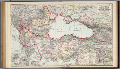
1883 Turkey in Europe, Greece, Roumania, Serv … World Atlas Turkey in Europe, Greece, Roumania, Serv … |
1879 Black Sea. Turkey, Greece, Russia. National Atlas Gray's New Map of the Countries Surround … |

1747 Hungary, Transilvania. Geography Book A new and accurate map of the Kingdom of … |

1891 Turkey in Europe : Turkey & Greece 27 World Atlas Turkey in Europe : Ramania, Servia, Mont … |

1925 Austria, Hungary, and Czecho-Slovakia. [State Atlas, World Atlas] Austria, Hungary, and Czecho-Slovakia. |

1925 Yugoslavia and the Balkan States. [State Atlas, World Atlas] Jugo-Slavia (Yugoslavia) and the Balkan … |

1780 Hongrie, Transilvanie, Esclavonie, Croat … World Atlas Le Royaume de Hongrie, divisee en Haute … |

1913 Roumanie. Coal Resources of the World. Geologic Atlas Coal Resources of the World. Roumania. M … |

1830 Ancient Macedonia, Thracia, Illyria, Moe … World Atlas Ancient Macedonia, Thracia, Illyria, Moe … |

1830 Turkey I, northern. World Atlas Turkey I. Containing the northern provin … |

1846 Austrian Empire. World Atlas Austrian Empire. (with) Environs of Vien … |

1875 Dacie, Pannonie, Illyrie, Moesie Ancienn … World Atlas Carte de la Dacie Ancienne de la Pannoni … |

1967 Yugoslavia and Danube Countries. Pergamo … World Atlas Yugoslavia and Danube Countries. (inset) … |

1963 Romania. Pergamon World Atlas. World Atlas Romania. (inset) Iron Gate. (inset) Buch … |

1963 Romania. Bulgaria. Pergamon World Atlas. World Atlas Romania. Bulgaria. Pergamon World Atlas. … |

1967 U.S.S.R. - Moldvian, Ukrainian S.S.R. Pe … World Atlas U.S.S.R. - Moldvian, Ukrainian S.S.R. (i … |

1897 Turkey In Europe. World Atlas Rand, McNally & Co.'s indexed atlas of t … |

1836 Austrian Empire. World Atlas Austrian Empire. (with) Environs of Vien … |

1736 Hungary and Transilvania. World Atlas Hungary and Transilvania. Agreeable to m … |

1937 Europe Orientale, Feuille Sud. World Atlas Europe Orientale, Feuille Sud. Carte 37. … |

1818 Turkey, in Europe and Hungary. World Atlas Turkey, in Europe and Hungary; from the … |

1878 Vicinity of the Black Sea. World Atlas Gray's New Map of the Countries Surround … |

1967 90-91. Danube Countries. The World Atlas … World Atlas 90-91. Danube Countries. The World Atlas … |

1967 93-94. Rumania. The World Atlas. World Atlas 93-94. Rumania. The World Atlas. |

1882 Hongrie et Turquie. World Atlas Hongrie et Turquie. Atlas St. Cyr. Furne … |