Browse All

1905 Ubersichtskarte von Groszbritannien und … World Atlas Ubersichtskarte von Groszbritannien und … |

1905 Schotiland World Atlas Schotiland. Juni. 1905. Bearbeitet von. … |

1859 Scotland. World Atlas Scotland. Entered according to Act of Co … |

1854 Geological, palaeontological map British … Physical Atlas Geological & palaeontological map of the … |

1854 Composite: Geological, palaeontological … Physical Atlas (Composite of) Geological & palaeontolog … |

1856 Ethnographic, Gt. Brit., Ireland. Physical Atlas Ethnographic map of Great Britain and Ir … |

1855 Britischen Inseln. World Atlas Die Britischen Inseln, oder die Vereinig … |

1853 Scotland. World Atlas Scotland, entworfen und gezeichnet von C … |
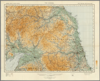
1921 Sheet 1. The Border. National Atlas Sheet 1. The Border. |

1901 Index Map: Index to the Ordnance Survey … National Atlas (Index Map) Index to the Ordnance Survey … |

1901 Sheet 1. National Atlas Sheet 1. |

1901 Sheet 2. National Atlas Sheet 2. |

1901 Sheet 3. National Atlas Sheet 3. |

1901 Sheet 4. National Atlas Sheet 4. |

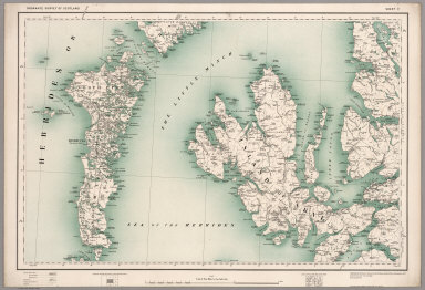
1901 Sheet 5. National Atlas Sheet 5. |

1901 Sheet 6. National Atlas Sheet 6. |
1902 Sheet 7. National Atlas Sheet 7. |

1902 Sheet 8. National Atlas Sheet 8. |

1902 Sheet 9. National Atlas Sheet 9. |

1902 Sheet 10. National Atlas Sheet 10. |

1902 Sheet 11. National Atlas Sheet 11. |

1902 Sheet 12. National Atlas Sheet 12. |

1902 Sheet 13. National Atlas Sheet 13. |

1902 Sheet 14. National Atlas Sheet 14. |

1902 Sheet 15 and Part of England Sheet 2. National Atlas Sheet 15 and Part of England Sheet 2. |

1902 Sheet 16. National Atlas Sheet 16 |

1901 Sheet 17. National Atlas Sheet 17. |

1778 N. Britain, Scotland. World Atlas North Britain or Scotland, divided into … |

1865 Die Britischen Inseln und das Umliegende … World Atlas Stieler's Hand-Atlas ... No. 15a. Die Br … |

1866 Grossbritannien. (Great Britain, Scotlan … World Atlas Stieler's Hand-Atlas ... No. 15c. Grossb … |

1825 England, Schottland und Ireland World Atlas England, Schottland und Ireland; entw. u … |

1824 Schotland World Atlas Schotland; mit der Nordlichen Spitze von … |

1823 Die Britischen Inseln World Atlas Die Britischen Jnseln England, Schotland … |

1807 H: Untitled outline map of Scotland School Atlas H: (Untitled outline map of Scotland). ( … |

1875 Grossbritannien. Nordliches Blatt: Schot … World Atlas Grossbritannien Im Maassstabe Von 1:1.50 … |

1875 Composite: Grossbritannien. World Atlas (Composite of) Grossbritannien Im Maasss … |

1811 Scotland. World Atlas Scotland with the Principal Roads from t … |

1850 Die Brittischen Inseln und Die Nord-See. … World Atlas No. XVII. Stieler's Hand-Atlas (No. 15a. … |

1850 Schotland. (Scotland). World Atlas No. XIX. Stieler's Hand-Atlas (No. 15c.) … |

1822 Scotland School Atlas Scotland. (to accompany) The Juvenile At … |

1907 British Isles, Comparative Value of Land … Statistical Atlas British Isles, Comparative Value of Land … |

1907 British Isles - Industrial. Agricultural … Statistical Atlas British Isles - Industrial. Agricultural … |

1852 The Mountains, Table Lands, Plains & Val … Physical Atlas The Mountains, Table Lands, Plains & Val … |

1808 Scotland. World Atlas Scotland. (inset) Shetland Isles. |

1817 United Kingdoms of Great Britain and Ire … World Atlas United Kingdoms of Great Britain and Ire … |

1817 Scotland. World Atlas Scotland. |

1808 Britain, or the United Kingdom of Englan … World Atlas Britain, or the United Kingdom of Englan … |

1808 Scotland. World Atlas Scotland. |

1794 A New Map of Great Britain and Ireland. World Atlas A New Map of Great Britain and Ireland. |

1794 A New and Accurate Map of Scotland. World Atlas A New and Accurate Map of Scotland. |