Who What Where WhenWHAT
|
Author
Flemming, Carl
Full Title
Mexico, Mittel-America, Texas. Lithographie, Druck u. Verlag von C. Flemming in Glogau. (1855)
Publisher
C. Flemming
Author
Flemming, Carl
Full Title
Texas. (with) Plan der Galveston Bay. Druck und Verlag von C. Flemming in Glogau. (1855)
Publisher
C. Flemming
Full Title
Mexico. (with) Texas. (Written and engraved by Jos. Perkins. 1845)
Publisher
Tanner's Geographical Establishment
Author
[Brue, Adrien Hubert, 1786-1832, Picquet, C.]
Full Title
Carte generale des Etats-Unis Mexicains, de la Republique du Texas et des etats de l'Amerique Centrale. (with) Guatemala ou Provinces-Unies de l'Amerique Centrale. Par A. Brue, Geographe du Roi (1825). Revue et augmentee par Ch. Picquet, Geographe du Roi et de Mgr. le Duc d'Orleans. Paris, 1840. Chez Ch. Picquet, Quai Conti No. 17, pres du Pont des Arts.
Publisher
C. Picquet
Author
Rand McNally and Company
Full Title
Rand McNally junior auto road map Texas. Copyright by Rand McNally & Co., Chicago, Ill. (1927)
Publisher
Rand McNally
Author
Rand McNally and Company
Full Title
St. Louis and vicinity. New Orleans and vicinity. Dallas Ft. Worth and vicinity. Portland and vicinity (Oregon). Copyright by Rand McNally & Co., Chicago, Ill. (1927)
Publisher
Rand McNally
Author
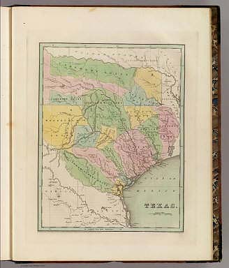
Greenleaf, Jeremiah
Full Title
Texas Compiled from the latest and best Authorities.
Publisher
J. Greenleaf.
Author
Colton, G.W.
Full Title
New Map of the State of Texas, Compiled from J. De Cordova's Large Map. No (35-) 36. Entered according to the Act of Congress in the year 1855 by J.H. Colton & Co. in the Clerk's Office of the District Court of the United States for the Southern District of New York.
Publisher
J.H. Colton
Author
Wyld, James, 1812-1887
Full Title
Republic of Mexico and Texas. J.W. del. (engraved by) Stockley, Sc. London, James Wyld, Charing Cross. (to accompany) An Atlas of the World, Comprehending Separate Maps of its various Countries, Constructed & drawn from the latest Astronomical & Geographical Observations. By James Wyld, Geographer to Her Majesty and H. Late R.H. Prince Albert. London. Published by James Wyld (Successor to Mr. Faden) Charing Cross East. 1864.
Publisher
James Wyld
Author
[Gray, Ormando Willis, Lloyd, H.H., Walling, H. F.]
Full Title
Atlas of the United States. Texas. (Published by Stedman, Brown & Lyon, Cincinnati. 1872. Entered ... 1872, by H.F. Walling, and O.W. Gray, and H.H. Lloyd & Co. ... Washington)
Publisher
Stedman, Brown & Lyon
Author
W. & A.K. Johnston Limited
Full Title
Oklahoma, Texas (North). Texas (South).
Publisher
W. & A.K. Johnston Limited
Author
Page, H.R. & Co.
Full Title
Map of Texas, Published by H.R. Page & Co., Chicago, Ill, 1886.
Publisher
H.R. Page & Co.
Author
Mitchell, Samuel Augustus
Full Title
Map of Texas from the most Recent Authorities. Philadelphia: Published By C.S. Williams, N.E. corner of Market & 7th. Streets. Entered ... 1845 by C.S. Williams ... Pennsylvania. (inset map) Texas North of Red River.
Publisher
S.A. Mitchell
Author
Bradford, Thomas G.
Full Title
Texas. Entered ... 1838, by T.G. Bradford ... Massachusetts. Engraved by G.W. Boynton.
Publisher
[Weeks, Jordan & Co., Wiley and Putnam.]
Author
Mitchell, Samuel Augustus Jr.
Full Title
County map of Texas. (inset map) 35. Galveston Bay and Vicinity. Entered ... 1860 by S. Augustus Mitchell, Jr. ... Pennsylvania.
Publisher
S.A. Mitchell Jr.
Author
Mitchell, Samuel Augustus Jr.
Full Title
County map of the state of Texas. Showing also portions of the adjoining states and territories. Drawn and engraved by W.H. Gamble, Philadelphia. (with inset) Plan of Galveston and vicinity. Entered ... 1873, by S. Augustus Mitchell ... Washington.
Publisher
S.A. Mitchell Jr.
Author
Mitchell, Samuel Augustus Jr.
Full Title
County map of the State of Texas: showing also portion of the adjoining States and Territories. Drawn and engraved by W.H. Gamble Philadelphia. Entered ... 1876 by S. Augustus Mitchell, . ... Washington. (inset map): Plan of Galveston and vicinity.
Publisher
S.A. Mitchell Jr.
Author
Lothian, John
Full Title
Mexico & Guatimala (Guatemala) with Texas.
Publisher
James MacLeod and Francis Orr & Sons
Author
Johnson, A.J.
Full Title
Johnson's Texas By Johnson & Browning. (with) inset maps: Plan Of Galveston Bay From The U.S. Coast Survey and Plan of Sabine Lake. No. 33.
Publisher
Johnson and Browning
Author
Mitchell, Samuel Augustus
Full Title
Map of Texas. (inset) Texas North of Red River.
Publisher
Thomas, Cowperthwait & Co.
Author
Mitchell, Samuel Augustus
Full Title
Map of Texas. (inset) Texas North of Red River.
Publisher
Thomas, Cowperthwait & Co.
Author
Mitchell, Samuel Augustus
Full Title
Map of the State of Texas from the Latest Authorities, By J.H. Young. J.L. Hazzard Sc. Published by Charles Desilver, Philadelphia. Entered ... 1856 by Charles Desilver ... Pennsylvania. (insets) Map of the Vicinity of Galveston City, and Northern Texas (Panhandle).
Publisher
Charles DeSilver
Author
[Raynal, G.T., Bonne, R.]
Full Title
Le Nouveau Mexique, Avec La Partie Septentrionale De L'Ancien, ou De La Nouvelle Espagne, par M. Bonne, Ingenieur-Hydrographe de la Marine. Grave par Dient. (on upper margin) Liv. VI. et X: No. 28. (on lower margin) 29. (to accompany) Histoire Philosophique et Politique Des Establissements et Du Commerce Des Europeens Dans Les Deux Indes.
Publisher
Jean-Leonard Pellet
Author
National Map Company
Full Title
Texas. (Copyrighted by) National Map Company, Indianapolis. (to accompany) Official Paved Road and Commercial Survey of the United States. (with inset).
Publisher
National Map Company
Author
Mitchell, Samuel Augustus Jr.
Full Title
County map of Texas. (inset map) Galveston Bay, and Vicinity. 40. Entered ... 1867 by S. Augustus Mitchell, Jr. ... Pennsylvania.
Publisher
S.A. Mitchell Jr.
Author
United States. War Department
Full Title
Engineer Bureau, War Department. Section of map of the states of Kansas and Texas and Indian Territory, with parts of the territories of Colorado and New Mexico. From the most recent official surveys and explorations and other authentic information. 1867. Julius Bien & Co., Lith., N.Y. (1891-1895)
Publisher
U.S. Government Printing Office
Author
[Julius Bien & Co., United States. War Department]
Full Title
General topographical map. Sheet XXII. Julius Bien & Co., Lith., N.Y. (1891-1895)
Publisher
U.S. Government Printing Office
Author
[Julius Bien & Co., United States. War Department]
Full Title
General topographical map. Sheet XXIII. Julius Bien & Co., Lith., N.Y. (1891-1895)
Publisher
U.S. Government Printing Office
Author
[Julius Bien & Co., United States. War Department]
Full Title
General topographical map. Sheet XXIV. Julius Bien & Co., Lith., N.Y. (1891-1895)
Publisher
U.S. Government Printing Office
Author
[Bradford, Thomas G., Goodrich, S.G.]
Full Title
Texas. Engraved by G.W. Boynton. Entered ... 1838, by T.G. Bradford ... Massachusetts.
Publisher
C.D. Strong
Author
Arrowsmith, John
Full Title
Mexico, By J. Arrowsmith. (with) Mexico, Shewing its connection with the Ports of Acapulco, Vera Cruz, & Tampico; on double the scale of the Map. (Map) 44. London, Pubd. 15 Feby. 1842, by J. Arrowsmith, 10 Soho Square.
Publisher
John Arrowsmith
Author
Arrowsmith, John
Full Title
Map of Texas, compiled from Surveys recorded in the Land Office of Texas, and other Official Surveys, By John Arrowsmith. Soho Square, London. (with) Plan of Galveston Bay from a M.S. (with) inset map of the Western United States, Texas and Mexico. London, Pubd. 8th June, 1843, by John Arrowsmith, 10 Soho Square.
Publisher
John Arrowsmith
Author
Jefferys, Thomas
Full Title
The Western Coast of Louisiana and the Coast of New Leon. By Thos. Jefferys, Geographer to His Majesty. London, printed for Robt. Sayer, Map & Printseller, no. 53 Fleet Street, as the Act directs 20th Feby. 1775.
Publisher
Sayer and Bennett
Author
Cornell, S. S. (Sarah S.)
Full Title
Texas. (with) California. Drawn by E. Wells, N.Y. Entered ... 1856, by S.S. Cornell ... Southern District of New York. New York: D. Appleton & Co., 443 & 445 Broadway. (1864)
Publisher
Appleton & Co.
Author
Cram, George Franklin
Full Title
Cram's Rail Road & Township Map of Texas. Published by Geo. F. Cram. Proprietor of the Western Map Depot. 66, Lake St. Chicago Ills. 1875.
Publisher
Cram Atlas Company
Author
Lloyd, H.H.
Full Title
Atlas of the United States. Texas. (by H.H. Lloyd. Published by Stedman, Brown & Lyon, Baltimore. 1873)
Publisher
Stedman, Brown & Lyon
Author
Mitchell, Samuel Augustus
Full Title
Map of the state of Texas. Engraved to illustrate Mitchell's school and family geography. Entered ... 1846 by S. Augustus Mitchell ... Eastern District of Pennsylvania.
Publisher
Thomas, Cowperthwait & Co.
Author
Touring club italiano
Full Title
Stati Uniti, United States of America, New Mexico, Oklahoma, Texas. (with New Orleans-Mississippi Delta region). Propr. Artistico-letteraria del T.C.I. Ufficio cartografico del T.C.I. (1929)
Publisher
Touring club italiano
Full Title
County map of the state of Texas. Showing also portions of the adjoining states and territories. (with) Plan of Galveston and vicinity. Copyright 1887 by Wm. M. Bradley & Bro. (1890)
Publisher
John Y. Huber & Co.
Author
Lisle, Guillaume de, 1675-1726
Full Title
Carte de la Louisiane et du Cours du Mississipi. Dressee sur un grand nombre de Memoires en trautres sur ceux de Mr. le Maire. Par Guillaume Delisle de l'Academie Rle. des Sciences. A Paris, chez l'Auteur le Sr. Delisle sur le Quay de l'Horloge, avec Privilege du Roy Juin 1718.
Publisher
Guillaume DeLisle, Quai de l'Horloge
Author
Mitchell, Samuel Augustus
Full Title
County map of Texas. (with) Galveston Bay and vicinity. Entered ... 1870 by S. Augustus Mitchell, Jr. ... Pennsylvania.
Publisher
[R.A. Campbell, S.A. Mitchell, Jr.]
Author
Mitchell, Samuel Augustus
Full Title
County map of the state of Texas. Showing also portions of the adjoining states and territories. Drawn and engraved by W.H. Gamble, Philadelphia. (with) Plan of Galveston and vicinity. Entered ... 1879 by S. Augustus Mitchell ... Washington. (1880)
Publisher
S.A. Mitchell
Author
Greenleaf, Jeremiah
Full Title
Texas Compiled from the latest and best Authorities.
Publisher
G.R. French
Author
[Scovel, James L., O'Brien, Emmett J]
Full Title
Streams. Delta. new Orleans, La.-Tex.
Publisher
John Wiley & Sons Inc.
Author
[Scovel, James L., O'Brien, Emmett J]
Full Title
Shorelines. Coastal Plain Shorlines. Aransas Pass, Texas. (inset map) Corpus Christi. (on opposite page) Jacksonville Beach, Fla. Scale 1:24,000..
Publisher
John Wiley & Sons Inc.
Author
Mitchell, Samuel Augustus
Full Title
Map of The State of Texas from the Latest Authorities. By J.H. Young. Philadelphia. Published By Charles Desilver, Philadelphia. 1859 Entered according to Act of Congress in the year 1860 by Charles Desilver in the Clerk's office if the District Court of the Eastern District of Pennsylvania. 15.
Publisher
Charles Desilver.
Author
[Rand McNally and Company, State Farm Insurance Companies Travel Bureau]
Full Title
Rand McNally Road map, Texas. Copyright by Rand McNally & Company, Chicago, Ill. Lithographed in the U.S.A. (inset maps) Panhandle Section, and Brownsville Section. (to accompany) State Farm Road Atlas: United States, Canada, Mexico,Central and South America. Copyright 1940 by Rand McNally & Company, Chicago, Ill.
Publisher
State Farm Insurance Companies Travel Bureau
Author
Stieler, Adolf
Full Title
Vereinigte Staaten Von Nord-Amerika In 6 Blattern, Bl. 5. Petermann. Bearbeitet v. H. Habenicht. Gest v. Metzeroth, Eberhardt, Kuhn & Kramer. Gotha: Justus Perthes. 1872.
Publisher
Justus Perthes
Author
Stieler, Adolf
Full Title
Vereinigte Staaten Von Nord-Amerika In 6 Blattern, Bl. 6. Petermann. Bearbeitet v. H. Habenicht. Gest v. Eberhardt, Kuhn, Metzeroth u. Weiler. Gotha: Justus Perthes. 1873.
Publisher
Justus Perthes
|