Browse All

1829 Principal Seat of the War of 1812-13-14 School Atlas Principal Seat of the War of 1812-13-14. … |

1849 Physical Map Of The United States School Atlas Physical Map Of The United States. Adapt … |

1849 Political Map Of The United States, Mexi … School Atlas Political Map Of The United States, Mexi … |

1849 Physical And Political Map Of The N. Eas … School Atlas Physical And Political Map Of The N. Eas … |

1849 Political Map Of The Northern Division O … School Atlas Political Map Of The Northern Division O … |

1849 Physical & Political Map Of The Southern … School Atlas Physical & Political Map Of The Southern … |

1816 United States and Part of Louisiana World Atlas A Map Of The United States and Part of L … |

1816 Middle States and Western Territories of … World Atlas The Middle States and Western Territorie … |

1816 The Southern States and Mississippi Terr … World Atlas The Southern States and Mississippi Terr … |

1816 The Northwestern Territories of the Unit … World Atlas The Northwestern Territories of the Unit … |

1890 England. United States. Bolivia. Egypt. World Atlas England. The United States. Bolivia. Egy … |

1875 New railroad map of the United States, . … State Atlas New railroad map of the United States, t … |

1875 Population - United States census, 1870. … State Atlas Population - United States census, 1870. … |

1875 Agricultural productions colored by grad … State Atlas Agricultural productions colored by grad … |

1875 Vital statistics, United Census, 1870: D … State Atlas Vital statistics, United Census, 1870: D … |

1884 Distribution of the Genera Carya & Umbel … Physical Atlas Map Showing the Distribution of the Gene … |

1884 Distribution of the Genus Juglans [The W … Physical Atlas Map Showing the Distribution of the Genu … |

1884 Distribution of the Genera Castanea & Ca … Physical Atlas Map Showing the Distribution of the Gene … |

1884 Distribution of Liriodendron Tulipifera … Physical Atlas Map Showing the Distribution of Lirioden … |

1884 Distribution of Prosopsis Juliflora, Que … Physical Atlas Map Showing the Distribution of Prosopsi … |
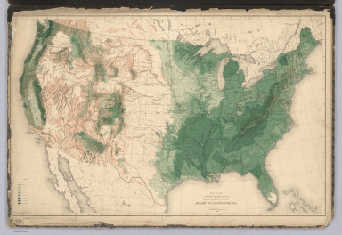
1884 United States showing the Relative Avera … Physical Atlas Map of the United States showing the Rel … |

1872 Map of the United States. [National Atlas, State Atlas] Map of the United States. Warner & Beers … |

1872 Atlas of the United States, New England, … [National Atlas, State Atlas] Atlas of the United States, New England, … |

1872 Atlas of the United States, Map of the C … [National Atlas, State Atlas] Atlas of the United States, Map of the C … |

1872 Atlas of the United States, Map of the W … [National Atlas, State Atlas] Atlas of the United States, Map of the W … |

1872 Atlas of the United States, Map of the S … [National Atlas, State Atlas] Atlas of the United States, Map of the S … |

1876 United States and Territories. County Atlas Map of the United States and Territories … |

1876 Map of the United States. State Atlas Map of the United States. 1876. (Publish … |

1874 United States and Territories together w … County Atlas Map of the United States and Territories … |

1876 United States. County Atlas Map of the United States. |

1876 Climatological and Geological Maps of th … County Atlas Climatological Map of the United States. … |

1814 United States School Atlas United States. (engraved by) H.S. Tanner … |

1828 United States And British Provinces School Atlas United States And British Provinces. (en … |

1821 United States School Atlas United States. Engraved by A. Willard & … |

1885 United States. County Atlas Map of the United States. Copyright 1884 … |

1845 Physical Map Of The United States. School Atlas Physical Map Of The United States. Adapt … |

1845 Political Map Of The United States, Mexi … School Atlas Political Map Of The United States, Mexi … |

1845 Physical & Political Map Of The North Ea … School Atlas Physical & Political Map Of The N. Easte … |

1845 Political Map Of the Northern Division O … School Atlas Political Map Of the Northern Division O … |

1845 Political Map Of the Southern Division O … School Atlas Physical & Political Map Of the Southern … |

1870 United States. World Atlas Johnson's United States. |

1845 Nord-Americanische Freistaaten. World Atlas Nord-Americanische Freistaaten, 1845. Na … |

1853 Geognos. Karte, Nord-Amer. Freistaate. World Atlas Geognostische Karte der Nord-Americanisc … |

1877 Railroad Map of the United States. State Atlas Railroad Map of the United States. |

1880 United States of America, 1880. County Atlas Map of the United States of America, 188 … |

1824 Nordliches America. Berlin 1824 von R.v. … [School Atlas, World Atlas] Nordliches America. Berlin 1824 von R.v. … |

1874 United States of America. County Atlas The United States of America. |

1848 Indian territory World Atlas Indian Territory. (to accompany) The Cer … |

1848 Hawaiian Islands World Atlas Hawaiian Islands. (to accompany) The Cer … |

1841 United States. World Atlas United States. Entered ... 1838 by T.G. … |