Browse All

1807 Carte des Provines Meridionales des Etat … Historical Atlas Carte des Provinces Meridionales des Eta … |

1807 l'Armee du Sud, in la Virginie, dans les … Historical Atlas Theatre des Operations les plus importan … |

1807 Investissement et Attaque D'York dans la … Historical Atlas Investissement et Attaque D'York dans la … |

1807 Virginia, North Carolina, South Carolina … Historical Atlas A Map of those parts of Virginia, North … |

1807 Investment and Attack of York in Virgini … Historical Atlas Plan of the Investment and Attack of Yor … |

1807 Siege of Charleston in S. Carolina. Historical Atlas Plan of the Siege of Charleston in S. Ca … |

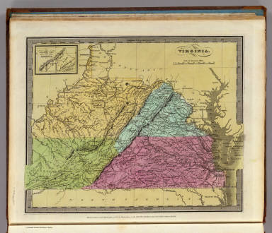
1857 Virginia. National Atlas Virginia. No. 25. Published by J.H. Colt … |

1885 Beverly Manor Magist. Dist. County Atlas Map of Beverly Manor Magisterial Distric … |

1885 Riverheads Magist. Dist. County Atlas Map of Riverheads Magisterial District, … |

1885 S. River Magist. Dist. County Atlas Map of the South River Magisterial Distr … |
1835 Virginia. World Atlas Virginia. (with) The Western Part of Vir … |

1826 Map of Virginia and Maryland. National Atlas Map Of Virginia And Maryland Contrusted … |

1838 Virginia. National Atlas Virginia. Entered ... 1838, by T.G. Brad … |

1906 Virginia, West Virginia, Maryland, Delaw … World Atlas Virginia, West Virginia, Maryland, Delaw … |

1823 Virginia, Maryland and Delaware. World Atlas Virginia, Maryland and Delaware By H.S. … |

1849 New Map of Virginia with its Canals, Roa … World Atlas A New Map of Virginia with its Canals, R … |

1865 County map of Virginia and West Virginia World Atlas County map of Virginia and West Virginia … |

1874 County map of Virginia and West Virginia World Atlas County map of Virginia and West Virginia … |

1877 County map of Virginia and West Virginia World Atlas County map of Virginia and West Virginia … |

1850 Country between Washington (DC) & Manass … World Atlas Country between Washington (DC) & Manass … |

1850 Virginia and Maryland. World Atlas Smith's Topographical Map of Virginia an … |

1850 Virginia. World Atlas A New Map of Virginia with the Canals, R … |

1857 A New Map of the State of Virginia World Atlas A New Map of the State of Virginia, Exhi … |

1860 Pennsylvania And Virginia. World Atlas Johnson's Pennsylvania And Virginia By J … |

1886 Virginia and West Virginia. County Atlas Virginia and West Virginia. (insets) Env … |

1927 West Virginia. Virginia National Atlas West Virginia. (Copyrighted by) National … |

1868 County map of Virginia and West Virginia World Atlas County map of Virginia and West Virginia … |

1895 Army of the Cumberland campaigns. Military Atlas Map prepared to exhibit the campaigns in … |

1841 Virginia. World Atlas Virginia. Engraved by G.W. Boynton. Ente … |

1895 Virginia, Averell routes. Military Atlas Map of a part of Virginia exhibiting the … |

1895 Gen. map I. Military Atlas General topographical map. Sheet I. Juli … |

1895 Gen. map II. Military Atlas General topographical map. Sheet II. Jul … |

1895 Gen. map III. Military Atlas General topographical map. Sheet III. Ju … |

1895 Gen. map VI. Military Atlas General topographical map. Sheet VI. Jul … |

1895 Gen. map VII. Military Atlas General topographical map. Sheet VII. Ju … |

1831 Virginia, Maryland. National Atlas Map of the states of Virginia and Maryla … |

1827 Virginie, Pensylvanie. Physical Atlas Carte des montagnes coupees par des rivi … |

1883 E. United States 7. World Atlas Eastern United States. No. 7. Letts's po … |

1804 Virginia. World Atlas Virginia. S. Lewis del. Tanner sc. (Publ … |

1812 Virginia. World Atlas Virginia. S. Lewis del. (Boston: Publish … |

1873 Map of the District of Columbia, Washing … State Atlas Map of the District of Columbia includin … |

1834 Canal de la Chesapeake a l'Ohio. National Atlas Canal de la Chesapeake a l'Ohio. Plan ge … |

1863 (Virginia, Maryland, Delaware) School Atlas (Map of Virginia, Maryland and Delaware. … |

1890 Del., Md., Va., W. Va. World Atlas County map of the states of Delaware, Ma … |

1823 Virginia, Md., Del. National Atlas Virginia, Maryland and Delaware. (with D … |

1870 Virginia, W. Virginia. [State Atlas, World Atlas] County map of Virginia and West Virginia … |

1880 Virginia, W. Virginia. World Atlas County map of Virginia and West Virginia … |

1840 Virginia. World Atlas Virginia. (with) The Western Part of Vir … |

1796 Virginia. National Atlas Virginia. W. Barker sculp. |

1824 Virginia, Maryland and Delaware. World Atlas Virginia, Maryland and Delaware By H.S. … |