Browse All

1891 R.21E T.14S. County Atlas Township 14 South, Range 21 East. (Compi … |

1876 Upper Mancungie, Lehigh County, Pennsylv … County Atlas Upper Mancungie. |

1876 Slatington. County Atlas Slatington. |

1876 Borough of Coplay. Whitehall. Laurys. Zi … County Atlas Borough of Coplay. Whitehall. Laurys. Zi … |

1876 Borough of Macungie. County Atlas Borough of Macungie. |
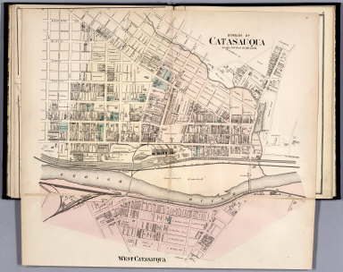
1876 Borough of Catasauqua. County Atlas Borough of Catasauqua. |

1876 Hanover, Lehigh County, Pennsylvania. County Atlas Hanover. |

1876 Whitehall, Lehigh County, Pennsylvania. … County Atlas Whitehall. Mechanicsville. |

1891 R.22E T.14S. County Atlas Township 14 South, Range 22 East. (Compi … |

1876 West Bethlehem. Saegersville. Ferndale ( … County Atlas West Bethlehem. Saegersville. Ferndale. … |

1876 Salsbury, Lehigh County, Pennsylvania. County Atlas Salsbury Tp. |

1891 Sanger. County Atlas Map of Sanger. Fresno County, California … |

1876 Borough of Emaus (Emmaus). Cedarville. County Atlas Borough of Emaus (Emmaus). Cedarville. |

1876 Fountain Hill. Guthsville. Slatedale. Or … County Atlas Fountain Hill. Guthsville. Slatedale. Or … |

1891 R.23E T.14S. County Atlas Township 14 South, Range 23 East. (Compi … |

1876 South Whitehall, Lehigh County, Pennsylv … County Atlas South Whitehall. Breinigsville. Crackers … |

1876 Heidelberg, Lehigh County, Pennsylvania. … County Atlas Heidelberg. |

1876 Map of the South Mountain and Boston Rai … County Atlas Map of the South Mountain and Boston Rai … |

1876 Washington. Lower Macungie. County Atlas Washington. Lower Macungie. |

1876 Friedensville. Ironton. East Texas. Unio … County Atlas Friedensville. Ironton. East Texas. Unio … |

1876 North Whitehall, Lehigh, Pennsylvania. S … County Atlas North Whitehall. Siegersville. New Tripo … |

1891 R.24-25E T.13-14S. County Atlas Range 24 East, Range 25 East, Township 1 … |

1891 R.26-31E T.13-14S. County Atlas Range 27 East, Range 28 East, Township 1 … |

1891 R.11-12E T.15-16S. County Atlas Range 11 East, Range 12 East, Township 1 … |

1874 Western Hemisphere. Eastern Hemisphere World Atlas Western Hemisphere. Entered ... 1874, by … |

1874 Map of the World on the Mercator Project … World Atlas Map of the World on the Mercator Project … |

1874 Map of North America World Atlas Map of North America. Showing its politi … |

1874 County Map of Nova Scotia, New Brunswick … World Atlas County Map of Nova Scotia, New Brunswick … |

1874 Map of Quebec in counties World Atlas Map of Quebec in counties. (with inset m … |

1874 Map of Ontario in counties World Atlas Map of Ontario in counties. Entered ... … |

1874 Map of the United States World Atlas Map Of The United States, And Territorie … |

1891 R.13-14E T.15-16S. County Atlas Range 13 East, Range 14 East, Township 1 … |

1874 County map of the State of Maine World Atlas County map of the State of Maine. (with … |

1874 New Hampshire and Vermont World Atlas New Hampshire and Vermont. Entered ... 1 … |

1874 County and township map of the states of … World Atlas County and township map of the states of … |

1874 Plan of Boston World Atlas Plan of Boston. (with) Map of the countr … |

1891 R.21E T.15S. County Atlas Township 15 South, Range 21 East. (Compi … |

1874 County map of the state of New York World Atlas County map of the state of New York. Dra … |

1874 New York and Brooklyn World Atlas New York and Brooklyn. Entered ... 1874, … |

1874 County map of the state of Pennsylvania World Atlas County map of the state of Pennsylvania. … |

1874 Plan of the city of Philadelphia and Cam … World Atlas Plan of the city of Philadelphia and Cam … |

1891 R.22E T.15S. County Atlas Township 15 South, Range 22 East. (Compi … |

1874 County map of New Jersey. (and) County m … World Atlas County map of New Jersey. (and) County m … |

1874 Plan of Baltimore World Atlas Plan of Baltimore. Entered ... 1874, by … |

1874 Plan of Washington World Atlas Plan of the city of Washington. The capi … |

1874 County map of Virginia and West Virginia World Atlas County map of Virginia and West Virginia … |

1874 Kentucky and Tennessee World Atlas Kentucky and Tennessee. Entered ... 1874 … |

1874 County map of the States of Georgia and … World Atlas County map of the States of Georgia and … |

1874 North and South Carolina World Atlas North and South Carolina. Entered ... 18 … |

1891 R.23E T.15S. County Atlas Township 15 South, Range 23 East. (Compi … |