Browse All

1877 Plan of Detroit World Atlas Plan of Detroit. Entered ... 1877 by S. … |

1877 County map of Minnesota World Atlas County map of Minnesota. Drawn and Engra … |

1877 County and township map of the States of … World Atlas County and township map of the States of … |

1826 16 Fechn. National Atlas (Carte topographique de l'Egypte et de p … |

1877 County map of Colorado, Wyoming, Dakota, … World Atlas County map of Colorado, Wyoming, Dakota, … |

1877 County map of Utah and Nevada World Atlas County map of Utah and Nevada. Drawn and … |

1877 County map of Arizona and New Mexico World Atlas County map of Arizona and New Mexico. En … |

1877 Map of Oregon, Washington, Idaho and par … World Atlas Map of Oregon, Washington, Idaho and par … |

1826 17 Gebel Gebei. National Atlas (Carte topographique de l'Egypte et de p … |

1877 County map of the State of California World Atlas County map of the State of California. E … |

1877 Northwestern America World Atlas North Western America; showing the terri … |

1877 Map of Mexico, Central America, and the … World Atlas Map of Mexico, Central America, and the … |

1826 18 Benisouif. National Atlas (Carte topographique de l'Egypte et de p … |

1877 Cuba World Atlas Cuba. Entered ... 1877 by S. Augustus Mi … |

1877 Map of South America, showing its politi … World Atlas Map of South America, showing its politi … |

1877 Map of New Granada, Venezuela and Guiana … World Atlas Map of New Granada, Venezuela and Guiana … |

1877 Map of Brazil, Bolivia, Paraguay, and Ur … World Atlas Map of Brazil, Bolivia, Paraguay, and Ur … |

1826 24 Le Caire, Belbeis. National Atlas (Carte topographique de l'Egypte et de p … |

1877 Map of Europe, showing its Gt. political … World Atlas Map of Europe, showing its gt. political … |

1877 County map of England and Wales World Atlas County map of England and Wales. Entered … |

1877 The World as known to the Children of Is … World Atlas The World as known to the Children of Is … |

1826 25 Ventre de la Vache. National Atlas (Carte topographique de l'Egypte et de p … |

1877 Map of the Roman Empire World Atlas Map of the Roman Empire, At the period o … |

1877 County Map Of Scotland (and) Ireland In … World Atlas County Map Of Scotland. (with inset map) … |

1877 Map of France, Spain and Portugal World Atlas Map of France, Spain and Portugal. (with … |

1877 Russia In Europe, Sweden, and Norway World Atlas Russia In Europe, Sweden, and Norway. (w … |

1826 26 Lacs Natroun. National Atlas (Carte topographique de l'Egypte et de p … |

1877 Prussia, And The German States World Atlas Prussia, And The German States. Entered … |

1877 Map of Austrian Empire, Italian States. … World Atlas Map of Austrian Empire, Italian States. … |

1877 Map Of Asia Showing its Gt. Political Di … World Atlas Map Of Asia Showing its Gt. Political Di … |

1826 27 Abu Mina. National Atlas (Carte topographique de l'Egypte et de p … |

1877 Map of Persia, Arabia, Turkey in Asia, A … World Atlas Map of Persia, Arabia, Turkey in Asia, A … |

1877 A new map of Palestine or the Holy Land World Atlas A new map of Palestine or the Holy Land. … |

1877 Map of Hindoostan, Farther India, China, … World Atlas Map of Hindoostan, Farther India, China, … |

1826 28 Fleuve Sans Eau. National Atlas (Carte topographique de l'Egypte et de p … |
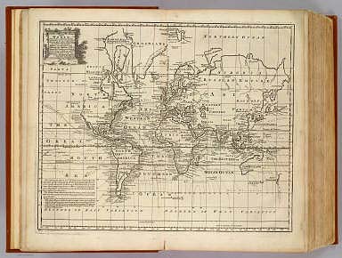
1747 Chart of the World. Geography Book A new & accurate chart of the world. Dra … |

1877 Map of Oceanica, exhibiting its various … World Atlas Map of Oceanica, exhibiting its various … |

1877 Map Of Africa, Showing Its Most Recent D … World Atlas Map Of Africa, Showing Its Most Recent D … |

1826 29 Menouf, Tant. National Atlas (Carte topographique de l'Egypte et de p … |

1882 Sedgwick County, Kansas. County Atlas Edwards Township. Map of Sedgwick County … |

1826 30 Bubaste, Salheih. National Atlas (Carte topographique de l'Egypte et de p … |

1882 Township 25 South Range 1 East, Sedgwick … County Atlas Township 25 South Range 1 East. |

1882 Edwards Map of the City of Wichita, Kans … County Atlas Edwards Map of the City of Wichita, Kans … |

1882 Township 28 South Range 1 East, Sedgwick … County Atlas Township 28 South Range 1 East. |

1882 Mulvane, Kansas. County Atlas Mulvane. |

1882 Township 25 South Range 1 West, Sedgwick … County Atlas Township 25 South Range 1 West. |

1826 31 Canal de Suez. National Atlas (Carte topographique de l'Egypte et de p … |

1882 Township 28 South Range 2 West, Sedgwick … County Atlas Township 28 South Range 2 West. |

1882 Railway and Postal Map of Kansas. County Atlas Edwards' Township, Railway and Postal Ma … |

1882 Township 26 South Range 1 East, Sedgwick … County Atlas Township 26 South Range 1 East. |