Browse All

1932 Plate 139. Transportation. Railroads, 18 … [Historical Atlas, National Atlas] Plate 139. Transportation. Railroads, 18 … |

1932 Plate 140. Transportation. Railroads, 18 … [Historical Atlas, National Atlas] Plate 140. Transportation. Railroads, 18 … |

1932 Plate 141. Transportation. Railroads, 18 … [Historical Atlas, National Atlas] Plate 141. Transportation. Western Railr … |

1932 Plate 142. Agriculture. Agricultural Reg … [Historical Atlas, National Atlas] Plate 142. Agriculture. Agricultural Reg … |

1932 Plate 143. Agriculture. Cattle, 1860 - 1 … [Historical Atlas, National Atlas] Plate 143. Agriculture. Cattle (Excludin … |

1932 Plate 144. Agriculture. Wheat, 1924. Imp … [Historical Atlas, National Atlas] Plate 144. Agriculture. Spring Wheat Pro … |

1932 Plate 145. Agriculture. Improved Land, 1 … [Historical Atlas, National Atlas] Plate 145. Agriculture. Improved Land, 1 … |

1932 Plate 146. Agriculture. Improved Land, 1 … [Historical Atlas, National Atlas] Plate 146. Agriculture. Improved Land, 1 … |

1799 Russian Empire. World Atlas A new map of the Russian Empire, divided … |

1932 Plate 147. Agriculture. Farm Lands and B … [Historical Atlas, National Atlas] Plate 147. Agriculture. Farm Lands and B … |

1932 Plate 148. Imports and Exports, 1701 - 1 … [Historical Atlas, National Atlas] Plate 148. Imports and Exports. Imports … |

1932 Plate 149. Imports and Exports, 1851 - 1 … [Historical Atlas, National Atlas] Plate 149. Imports and Exports. Exports … |

1932 Plate 150. Imports and Exports, 1871 - 1 … [Historical Atlas, National Atlas] Plate 150. Imports and Exports. Exports, … |

1932 Plate 151. Imports and Exports, 1851 - 1 … [Historical Atlas, National Atlas] Plate 151. Imports and Exports. Exports, … |

1932 Plate 152. Wealth, 1799 - 1880. [Historical Atlas, National Atlas] Plate 152. Wealth. Wealth (Houses and La … |

1932 Plate 153. Wealth, 1880 - 1922. [Historical Atlas, National Atlas] Plate 153. Wealth. Wealth (All Property) … |

1932 Plate 154. Banks, 1800 - 1828. [Historical Atlas, National Atlas] Plate 154. Banks, 1800. Banks, 1800 (Cap … |

1932 Plate 155. Federal Income Taxes, 1866 - … [Historical Atlas, National Atlas] Plate 155. Federal Income Taxes. Federal … |

1932 Plate 156. Town of Boston, 1775 (Facsimi … [Historical Atlas, National Atlas] Plate 156. Plans of Cities. A Plan of th … |

1795 Turkey In Europe. World Atlas European dominions of the Ottomans, or T … |

1932 Plate 157. Charlestown, 1780. Philadelph … [Historical Atlas, National Atlas] Plate 157. Plans of Cities. Charlestown, … |

1932 Plate 158. Washington (D.C.) (1793) (Fac … [Historical Atlas, National Atlas] Plate 158. Plans of Cities. Plan of the … |

1932 Plate 159. City of New York, 1776. Balti … [Historical Atlas, National Atlas] Plate 159. Plans of the Cities. Plan of … |

1932 Plate 160. Military History. American Re … [Historical Atlas, National Atlas] Plate 160. Military History. The America … |

1791 Greece, Anadoli. World Atlas Greece, Archipelago and part of Anadoli. … |

1932 Plate 161. Military History. Colonial Wa … [Historical Atlas, National Atlas] Plate 161. Military History. Colonial Wa … |

1932 Plate 162. Military History. 1812 - 1847 … [Historical Atlas, National Atlas] Plate 162. Military History. 1812. Jacks … |

1932 Plate 163. Military History. Civil War 1 … [Historical Atlas, National Atlas] Plate 163. Military History. Civil War 1 … |

1932 Plate 164. Military History. Virginia Ca … [Historical Atlas, National Atlas] Plate 164. Military History. Virginia Ca … |

1932 Plate 165. Military History. American Wa … [Historical Atlas, National Atlas] Plate 165. Military History. Spanish Ame … |

1808 Asia. World Atlas Asia. London, published by W. Faden, Geo … |

1932 Plate 166. Possessions and Territorial C … [Historical Atlas, National Atlas] Plate 166. Possessions and Territorial C … |

1616 Plate 19. Facsimile Cartography 1492-186 … [Historical Atlas, National Atlas] Plate 19. Cartography 1492-1867. Smith M … |

1794 Turkey in Asia. World Atlas A new map of Turkey in Asia by Monsr. d' … |

1800 Hind, Hindoostan, or India. World Atlas Hind, Hindoostan, or India. By L.S. de l … |

1938 (County and Road) Map of California. [State Atlas, Statistical Atlas] (County and Road) Map of California. |

1786 Bengal, Bahar, Oude, Allahabad. World Atlas A map of Bengal, Bahar, Oude & Allahabad … |

1938 Highways of the Western States. [State Atlas, Statistical Atlas] Highways of the Western States. |

1938 Highway Map of the State of Oregon. [State Atlas, Statistical Atlas] Highway Map of the State of Oregon. |

1938 Thomas Bros. Highway Map, State of Washi … [State Atlas, Statistical Atlas] Thomas Bros. Highway Map, State of Washi … |

1938 Highway Map State of Idaho. [State Atlas, Statistical Atlas] Highway Map State of Idaho. (inset) City … |

1800 India peninsula N. World Atlas (A map of the peninsula of India from th … |

1938 Highway Map States of Utah and Nevada. [State Atlas, Statistical Atlas] Highway Map States of Utah and Nevada. |

1938 Highway Map State of Arizona. [State Atlas, Statistical Atlas] Highway Map State of Arizona. |
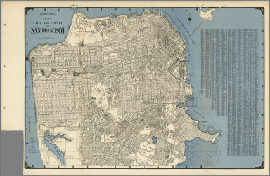
1938 City and County of San Francisco. [State Atlas, Statistical Atlas] Thomas Bros. Map of the City and County … |

1938 Map of Oakland, Berkeley, Alameda, San L … [State Atlas, Statistical Atlas] Map of Oakland, Berkeley, Alameda, San L … |

1800 India peninsula S. World Atlas A map of the peninsula of India from the … |

1938 Daly City, South San Francisco, San Brun … [State Atlas, Statistical Atlas] Thomas Bros: Map of Daly City, South San … |

1938 Thomas Bros. Map of the Major Part of th … [State Atlas, Statistical Atlas] Thomas Bros. Map of the Major Part of th … |

1938 Map of Palo Alto, Redwood City, Mountain … [State Atlas, Statistical Atlas] Map of Palo Alto, Redwood City, Mountain … |