Browse All

1851 39. Die Feldzüge der Macedonier unter Al … Physical Atlas 39. Die Feldzüge der Macedonier unter Al … |

1851 40. Das Romische Weltreich, nebst Versin … Physical Atlas 40. Das Romische Weltreich, nebst Versin … |

1851 41. Die Erde, so weit solche den Alten b … Physical Atlas 41. Die Erde, so weit solche den Alten b … |

1850 42. Die ozeanischen Entdeckungen Physical Atlas 42. Die ozeanischen Entdeckungen und die … |
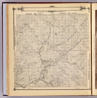
1892 T.16-17S R.28-29E. County Atlas Township 16 South, Township 17 South, Ra … |

1892 T.16-17S R.30-31E. County Atlas Township 16 South, Township 17 South, Ra … |

1907 Natural Vegetation & Ocean Currents. For … Statistical Atlas Natural Vegetation & Ocean Currents. For … |

1907 Temperatures. Statistical Atlas January, July, Mean Annual Temperatures. |

1892 T.17S R.21E. County Atlas Township 17 South, Range 21 East, Tulare … |

1907 Rainfall. Winds. Climatic Diseases. Statistical Atlas Mean Annual Rainfall. Prevailing Winds. … |

1907 Density of Population, 1906. (World), Un … Statistical Atlas Density of Population, 1906. (World), Un … |

1907 Races of Mankind. Religions of Mankind. Statistical Atlas Races of Mankind. Religions of Mankind. |

1907 Languages of Commerce. Statistical Atlas Languages of Commerce. |

1907 Commercial Development of the World. Statistical Atlas Commercial Development of the World. |

1907 British Isles, Comparative Value of Land … Statistical Atlas British Isles, Comparative Value of Land … |

1907 States and British Representation. Statistical Atlas States and British Representation. |

1892 T.17S R.22E. County Atlas Township 17 South, Range 22 East, Tulare … |

1907 States and British Representation (in Am … Statistical Atlas States and British Representation (in Am … |

1907 Total British Trade (Import and Export). Statistical Atlas Total British Trade (Import and Export). |

1907 Commercial Highways of the World. Statistical Atlas Commercial Highways of the World. |

1892 T.17S R.23E. County Atlas Township 17 South, Range 23 East, Tulare … |

1907 British Naval Chart. Comparative Strengt … Statistical Atlas British Naval Chart. Comparative Strengt … |

1907 Isochronic Distance Chart, 1904. Average … Statistical Atlas Isochronic Distance Chart, 1904. Average … |

1907 Postal Map, 1907. Currency Map. Statistical Atlas Postal Map, 1907. Currency Map. |

1907 Telegraphic Communication. Statistical Atlas Telegraphic Communication. |

1907 British Isles - Industrial. Agricultural … Statistical Atlas British Isles - Industrial. Agricultural … |

1907 Europe and Near East - General Commercia … Statistical Atlas Europe & Near East - General Commercial … |

1907 Europe - Industrial. Statistical Atlas Europe - Industrial. |

1907 Central Europe, Industrial. Statistical Atlas Central Europe, Industrial. |

1907 Agricultural. India. Statistical Atlas Agricultural. India. |

1892 Traver, Tulare County. County Atlas Map of Traver, Tulare County. (with) Map … |

1907 China. Japan. Industrial. Statistical Atlas China. Japan. |

1907 The Far East - Central Commercial Chart. … Statistical Atlas The Far East - Central Commercial Chart. … |

1907 West Africa. Egypt. Statistical Atlas West Africa. Egypt. |
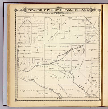
1892 T.17S R.24E. County Atlas Township 17 South, Range 24 East, Tulare … |

1860 Western Hemisphere. World Atlas Johnson's Western Hemisphere By Johnson … |

1857 City of Charleston. National Atlas The City of Charleston, (South Carolina, … |

1907 Central and South Africa. Statistical Atlas Central & South Africa. |

1907 Africa - Central Commercial Chart. (Base … Statistical Atlas Africa - Central Commercial Chart. (Base … |

1907 North Atlantic Chart. Statistical Atlas North Atlantic Chart. |

1907 Dominion of Canada. Statistical Atlas Dominion of Canada. |

1907 North America - General Commercial Chart … Statistical Atlas North America - General Commercial Chart … |

1907 United States. (Base Map includes Vegeta … Statistical Atlas United States. (Base Map includes Vegeta … |

1907 South America - Central Commercial Chart … Statistical Atlas South America - Central Commercial Chart … |

1907 West Indies & Central America. Statistical Atlas West Indies & Central America. |

1907 (Eastern Australia). (Base Map includes … Statistical Atlas (Eastern Australia). (Base Map includes … |

1892 T.17S R.25E. County Atlas Township 17 South, Range 25 East, Tulare … |

1907 Australia - General Commercial Chart. Statistical Atlas Australia - General Commercial Chart. |

1907 New Zealand. Statistical Atlas New Zealand. |

1907 Wheat - Growing Countries. Statistical Atlas Wheat - Growing Countries. |