Browse All

1829 Clinton County. State Atlas Map of the County of Clinton. By David H … |

1829 Franklin County. State Atlas Map of the County of Franklin. By David … |

1829 St. Lawrence County. State Atlas Map of the County of St. Lawrence. By Da … |

1829 Jefferson County. State Atlas Map of the County of Jefferson. By David … |

1846 West Indies. World Atlas West Indies. |

1829 Lewis County. State Atlas Map of the County of Lewis. By David H. … |

1829 Herkimer County. State Atlas Map of the County of Herkimer. By David … |

1829 Oneida County. State Atlas Map of the County of Oneida. By David H. … |

1829 Madison County. State Atlas Map of the County of Madison. By David H … |

1829 Oswego County. State Atlas Map of the County of Oswego. By David H. … |

1829 Otsego County. State Atlas Map of the County of Otsego. By David H. … |

1829 Chenango County. State Atlas Map of the County of Chenango. By David … |

1829 Broome County. State Atlas Map of the County of Broome. By David H. … |

1829 Cortland County. State Atlas Map of the County of Cortland by David H … |

1829 Tompkins County. State Atlas Map of the County of Tompkins. By David … |

1846 South America. World Atlas South America. |

1829 Tioga County. State Atlas Map of the County of Tioga. By David H. … |

1829 Steuben County. State Atlas Map of the County of Steuben. By David H … |

1829 Onondaga County. State Atlas Map of the County of Onondaga. By David … |

1829 Cayuga County. State Atlas Map of the County of Cayuga. By David H. … |

1829 Seneca County. State Atlas Map of the County of Seneca. By David H. … |

1829 Ontario, Yates counties. State Atlas Map of the counties of Ontario & Yates. … |

1829 Wayne County. State Atlas Map of the County of Wayne. By David H. … |

1829 Livingston County. State Atlas Map of the County of Livingston. By Davi … |

1829 Monroe County. State Atlas Map of the County of Monroe. By David H. … |

1829 Orleans County. State Atlas Map of the County of Orleans. By David H … |

1846 Venezuela, New Grenada & Equador. World Atlas Venezuela, New Grenada & Equador. (with) … |
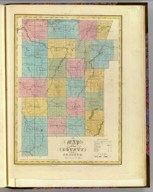
1829 Genesee County. State Atlas Map of the County of Genesee. By David H … |

1829 Allegany County. State Atlas Map of the County of Allegany. By David … |

1829 Niagara County. State Atlas Map of the County of Niagara. By David H … |

1829 Erie County. State Atlas Map of the County of Erie. By David H. B … |

1829 Cattaraugus County. State Atlas Map of the County of Cattaraugus. By Dav … |

1829 Chautauque County. State Atlas Map of the County of Chautauque (sic). B … |

1846 Brazil. World Atlas Brazil. (with) two inset maps: Paraguay … |

1840 Mapa-mundi historico. National Atlas Mapa-mundi historico. Lith. de Thierry f … |

1840 America historica, fisica y politica act … National Atlas America historica, fisica y politica act … |

1840 Mapa de las costas de Tierra-Firme. National Atlas Mapa de las costas de Tierra-Firme, desd … |

1840 Mapa politico de Venezuela, antes 1810, … National Atlas Mapa politico de Venezuela antes de la R … |

1840 Mapas fisicos de Venezuela. National Atlas Mapa fisico de Venezuela divida en hoyas … |

1840 Mapa de Venezuela ... guerra de independ … National Atlas Mapa de Venezuela para servir a la histo … |

1840 Mapa de Venezuela, N. Granada y Quito, 1 … National Atlas Mapa de Venezuela, Nueva Granada y Quito … |

1840 Mapa de Venezuela, Cundinamarca y Ecuado … National Atlas Mapa de los tres Departamentos Venezuela … |

1839 Tableau Comparatif de la Hauteur des Mon … School Atlas Tableau Comparatif de la Hauteur des Mon … |

1839 Tableau de Geographie Physique. School Atlas Tableau de Geographie Physique. |

1840 Mapa, Ecuador, Peru y Bolivia, 1826. National Atlas Mapa que contiene una parte de la Republ … |

1839 Tableau de Systeme Solaire. School Atlas Tableau de Systeme Solaire. |

1839 Mappemonde en deux hemispheres. School Atlas Mappemonde en Deux Hemispheres. Paris, H … |

1839 Europe School Atlas Carte Generale de L'Europe, Dressee par … |

1839 France. School Atlas France, En trente-deux Provinces ou Gouv … |

1839 France, en 86 Departemens. School Atlas France, en 86 Departemens par C.V. Monin … |