Browse All

1878 Climatological map of Wisconsin. State Atlas Climatological map of Wisconsin. Compile … |

1883 Topographical Map Of The Yosemite Valley … National Atlas Topographical Map Of The Yosemite Valley … |

1878 Products raised in 1870. Wheat. Dairy Pr … State Atlas These maps show amount of products raise … |

1878 Products raised in 1870. Hay. Tobacco. C … State Atlas These maps show amount of products raise … |

1878 Map of Wisconsin, showing assembly distr … State Atlas Map of Wisconsin, showing assembly distr … |

1878 Map of the State of Wisconsin. State Atlas Map of the State of Wisconsin, compiled … |

1878 Map of Walworth County, State of Wiscons … State Atlas Map of Walworth County, State of Wiscons … |

1878 Map of Milwaukee County, State of Wiscon … State Atlas Map of Milwaukee County, State of Wiscon … |

1878 Map of the City of Milwaukee, Milwaukee … State Atlas Map of the City of Milwaukee, Milwaukee … |

1878 Plan of Jefferson. Kenosha. State Atlas Plan of Jefferson, county seat of Jeffer … |

1878 Whitewater, Elkhorn and Geneva. State Atlas Whitewater. (with) Elkhorn, county seat … |

1878 Map of Waukesha County, State of Wiscons … State Atlas Map of Waukesha County, State of Wiscons … |

1878 Waukesha, Oconomowoc and Pewaukee, Wauke … State Atlas Waukesha, county seat of Waukesha Co. (w … |

1878 Map of Washington and Ozaukee counties, … State Atlas Map of Washington and Ozaukee counties, … |

1878 West Bend, Port Washington, Hartford and … State Atlas West Bend, county seat of Washington Co. … |

1878 Map of Dodge County, State of Wisconsin. State Atlas Map of Dodge County, State of Wisconsin. … |

1878 Map of Jefferson County, State of Wiscon … State Atlas Map of Jefferson County, State of Wiscon … |

1878 Watertown, Dodge & Jefferson cos. State Atlas Watertown, Dodge & Jefferson cos. (Compi … |

1878 Beaver Dam, Waupun and New Lisbon. State Atlas Beaver Dam, Dodge Co. (with) Map of Waup … |

1878 Tomah, Mauston, Fox Lake and Juneau. State Atlas Map of Tomah, Monroe Co. (with) Mauston, … |

1878 Fort Atkinson, Waterloo and Palmyra, Jef … State Atlas Fort Atkinson, Jefferson Co. (with) Plan … |

1878 Map of Rock County, State of Wisconsin. State Atlas Map of Rock County, State of Wisconsin. … |

1878 Janesville, county seat of Rock Co. State Atlas Janesville, county seat of Rock Co. Copy … |

1878 City of Beloit, Rock Co. and Shullsburg, … State Atlas City of Beloit, Rock Co. (with) Village … |

1878 Map of Green County, State of Wisconsin. State Atlas Map of Green County, State of Wisconsin. … |

1878 Brodhead and Village of Monroe, Green Co … State Atlas Brodhead, Green Co. (with) Village of Mo … |

1823 Tartary. World Atlas Tartary. |

1878 Map of Madison, Wisconsin. State Atlas Map of Madison, Wisconsin. Copyright 187 … |

1878 Map of Dane County, State of Wisconsin. State Atlas Map of Dane County, State of Wisconsin. … |

1878 Portage, county seat of Columbia Co. State Atlas Portage, county seat of Columbia Co. Cop … |

1878 Map of Columbia County, State of Wiscons … State Atlas Map of Columbia County, State of Wiscons … |

1878 Map of Sauk County and Kilbourn City, St … State Atlas Map of Sauk County, State of Wisconsin. … |

1878 Map of Iowa County, State of Wisconsin. State Atlas Map of Iowa County, State of Wisconsin. … |

1878 City of Mineral Point and Village of Dod … State Atlas Map of the City of Mineral Point, Iowa C … |

1878 Map of Lafayette County, State of Wiscon … State Atlas Map of Lafayette County, State of Wiscon … |

1878 Villages of Platteville, Boscobel and Da … State Atlas Village of Platteville, Grant Co. (with) … |

1878 Map of Grant County and Village of Lanca … State Atlas Map of Grant County, State of Wisconsin. … |

1878 Map of Crawford County, State of Wiscons … State Atlas Map of Crawford County, State of Wiscons … |

1878 Prairie du Chien, county seat of Crawfor … State Atlas Prairie du Chien, county seat of Crawfor … |

1878 Map of Richland County, State of Wiscons … State Atlas Map of Richland County, State of Wiscons … |

1878 Map of Vernon County, Arcadia and Viroqu … State Atlas Map of Vernon County. (with) Village of … |
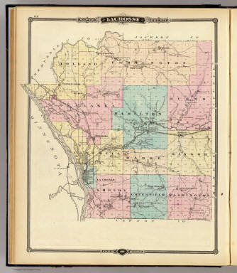
1878 Lacrosse County, Wisconsin. State Atlas Map of Lacrosse County, State of Wiscons … |

1878 City of La Crosse, county seat of La Cro … State Atlas City of La Crosse, county seat of La Cro … |

1878 Trempealeau County, Wisconsin. State Atlas Map of Trempealeau County, State of Wisc … |

1878 Map of Buffalo County and Village of Alm … State Atlas Map of Buffalo County, State of Wisconsi … |

1878 Baraboo, Black River Falls and Sparta. State Atlas Baraboo, co. seat of Sauk Co. (with) Bla … |

1878 Map of Jackson County, Plat of Friendshi … State Atlas Map of Jackson County, State of Wisconsi … |

1878 Map of Monroe County, State of Wisconsin … State Atlas Map of Monroe County, State of Wisconsin … |

1878 Map of Juneau and Adams counties, State … State Atlas Map of Juneau and Adams counties, State … |

1878 Cities of Centralia & Grand Rapids, Vill … State Atlas Cities of Centralia & Grand Rapids, Wood … |