Who What Where WhenREMOVEWHAT
|
Author
Mitchell, Samuel Augustus
Full Title
Asia. Entered ... 1850, by Thomas, Cowperthwait & Co. ... Pennsylvania. (inset map) New Holland or Australia.
Publisher
Thomas, Cowperthwait & Co.
Author
Mitchell, Samuel Augustus
Full Title
Russia in Asia and Tartary. Entered ... 1850, by Thomas, Cowperthwait & Co. ... Pennsylvania. (inset map) Western Part of Russia (Caucasus and Georgia).
Publisher
Thomas, Cowperthwait & Co.
Author
Mitchell, Samuel Augustus
Full Title
Turkey in Asia. Entered ... 1850, by Thomas, Cowperthwait & Co. ... Pennsylvania. (inset map) Environs of Constantinople.
Publisher
Thomas, Cowperthwait & Co.
Author
Mitchell, Samuel Augustus
Full Title
Palestine and Adjacent Countries. Published by Thomas, Cowperthwait & Co. No. 253 Market Street, Philadelphia. Entered ... 1850, by Thomas, Cowperthwait & Co. ... Pennsylvania. (inset map) Environs of Jerusalem.
Publisher
Thomas, Cowperthwait & Co.
Author
Mitchell, Samuel Augustus
Full Title
Persia, Arabia &c. Entered ... 1850, by Thomas, Cowperthwait & Co. ... Pennsylvania.
Publisher
Thomas, Cowperthwait & Co.
Author
Mitchell, Samuel Augustus
Full Title
Hindoostan. Entered ... 1850, by Thomas, Cowperthwait & Co. ... Pennsylvania. (inset map) Delta of the Ganges.
Publisher
Thomas, Cowperthwait & Co.
Author
Mitchell, Samuel Augustus
Full Title
China. Entered ... 1850, by Thomas, Cowperthwait & Co. ... Pennsylvania.
Publisher
Thomas, Cowperthwait & Co.
Author
Mitchell, Samuel Augustus
Full Title
Map of Africa from the Latest Authorities. Published by Thomas, Cowperthwait & Co. No. 253 Market Street, Philadelphia. Entered ... 1850, by Thomas, Cowperthwait & Co. ... Pennsylvania. (inset map) Map of the Republic of Liberia From Gurley's Report Made to the Senate of the United States, 1850.
Publisher
Thomas, Cowperthwait & Co.
Author
Mitchell, Samuel Augustus
Full Title
Egypt &c. Entered ... 1850, by Thomas, Cowperthwait & Co. ... Pennsylvania. (inset map) Nubia.
Publisher
Thomas, Cowperthwait & Co.
Author
Mitchell, Samuel Augustus
Full Title
The Pacific Ocean Including Oceanica, with its Several Divisions, Islands, Groups &c.. Entered ... 1850, by Thomas, Cowperthwait & Co. ... Pennsylvania. (with two inset maps) Antarctic Continent, and The Sandwich or Hawaiian Islands.
Publisher
Thomas, Cowperthwait & Co.
Author
Mitchell, Samuel Augustus Jr.
Full Title
Western Hemisphere. Entered ... 1874 by S. Augustus Mitchell ... Washington.
Publisher
Ziegler & McCurdy
Author
Mitchell, Samuel Augustus Jr.
Full Title
Map of the World on the Mercator Projection, Exhibiting the American Continent as its Centre. Entered ... 1874 by S. Augustus Mitchell ... Washington.
Publisher
Ziegler & McCurdy
Author
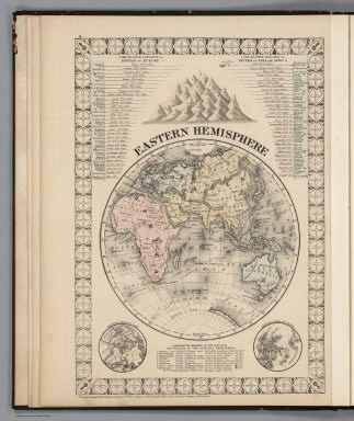
Mitchell, Samuel Augustus Jr.
Full Title
Eastern Hemisphere. Entered ... 1874 by S. Augustus Mitchell ... Washington. Entered ... 1874 by S. Augustus Mitchell ... Washington.
Publisher
Ziegler & McCurdy
Author
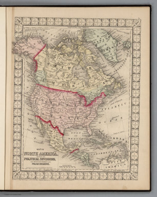
Mitchell, Samuel Augustus Jr.
Full Title
Map of North America Showing its Political Divisions and Recent Discoveries in the Polar Regions. Entered ... 1874 by S. Augustus Mitchell ... Washington.
Publisher
Ziegler & McCurdy
Author
Mitchell, Samuel Augustus Jr.
Full Title
Map of the United States, and Territories together with Canada &c. (inset) Island of Newfoundland. Entered ... 1874 by S. Augustus Mitchell ... Washington.
Publisher
Ziegler & McCurdy
Author
Mitchell, Samuel Augustus Jr.
Full Title
Plan of the City of Washington, the Capitol of the United States of America. Entered ... 1874 by S. Augustus Mitchell ... Washington.
Publisher
Ziegler & McCurdy
Author
Mitchell, Samuel Augustus Jr.
Full Title
County Map of the State of Maine. (inset) Portland Har. and Vicinity. Entered ... 1874 by S. Augustus Mitchell ... Washington.
Publisher
Ziegler & McCurdy
Author
Mitchell, Samuel Augustus Jr.
Full Title
County and Township Map of the States of Massachusetts, Connecticut, and Rhode Island. Entered ... 1874 by S. Augustus Mitchell ... Washington.
Publisher
Ziegler & McCurdy
Author
Mitchell, Samuel Augustus Jr.
Full Title
New Hampshire and Vermont. Entered ... 1874 by S. Augustus Mitchell ... Washington.
Publisher
Ziegler & McCurdy
Author
Mitchell, Samuel Augustus Jr.
Full Title
County Map of Virginia and West Virginia. Entered ... 1874 by S. Augustus Mitchell ... Washington.
Publisher
Ziegler & McCurdy
Author
Mitchell, Samuel Augustus Jr.
Full Title
Plan of Boston. Entered ... 1874 by S. Augustus Mitchell ... Washington. Entered ... 1874 by S. Augustus Mitchell ... Washington.
Publisher
Ziegler & McCurdy
Author
Mitchell, Samuel Augustus Jr.
Full Title
Plan of Baltimore. Entered ... 1874 by S. Augustus Mitchell ... Washington. Entered ... 1874 by S. Augustus Mitchell ... Washington.
Publisher
Ziegler & McCurdy
Author
Andreas, A. T. (Alfred Theodore), 1839-1900
Full Title
Counties of Cottonwood, Murray, Pipestone, Jackson, Nobles and Rock, Minn. (Published by A.T. Andreas, Lakeside Building, Chicago, 1874. Chas. Shober & Co. Proprietors of Chicago Lith. Co.)
Publisher
A.T. Andreas
Author
Mitchell, Samuel Augustus Jr.
Full Title
County Map of Maryland and Delaware. County Map of New Jersey. Entered ... 1874 by S. Augustus Mitchell ... Washington.
Publisher
Ziegler & McCurdy
Author
Mitchell, Samuel Augustus Jr.
Full Title
County Map of the State of New York. (insets) West Troy, Troy, Albany, Buffalo, Rochester, and Harbor and Vicinity of New York. Entered ... 1874 by S. Augustus Mitchell ... Washington.
Publisher
Ziegler & McCurdy
Author
Mitchell, Samuel Augustus Jr.
Full Title
Chicago. Entered ... 1874 by S. Augustus Mitchell ... Washington.
Publisher
Ziegler & McCurdy
Author
Mitchell, Samuel Augustus Jr.
Full Title
County Map of the State of Illinois. (inset) Vicinity of Springfield. Entered ... 1874 by S. Augustus Mitchell ... Washington.
Publisher
Ziegler & McCurdy
Author
Mitchell, Samuel Augustus Jr.
Full Title
New York and Brooklyn. (inset) Northern Portion of New York City and County. Entered ... 1874 by S. Augustus Mitchell ... Washington.
Publisher
Ziegler & McCurdy
Author
Mitchell, Samuel Augustus Jr.
Full Title
North and South Carolina. (inset) Plan of Charleston. Map of Charleston Harbor. Entered ... 1874 by S. Augustus Mitchell ... Washington.
Publisher
Ziegler & McCurdy
Author
Mitchell, Samuel Augustus Jr.
Full Title
County Map of the State of Pennsylvania. Entered ... 1874 by S. Augustus Mitchell ... Washington.
Publisher
Ziegler & McCurdy
Author
Mitchell, Samuel Augustus Jr.
Full Title
Plan of the City of Philadelphia and Camden. Entered ... 1874 by S. Augustus Mitchell ... Washington.
Publisher
Ziegler & McCurdy
Author
Mitchell, Samuel Augustus Jr.
Full Title
Plan of Cincinnati. Entered ... 1874 by S. Augustus Mitchell ... Washington.
Publisher
Ziegler & McCurdy
Author
Andreas, A. T. (Alfred Theodore), 1839-1900
Full Title
Map of Rice County, Minn. (Published by A.T. Andreas, Lakeside Building, Chicago, 1874. Chas. Shober & Co. Proprietors of Chicago Lith. Co.)
Publisher
A.T. Andreas
Author
Mitchell, Samuel Augustus Jr.
Full Title
County Map of Ohio and Indiana.
Publisher
Ziegler & McCurdy
Author
Mitchell, Samuel Augustus Jr.
Full Title
County Map of the States of Georgia and Alabama. (insets) Savannah, Georgia. City of Atlanta, the Capitol of Georgia. Entered ... 1874 by S. Augustus Mitchell ... Washington.
Publisher
Ziegler & McCurdy
Author
Mitchell, Samuel Augustus Jr.
Full Title
St. Louis. Entered ... 1874 by S. Augustus Mitchell ... Washington.
Publisher
Ziegler & McCurdy
Author
[Andreas, A. T. (Alfred Theodore), 1839-1900, Faribault, Alex]
Full Title
Map of Faribault, laid out in 1855 by Alex Faribault. F.B. Sibley, Porter Nuttings, and John W. North, proprietors ... Rice County, Minn. (Published by A.T. Andreas, Lakeside Building, Chicago, 1874. Chas. Shober & Co. Proprietors of Chicago Lith. Co.)
Publisher
A.T. Andreas
Author
Mitchell, Samuel Augustus Jr.
Full Title
County and Township Map of the States of Iowa and Missouri. Entered ... 1874 by S. Augustus Mitchell ... Washington.
Publisher
Ziegler & McCurdy
Author
Mitchell, Samuel Augustus Jr.
Full Title
County Map of the States of Arkansas, Mississippi, and Louisiana.
Publisher
Ziegler & McCurdy
Author
Mitchell, Samuel Augustus Jr.
Full Title
Plan of New Orleans. Entered ... 1874 by S. Augustus Mitchell ... Washington.
Publisher
Ziegler & McCurdy
Author
Mitchell, Samuel Augustus Jr.
Full Title
County Map of Florida. (inset) Mobile.
Publisher
Ziegler & McCurdy
Author
Mitchell, Samuel Augustus Jr.
Full Title
County Map of the State of Texas, Showing also portions of the Adjoining States and Territories. (inset) Plan of Galveston and Vicinity. Entered ... 1874 by S. Augustus Mitchell ... Washington.
Publisher
Ziegler & McCurdy
Author
Mitchell, Samuel Augustus Jr.
Full Title
County Map of Minnesota. Entered ... 1874 by S. Augustus Mitchell ... Washington.
Publisher
Ziegler & McCurdy
Author
Mitchell, Samuel Augustus Jr.
Full Title
County Map of Kentucky and Tennessee. Entered ... 1874 by S. Augustus Mitchell ... Washington.
Publisher
Ziegler & McCurdy
Author
Mitchell, Samuel Augustus Jr.
Full Title
County and Township Map of the States of Michigan and Wisconsin. Entered ... 1874 by S. Augustus Mitchell ... Washington.
Publisher
Ziegler & McCurdy
Author
Mitchell, Samuel Augustus Jr.
Full Title
Plan of Detroit.
Publisher
Ziegler & McCurdy
Author
Mitchell, Samuel Augustus Jr.
Full Title
Plan of Milwaukee. Entered ... 1874 by S. Augustus Mitchell ... Washington.
Publisher
Ziegler & McCurdy
Author
Mitchell, Samuel Augustus Jr.
Full Title
County & Township Map of the States of Kansas and Nebraska. Entered ... 1874 by S. Augustus Mitchell ... Washington.
Publisher
Ziegler & McCurdy
Author
Mitchell, Samuel Augustus Jr.
Full Title
County Map of Utah and Nevada.
Publisher
Ziegler & McCurdy
Author
Andreas, A. T. (Alfred Theodore), 1839-1900
Full Title
Map of New Auburn, New Auburn Township ... Sibley Co., Minn. (with) New Ulm, Brown Co., Minn. 1874. (Published by A.T. Andreas, Lakeside Building, Chicago, 1874. Chas. Shober & Co. Proprietors of Chicago Lith. Co.)
Publisher
A.T. Andreas
|