Browse All

1878 Map Number Three. (Marion County, Oregon … County Atlas Map Number Three. (Marion County, Oregon … |

1878 Map Number Four. (Marion County, Oregon) … County Atlas Map Number Four. (Marion County, Oregon) … |

1878 Map Number Five. (Marion County, Oregon) … County Atlas Map Number Five. (Marion County, Oregon) … |

1845 Louisiana. National Atlas Louisiana. Entered ... 1842 by Sidney E. … |

1878 Map Number Six. (Marion County, Oregon). County Atlas Map Number Six. (insets) Map of Stayton, … |

1878 City of Salem, Oregon, 1878. County Atlas Map of the City of Salem, Oregon, 1878. … |

1878 Map of Linn County, Oregon, 1878. County Atlas Map of Linn County, Oregon, 1878. |

1878 Map Number One. Map Number Two. Map Numb … County Atlas Map Number One. Map Number Two. Map Numb … |

1878 Map Number Three (Linn County, Oregon). County Atlas Map Number Three (Linn County, Oregon). … |

1878 Map Number Four. (Linn County, Oregon). County Atlas Map Number Four. (Linn County, Oregon). … |

1878 Map Number Five (Linn County, Oregon). County Atlas Map Number Five (Linn County, Oregon). |

1878 Map Number Six (Linn County, Oregon). County Atlas Map Number Six (Linn County, Oregon). (i … |

1878 A topographical map of the State of New … Geologic Atlas A topographical map of the State of New … |

1878 Map Number Seven (Linn County, Oregon). County Atlas Map Number Seven (Linn County, Oregon). |

1878 Map Number Eight (Linn County, Ore.) County Atlas Map Number Eight (Linn County, Ore.) |

1878 Map Number Ten (Linn County, Oregon). County Atlas Map Number Ten (Linn County, Oregon). (i … |

1878 Map Number Eleven (Linn County, Oregon). County Atlas Map Number Eleven (Linn County, Oregon). |

1878 City of Albany, Linn County, Oregon, 187 … County Atlas Map of City of Albany, Linn County, Oreg … |

1878 Map of New Hampshire. 1816. Geologic Atlas Map of New Hampshire by Philip Carrigain … |

1880 Dominion of Canada (Eastern Sheet). State Atlas Dominion of Canada (Eastern Sheet). |

1880 Dominion of Canada (Western Sheet). State Atlas Dominion of Canada (Western Sheet). |

1878 (General geological map of New Hampshire … Geologic Atlas (General geological map of New Hampshire … |
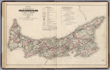
1880 Province of Prince Edward Island in the … State Atlas Map of the Province of Prince Edward Isl … |

1880 Plan of Lot One, Prince Co., P.E.I. State Atlas Plan of Lot One, Prince Co., P.E.I. (ins … |

1880 Plan of Lot Six, Prince Co., P.E.I. State Atlas Plan of Lot Six, Prince Co., P.E.I. (ins … |

1880 Plan of Lots Two & Three, Prince County, … State Atlas Plan of Lots Two & Three, Prince County, … |

1880 Mount Stewart, Lot 37. State Atlas Mount Stewart, Lot 37. |

1878 (General geological map of New Hampshire … Geologic Atlas (General geological map of New Hampshire … |

1880 Plan of Lots Four & Five, Prince Co. State Atlas Plan of Lots Four & Five, Prince Co. |

1880 Plan of Lot Eight, Prince Co., P.E.I. State Atlas Plan of Lot Eight, Prince Co., P.E.I. |

1880 Plan of Lot Thirteen, Prince Co., P.E.I. State Atlas Plan of Lot Thirteen, Prince Co., P.E.I. … |

1880 Map: Plan of Lot Nine, Prince Co., P.E.I … State Atlas (Map) Plan of Lot Nine, Prince Co., P.E. … |

1880 Plan of Lots Fourteen & Sixteen, Prince … State Atlas Plan of Lots Fourteen & Sixteen, Prince … |

1880 Views: Residences of Charlottesville, P. … State Atlas (Views) "Wynther Grange" Residence of Ar … |

1880 Plan of Lot Seventeen, Prince Co., P.E.I … State Atlas Plan of Lot Seventeen, Prince Co., P.E.I … |

1880 Map: Plan of Lot Eleven, Prince Co., P.E … State Atlas (Map) Plan of Lot Eleven, Prince Co., P. … |

1878 (General geological map of New Hampshire … Geologic Atlas (General geological map of New Hampshire … |

1880 Plan of Lots Twenty One & Twenty, Queens … State Atlas Plan of Lots Twenty One & Twenty, Queens … |

1880 Views: Residences, P.E.I. Maps: Victoria … State Atlas (Views) Farm Res. of Saml. Drake & Son W … |

1880 Plan of Lots 22 & 23, Queens Co., P.E.I. State Atlas Plan of Lots 22 & 23, Queens Co., P.E.I. … |

1880 Plan of Lot Twelve, Prince Co., P.E.I. State Atlas Plan of Lot Twelve, Prince Co., P.E.I. |

1880 Plan of Lot Twenty Four, Queens Co., P.E … State Atlas Plan of Lot Twenty Four, Queens Co., P.E … |

1880 View: Union Bank, Charlottetown. Map: Pl … State Atlas (View) 1863 - 1879, Union Bank, Main Off … |

1880 Map: Summerside, Prince Co. Views: Resid … State Atlas (Map:) Summerside, Prince Co. (Views:) P … |

1880 Plan of Lots Twenty Five & Twenty Six, P … State Atlas Plan of Lots Twenty Five & Twenty Six, P … |

1880 Plan of Lot Twenty Seven, Prince Co., P. … State Atlas Plan of Lot Twenty Seven, Prince Co., P. … |

1878 (General geological map of New Hampshire … Geologic Atlas (General geological map of New Hampshire … |

1880 Plan of Lot 28, Prince Co., P.E.I. State Atlas Plan of Lot 28, Prince Co., P.E.I. |

1880 Plan of Lots Twenty Nine & Thirty, Queen … State Atlas Plan of Lots Twenty Nine & Thirty, Queen … |

1880 Princetown Royalty, Prince Co. State Atlas Princetown Royalty, Prince Co. |